Bellflower North Topo Map Missouri
To zoom in, hover over the map of Bellflower North
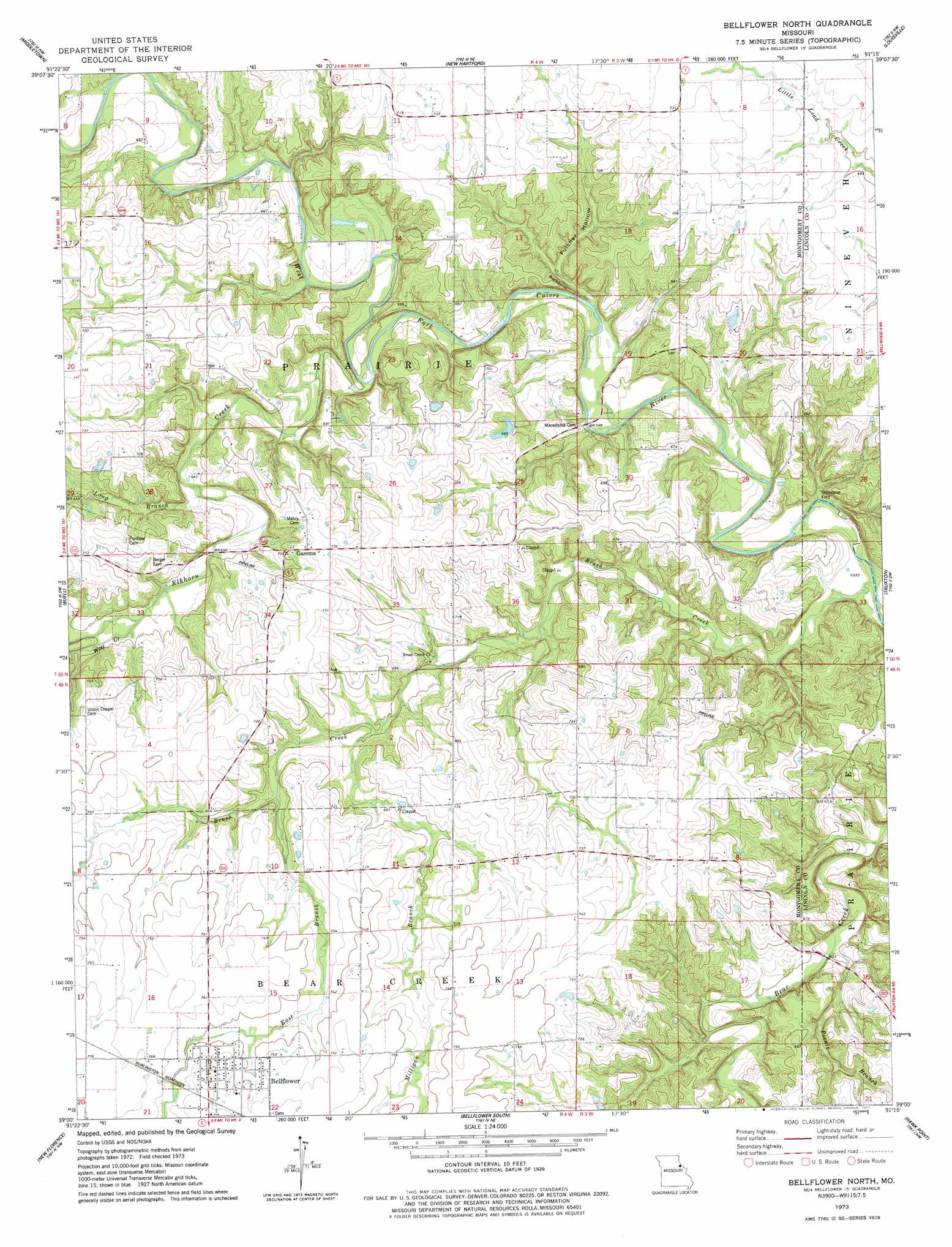
USGS Topo Quad 39091a3 - 1:24,000 scale
| Topo Map Name: | Bellflower North |
| USGS Topo Quad ID: | 39091a3 |
| Print Size: | ca. 21 1/4" wide x 27" high |
| Southeast Coordinates: | 39° N latitude / 91.25° W longitude |
| Map Center Coordinates: | 39.0625° N latitude / 91.3125° W longitude |
| U.S. State: | MO |
| Filename: | o39091a3.jpg |
| Download Map JPG Image: | Bellflower North topo map 1:24,000 scale |
| Map Type: | Topographic |
| Topo Series: | 7.5´ |
| Map Scale: | 1:24,000 |
| Source of Map Images: | United States Geological Survey (USGS) |
| Alternate Map Versions: |
Bellflower North MO 1973, updated 1977 Download PDF Buy paper map Bellflower North MO 2012 Download PDF Buy paper map Bellflower North MO 2014 Download PDF Buy paper map |
1:24,000 Topo Quads surrounding Bellflower North
Farber |
Vandalia |
Curryville |
Bowling Green |
Cyrene |
Vandalia Lake |
Middletown |
New Hartford |
Louisville |
Eolia |
Wellsville |
Buell |
Bellflower North |
Truxton |
Silex |
Montgomery City |
New Florence |
Bellflower South |
Hawk Point |
Warrenton Ne |
Americus |
Pinnacle Lake |
Jonesburg |
Warrenton |
Wright City |
> Back to 39091a1 at 1:100,000 scale
> Back to 39090a1 at 1:250,000 scale
> Back to U.S. Topo Maps home
Bellflower North topo map: Gazetteer
Bellflower North: Dams
Hawkins Dam elevation 203m 666′Bellflower North: Populated Places
Bellflower elevation 234m 767′Gamma elevation 215m 705′
Stillhouse Ford elevation 170m 557′
Bellflower North: Ridges
Backbone elevation 213m 698′Bellflower North: Streams
Brush Creek elevation 170m 557′East Branch Brush Creek elevation 206m 675′
Elkhorn Creek elevation 181m 593′
Long Branch elevation 189m 620′
Milligan Branch elevation 198m 649′
Picnic Branch elevation 179m 587′
Wolf Creek elevation 195m 639′
Bellflower North: Valleys
Fulcher Hollow elevation 179m 587′Bellflower North digital topo map on disk
Buy this Bellflower North topo map showing relief, roads, GPS coordinates and other geographical features, as a high-resolution digital map file on DVD: