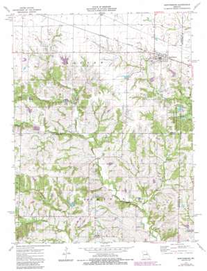
Martinsburg Topo Map Missouri
To zoom in, hover over the map of Martinsburg
USGS Topo Quad 39091a6 - 1:24,000 scale
| Topo Map Name: | Martinsburg |
| USGS Topo Quad ID: | 39091a6 |
| Print Size: | ca. 21 1/4" wide x 27" high |
| Southeast Coordinates: | 39° N latitude / 91.625° W longitude |
| Map Center Coordinates: | 39.0625° N latitude / 91.6875° W longitude |
| U.S. State: | MO |
| Filename: | o39091a6.jpg |
| Download Map JPG Image: | Martinsburg topo map 1:24,000 scale |
| Map Type: | Topographic |
| Topo Series: | 7.5´ |
| Map Scale: | 1:24,000 |
| Source of Map Images: | United States Geological Survey (USGS) |
| Alternate Map Versions: |
Martinsburg MO 1973, updated 1975 Download PDF Buy paper map Martinsburg MO 1973, updated 1984 Download PDF Buy paper map Martinsburg MO 2012 Download PDF Buy paper map Martinsburg MO 2015 Download PDF Buy paper map |
1:24,000 Topo Quads surrounding Martinsburg
> Back to 39091a1 at 1:100,000 scale
> Back to 39090a1 at 1:250,000 scale
> Back to U.S. Topo Maps home
Martinsburg topo map: Gazetteer
Martinsburg: Dams
Brown Lake Dam elevation 242m 793′Covington Lake Dam elevation 222m 728′
Lone Rock Lake Dam elevation 224m 734′
Marshall Diggs Wildlife Area Dam - North elevation 237m 777′
Marshell Diggs Wildlife Area South Dam elevation 233m 764′
Norfolk Lake Dam elevation 241m 790′
Wieburg Lake Dam elevation 241m 790′
Zander Lake Dam elevation 225m 738′
Martinsburg: Parks
Marshall I Diggs State Wildlife Management A elevation 232m 761′Martinsburg: Populated Places
Martinsburg elevation 246m 807′Shamrock elevation 233m 764′
Martinsburg: Reservoirs
Lone Rock Lake elevation 224m 734′Marshall Diggs Wildlife Area Lake elevation 237m 777′
Martinsburg: Streams
Brushy Branch elevation 195m 639′Harrison Creek elevation 210m 688′
Morris Branch elevation 198m 649′
Martinsburg digital topo map on disk
Buy this Martinsburg topo map showing relief, roads, GPS coordinates and other geographical features, as a high-resolution digital map file on DVD:


