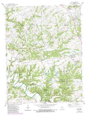
Eolia Topo Map Missouri
To zoom in, hover over the map of Eolia
USGS Topo Quad 39091b1 - 1:24,000 scale
| Topo Map Name: | Eolia |
| USGS Topo Quad ID: | 39091b1 |
| Print Size: | ca. 21 1/4" wide x 27" high |
| Southeast Coordinates: | 39.125° N latitude / 91° W longitude |
| Map Center Coordinates: | 39.1875° N latitude / 91.0625° W longitude |
| U.S. State: | MO |
| Filename: | o39091b1.jpg |
| Download Map JPG Image: | Eolia topo map 1:24,000 scale |
| Map Type: | Topographic |
| Topo Series: | 7.5´ |
| Map Scale: | 1:24,000 |
| Source of Map Images: | United States Geological Survey (USGS) |
| Alternate Map Versions: |
Eolia MO 1975, updated 1977 Download PDF Buy paper map Eolia MO 1975, updated 1985 Download PDF Buy paper map Eolia MO 2012 Download PDF Buy paper map Eolia MO 2015 Download PDF Buy paper map |
1:24,000 Topo Quads surrounding Eolia
> Back to 39091a1 at 1:100,000 scale
> Back to 39090a1 at 1:250,000 scale
> Back to U.S. Topo Maps home
Eolia topo map: Gazetteer
Eolia: Arches
Natural Bridge elevation 198m 649′Eolia: Bridges
Reynolds Ford Bridge elevation 165m 541′Eolia: Dams
Luecke Lake Dam elevation 231m 757′White Memorial Area Section 16 Lake Dam elevation 238m 780′
William Logan State Wildlife Area Lake Number 4 Dam elevation 200m 656′
Eolia: Lakes
Old Negro Pond elevation 228m 748′Eolia: Parks
Vonaventure State Memorial Forest And elevation 180m 590′White Memorial State Wildlife Area elevation 238m 780′
William Logan State Wildlife Area elevation 200m 656′
Eolia: Populated Places
Eolia elevation 252m 826′Hobart elevation 183m 600′
Hopkinsville elevation 209m 685′
Whiteside elevation 243m 797′
Eolia: Reservoirs
Luecke Lake elevation 231m 757′Number Five Lake elevation 202m 662′
Number Four Lake elevation 203m 666′
Number One Lake elevation 209m 685′
Number Three Lake elevation 208m 682′
Number Two Lake elevation 202m 662′
William Logan State Wildlife Area Lake elevation 200m 656′
Eolia: Ridges
Pea Ridge elevation 230m 754′Eolia: Springs
Copper Spring elevation 164m 538′Eolia: Streams
Anderson Creek elevation 207m 679′Brushy Creek elevation 173m 567′
Buck Creek elevation 158m 518′
Dry Branch elevation 152m 498′
Little Sandy Creek elevation 175m 574′
Lolar Branch elevation 158m 518′
Reid Creek elevation 183m 600′
Sandy Creek elevation 165m 541′
Sulphur Creek elevation 161m 528′
Eolia digital topo map on disk
Buy this Eolia topo map showing relief, roads, GPS coordinates and other geographical features, as a high-resolution digital map file on DVD:


