Hutchison Topo Map Missouri
To zoom in, hover over the map of Hutchison
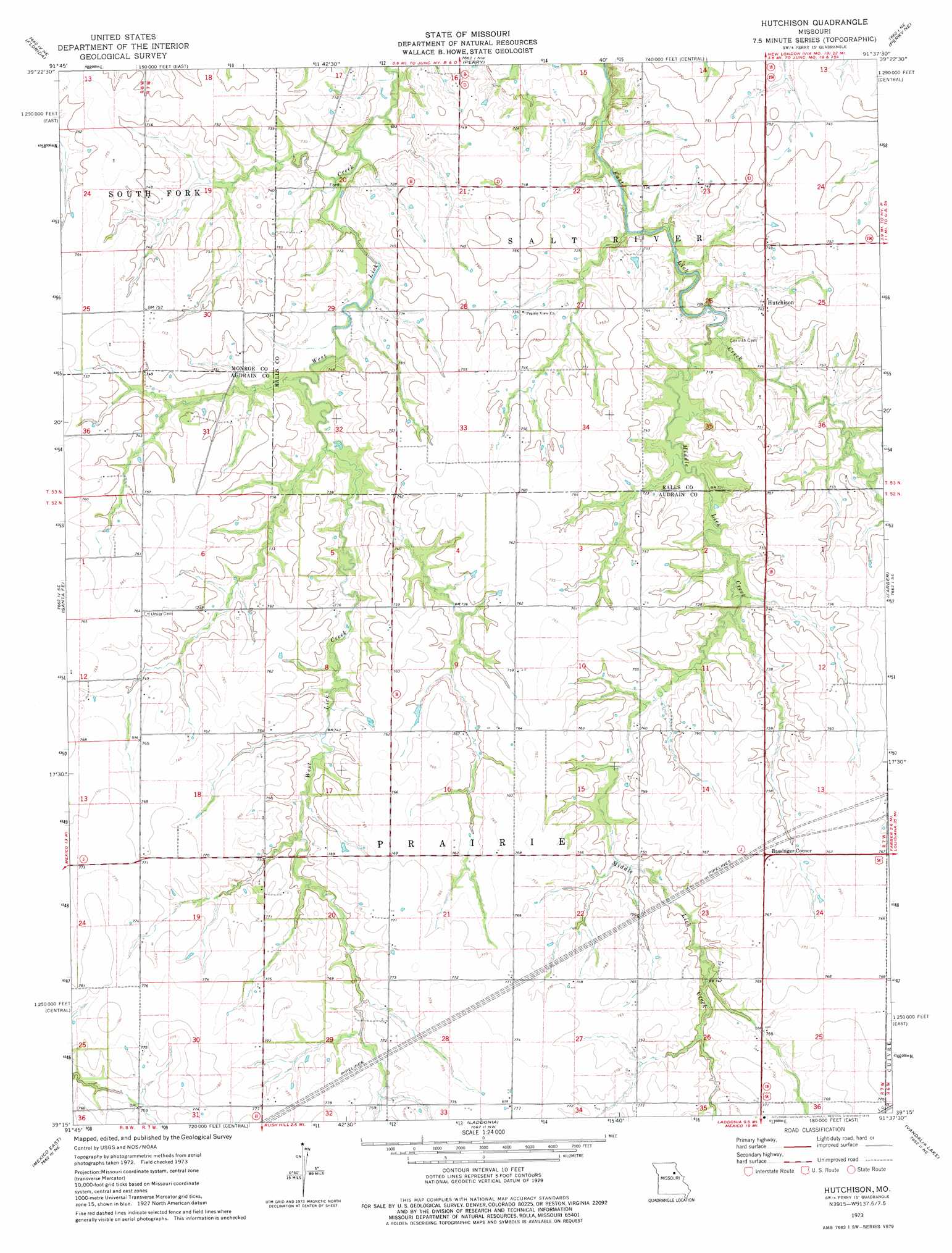
USGS Topo Quad 39091c6 - 1:24,000 scale
| Topo Map Name: | Hutchison |
| USGS Topo Quad ID: | 39091c6 |
| Print Size: | ca. 21 1/4" wide x 27" high |
| Southeast Coordinates: | 39.25° N latitude / 91.625° W longitude |
| Map Center Coordinates: | 39.3125° N latitude / 91.6875° W longitude |
| U.S. State: | MO |
| Filename: | o39091c6.jpg |
| Download Map JPG Image: | Hutchison topo map 1:24,000 scale |
| Map Type: | Topographic |
| Topo Series: | 7.5´ |
| Map Scale: | 1:24,000 |
| Source of Map Images: | United States Geological Survey (USGS) |
| Alternate Map Versions: |
Hutchison MO 1973, updated 1975 Download PDF Buy paper map Hutchison MO 2012 Download PDF Buy paper map Hutchison MO 2015 Download PDF Buy paper map |
1:24,000 Topo Quads surrounding Hutchison
Goss |
Stoutsville |
Joanna |
Center |
New London |
Paris East |
Florida |
Perry |
Perry Ne |
Spencerburg |
Molino |
Sante Fe |
Hutchison |
Farber |
Vandalia |
Mexico West |
Mexico East |
Laddonia |
Vandalia Lake |
Middletown |
Auxvasse |
Mexico Se |
Martinsburg |
Wellsville |
Buell |
> Back to 39091a1 at 1:100,000 scale
> Back to 39090a1 at 1:250,000 scale
> Back to U.S. Topo Maps home
Hutchison topo map: Gazetteer
Hutchison: Airports
Schlemmer Airport elevation 233m 764′Hutchison: Dams
Black Lake Dam elevation 225m 738′Peery Lake Dam elevation 214m 702′
Pound Lake Dam elevation 229m 751′
Hutchison: Populated Places
Bassinger Corner elevation 232m 761′Hutchison elevation 226m 741′
Hutchison: Streams
Middle Lick Creek elevation 213m 698′Hutchison digital topo map on disk
Buy this Hutchison topo map showing relief, roads, GPS coordinates and other geographical features, as a high-resolution digital map file on DVD: