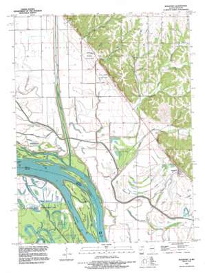
Rockport Topo Map Illinois
To zoom in, hover over the map of Rockport
USGS Topo Quad 39091e1 - 1:24,000 scale
| Topo Map Name: | Rockport |
| USGS Topo Quad ID: | 39091e1 |
| Print Size: | ca. 21 1/4" wide x 27" high |
| Southeast Coordinates: | 39.5° N latitude / 91° W longitude |
| Map Center Coordinates: | 39.5625° N latitude / 91.0625° W longitude |
| U.S. States: | IL, MO |
| Filename: | o39091e1.jpg |
| Download Map JPG Image: | Rockport topo map 1:24,000 scale |
| Map Type: | Topographic |
| Topo Series: | 7.5´ |
| Map Scale: | 1:24,000 |
| Source of Map Images: | United States Geological Survey (USGS) |
| Alternate Map Versions: |
Rockport IL 1978, updated 1978 Download PDF Buy paper map Rockport IL 1991, updated 1995 Download PDF Buy paper map Rockport IL 2012 Download PDF Buy paper map Rockport IL 2015 Download PDF Buy paper map |
1:24,000 Topo Quads surrounding Rockport
> Back to 39091e1 at 1:100,000 scale
> Back to 39090a1 at 1:250,000 scale
> Back to U.S. Topo Maps home
Rockport topo map: Gazetteer
Rockport: Basins
Brewster Settling Basin elevation 142m 465′Brown Branch Settling Basin elevation 138m 452′
Horton-Dutch Creek Settling Basin elevation 139m 456′
Rockport: Bays
Murphy Bay elevation 137m 449′Rockport: Canals
Collins Pond Ditch elevation 137m 449′Easley Ditch elevation 140m 459′
East Gibson Ditch elevation 135m 442′
Kiser Creek Diversion Ditch elevation 139m 456′
Sand Slough Ditch elevation 136m 446′
West Gibson Ditch elevation 137m 449′
Rockport: Guts
Barney Backup elevation 137m 449′Coon Slough elevation 135m 442′
Crooked Slough elevation 137m 449′
Jordan Slough elevation 136m 446′
Milyard Slough elevation 137m 449′
Mud Slough elevation 135m 442′
Old Sny elevation 136m 446′
Salt Slough elevation 137m 449′
Swift Slough elevation 136m 446′
Rockport: Islands
Bay Island elevation 138m 452′Cottonwood Island elevation 139m 456′
Ducher Island elevation 137m 449′
North Fritz Island elevation 139m 456′
North Fritz Island elevation 139m 456′
Sand Bar Island elevation 137m 449′
South Fritz Island elevation 139m 456′
South Fritz Island elevation 139m 456′
Willow Bar Island elevation 137m 449′
Willow Island elevation 137m 449′
Rockport: Lakes
Bradley Pond elevation 137m 449′Fish Ponds elevation 137m 449′
Flag Pond elevation 137m 449′
Goose Pond elevation 137m 449′
Horseshoe Lake elevation 137m 449′
Long Lake elevation 137m 449′
Perry Pond elevation 137m 449′
Rainbow Pond elevation 137m 449′
Willow Pond elevation 135m 442′
Rockport: Populated Places
Horton elevation 144m 472′Rockport elevation 149m 488′
Rockport: Streams
Brewster Creek elevation 137m 449′Brown Branch elevation 137m 449′
Crozier Creek elevation 170m 557′
Drift Chute elevation 137m 449′
Dutch Creek elevation 137m 449′
Horton Creek elevation 140m 459′
Jimtown Branch elevation 136m 446′
Kiser Creek elevation 137m 449′
Stillhouse Branch elevation 140m 459′
Rockport digital topo map on disk
Buy this Rockport topo map showing relief, roads, GPS coordinates and other geographical features, as a high-resolution digital map file on DVD:


