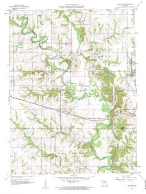
Lakenan Topo Map Missouri
To zoom in, hover over the map of Lakenan
USGS Topo Quad 39091f8 - 1:24,000 scale
| Topo Map Name: | Lakenan |
| USGS Topo Quad ID: | 39091f8 |
| Print Size: | ca. 21 1/4" wide x 27" high |
| Southeast Coordinates: | 39.625° N latitude / 91.875° W longitude |
| Map Center Coordinates: | 39.6875° N latitude / 91.9375° W longitude |
| U.S. State: | MO |
| Filename: | o39091f8.jpg |
| Download Map JPG Image: | Lakenan topo map 1:24,000 scale |
| Map Type: | Topographic |
| Topo Series: | 7.5´ |
| Map Scale: | 1:24,000 |
| Source of Map Images: | United States Geological Survey (USGS) |
| Alternate Map Versions: |
Lakenan MO 1959, updated 1960 Download PDF Buy paper map Lakenan MO 1959, updated 1960 Download PDF Buy paper map Lakenan MO 2012 Download PDF Buy paper map Lakenan MO 2014 Download PDF Buy paper map |
1:24,000 Topo Quads surrounding Lakenan
> Back to 39091e1 at 1:100,000 scale
> Back to 39090a1 at 1:250,000 scale
> Back to U.S. Topo Maps home
Lakenan topo map: Gazetteer
Lakenan: Bridges
Kincheloe Bridge elevation 194m 636′Salt River Railroad Bridge elevation 188m 616′
Lakenan: Dams
Buckman Dam elevation 221m 725′Simmons Lake Dam elevation 216m 708′
Smith Lake Dam elevation 214m 702′
Lakenan: Populated Places
Kendall elevation 220m 721′Lakenan elevation 221m 725′
Lakenan: Reservoirs
Buckman Lake elevation 221m 725′Paradise Lake elevation 214m 702′
Lakenan: Streams
Baker Branch elevation 196m 643′Black Creek elevation 191m 626′
Horseshoe Branch elevation 188m 616′
Jackson Creek elevation 188m 616′
Thomas Creek elevation 195m 639′
Lakenan: Summits
The Mound elevation 207m 679′Lakenan digital topo map on disk
Buy this Lakenan topo map showing relief, roads, GPS coordinates and other geographical features, as a high-resolution digital map file on DVD:


