Hallsville Topo Map Missouri
To zoom in, hover over the map of Hallsville
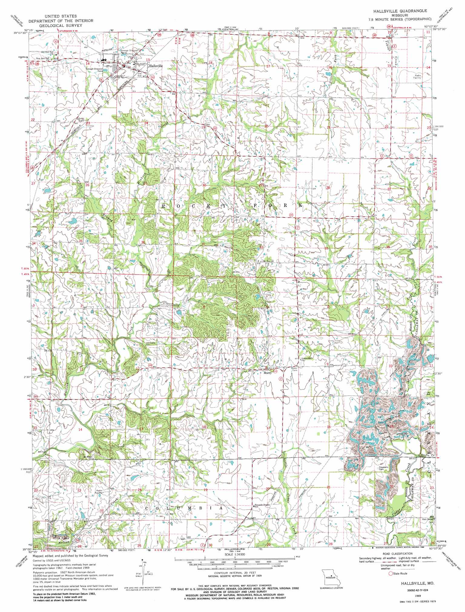
USGS Topo Quad 39092a2 - 1:24,000 scale
| Topo Map Name: | Hallsville |
| USGS Topo Quad ID: | 39092a2 |
| Print Size: | ca. 21 1/4" wide x 27" high |
| Southeast Coordinates: | 39° N latitude / 92.125° W longitude |
| Map Center Coordinates: | 39.0625° N latitude / 92.1875° W longitude |
| U.S. State: | MO |
| Filename: | o39092a2.jpg |
| Download Map JPG Image: | Hallsville topo map 1:24,000 scale |
| Map Type: | Topographic |
| Topo Series: | 7.5´ |
| Map Scale: | 1:24,000 |
| Source of Map Images: | United States Geological Survey (USGS) |
| Alternate Map Versions: |
Hallsville MO 1969, updated 1971 Download PDF Buy paper map Hallsville MO 1969, updated 1986 Download PDF Buy paper map Hallsville MO 2012 Download PDF Buy paper map Hallsville MO 2014 Download PDF Buy paper map |
| FStopo: | US Forest Service topo Hallsville is available: Download FStopo PDF Download FStopo TIF |
1:24,000 Topo Quads surrounding Hallsville
Renick |
Clark |
Tulip |
Rowena |
Molino |
Harrisburg |
Sturgeon |
Centralia |
Centralia Ne |
Mexico West |
Sturgeon Sw |
Browns |
Hallsville |
Hatton |
Auxvasse |
Huntsdale |
Columbia |
Millersburg |
Millersburg Ne |
Kingdom City |
Jamestown |
Ashland |
Millersburg Sw |
Guthrie |
Fulton |
> Back to 39092a1 at 1:100,000 scale
> Back to 39092a1 at 1:250,000 scale
> Back to U.S. Topo Maps home
Hallsville topo map: Gazetteer
Hallsville: Airports
Hardin Field elevation 275m 902′Hallsville: Areas
Two Mile Prairie elevation 268m 879′Hallsville: Dams
Andy Lake Dam elevation 264m 866′Cumminghams Lake Dam elevation 256m 839′
Linn Lake Dam elevation 268m 879′
Scott Lake Dam elevation 265m 869′
Wasley Lake Dam elevation 272m 892′
Hallsville: Populated Places
Hallsville elevation 275m 902′Lebanon (historical) elevation 252m 826′
Murry elevation 275m 902′
Points (historical) elevation 275m 902′
Hallsville: Reservoirs
Andy Lake elevation 264m 866′Scott Lake elevation 265m 869′
Hallsville: Streams
Renfro Creek elevation 250m 820′Varnon Branch elevation 248m 813′
Hallsville digital topo map on disk
Buy this Hallsville topo map showing relief, roads, GPS coordinates and other geographical features, as a high-resolution digital map file on DVD: