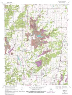
Browns Topo Map Missouri
To zoom in, hover over the map of Browns
USGS Topo Quad 39092a3 - 1:24,000 scale
| Topo Map Name: | Browns |
| USGS Topo Quad ID: | 39092a3 |
| Print Size: | ca. 21 1/4" wide x 27" high |
| Southeast Coordinates: | 39° N latitude / 92.25° W longitude |
| Map Center Coordinates: | 39.0625° N latitude / 92.3125° W longitude |
| U.S. State: | MO |
| Filename: | o39092a3.jpg |
| Download Map JPG Image: | Browns topo map 1:24,000 scale |
| Map Type: | Topographic |
| Topo Series: | 7.5´ |
| Map Scale: | 1:24,000 |
| Source of Map Images: | United States Geological Survey (USGS) |
| Alternate Map Versions: |
Browns MO 1969, updated 1971 Download PDF Buy paper map Browns MO 1969, updated 1982 Download PDF Buy paper map Browns MO 2012 Download PDF Buy paper map Browns MO 2014 Download PDF Buy paper map |
1:24,000 Topo Quads surrounding Browns
> Back to 39092a1 at 1:100,000 scale
> Back to 39092a1 at 1:250,000 scale
> Back to U.S. Topo Maps home
Browns topo map: Gazetteer
Browns: Airports
E W Cotton Woods Memorial Airport elevation 232m 761′Browns: Dams
Aaron Lake Dam elevation 268m 879′Ausburns Lake Dam elevation 206m 675′
Boco Mo Dam elevation 210m 688′
Bon-Gor Lake Dam elevation 216m 708′
Columbia Sportsmans Club Lake Dam elevation 224m 734′
Country View Acres Lake Dam elevation 237m 777′
County Downes Lake Dam elevation 230m 754′
Garrett Lake Dam elevation 238m 780′
Hopper Dam elevation 223m 731′
Lewis Lake Dam South elevation 242m 793′
McKenzie Lake Dam elevation 261m 856′
Rayfield Lake Dam elevation 219m 718′
Rocky Fork Creek Dam elevation 213m 698′
Seltsam Lake Dam elevation 258m 846′
Silver Creek Lake Dam elevation 226m 741′
Walnut Crest Lake Dam elevation 228m 748′
Weil Lake Dam elevation 228m 748′
Browns: Parks
Finger Lakes State Park elevation 214m 702′Rocky Fork Lakes Conservation Area elevation 218m 715′
Browns: Populated Places
Browns elevation 277m 908′Hinton elevation 239m 784′
Middleton elevation 256m 839′
Prathersville elevation 244m 800′
Stephens elevation 260m 853′
Switzler elevation 251m 823′
Browns: Reservoirs
Aaron Lake elevation 268m 879′Bo Co Mo Lake elevation 210m 688′
Lake Caroline elevation 230m 754′
Silver Creek Lake elevation 226m 741′
Browns: Streams
Clays Fork elevation 195m 639′Nelson Creek elevation 221m 725′
Browns digital topo map on disk
Buy this Browns topo map showing relief, roads, GPS coordinates and other geographical features, as a high-resolution digital map file on DVD:


