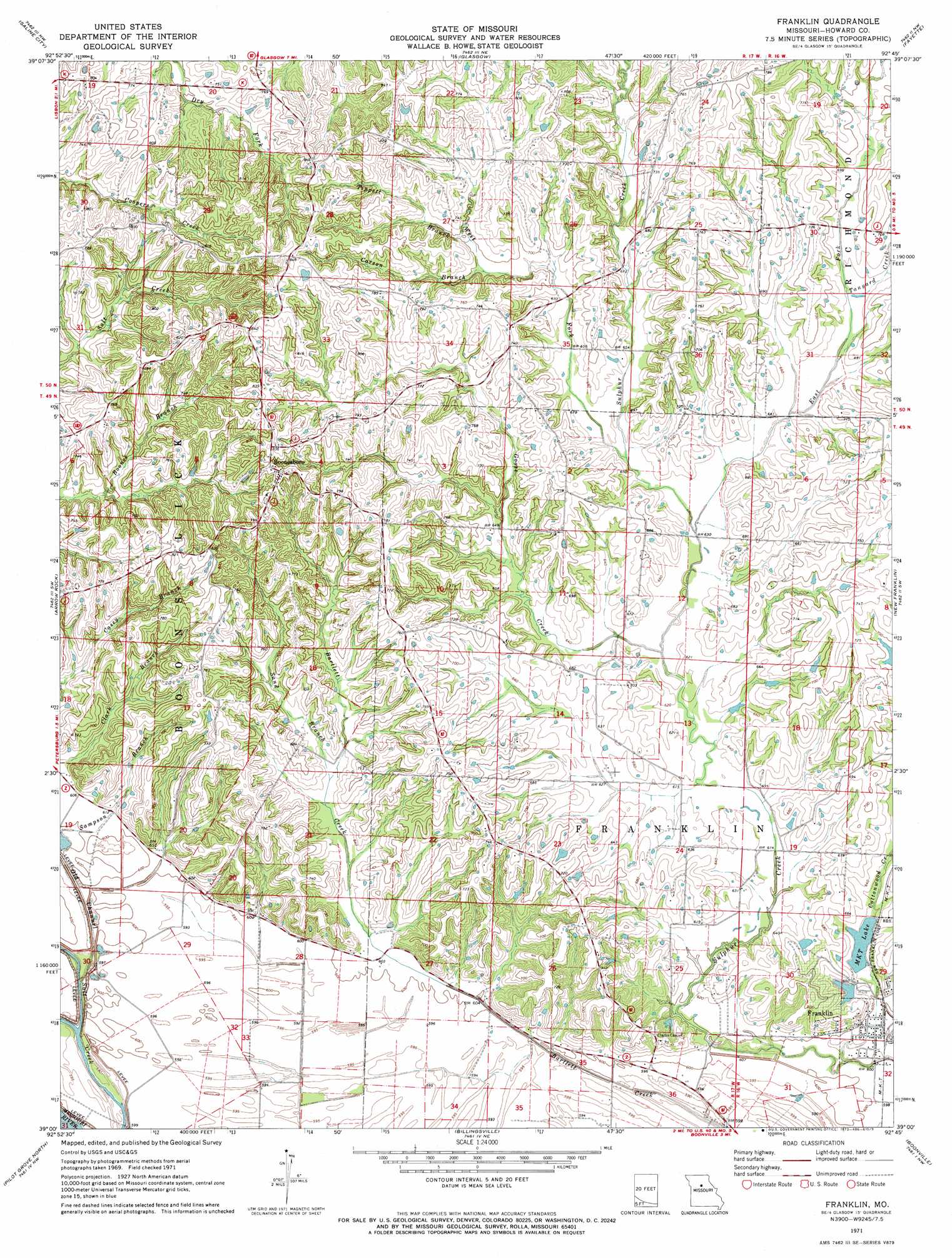
Franklin Topo Map Missouri
To zoom in, hover over the map of Franklin
USGS Topo Quad 39092a7 - 1:24,000 scale
| Topo Map Name: | Franklin |
| USGS Topo Quad ID: | 39092a7 |
| Print Size: | ca. 21 1/4" wide x 27" high |
| Southeast Coordinates: | 39° N latitude / 92.75° W longitude |
| Map Center Coordinates: | 39.0625° N latitude / 92.8125° W longitude |
| U.S. State: | MO |
| Filename: | o39092a7.jpg |
| Download Map JPG Image: | Franklin topo map 1:24,000 scale |
| Map Type: | Topographic |
| Topo Series: | 7.5´ |
| Map Scale: | 1:24,000 |
| Source of Map Images: | United States Geological Survey (USGS) |
| Alternate Map Versions: |
Franklin MO 1971, updated 1973 Download PDF Buy paper map Franklin MO 1971, updated 1973 Download PDF Buy paper map Franklin MO 2012 Download PDF Buy paper map Franklin MO 2014 Download PDF Buy paper map |
1:24,000 Topo Quads surrounding Franklin
New Frankfort |
Cambridge |
Forest Green |
Armstrong |
Higbee |
Slater |
Saline City |
Glasgow |
Fayette |
Burton |
Napton |
Arrow Rock |
Franklin |
New Franklin |
Hilldale |
Nelson |
Pilot Grove North |
Billingsville |
Boonville |
Rocheport |
Clifton City |
Pilot Grove South |
Bunceton |
Lone Elm |
Prairie Home |
> Back to 39092a1 at 1:100,000 scale
> Back to 39092a1 at 1:250,000 scale
> Back to U.S. Topo Maps home
Franklin topo map: Gazetteer
Franklin: Dams
Lippold Lake Dam elevation 203m 666′New Horticulture Farm Dam elevation 193m 633′
Okaydy Reservoir Dam elevation 189m 620′
Franklin: Populated Places
Boonesboro elevation 250m 820′Franklin elevation 182m 597′
Franklin: Reservoirs
Horticulture Lake elevation 193m 633′M K T Lake elevation 189m 620′
Franklin: Streams
Carson Branch elevation 211m 692′Cottonwood Creek elevation 178m 583′
East Fork Sulphur Creek elevation 189m 620′
Goose Creek elevation 189m 620′
Sampson Branch elevation 183m 600′
Sand Branch elevation 194m 636′
Tanyard Creek elevation 200m 656′
Tippett Branch elevation 212m 695′
West Fork Sulphur Creek elevation 194m 636′
Franklin digital topo map on disk
Buy this Franklin topo map showing relief, roads, GPS coordinates and other geographical features, as a high-resolution digital map file on DVD: