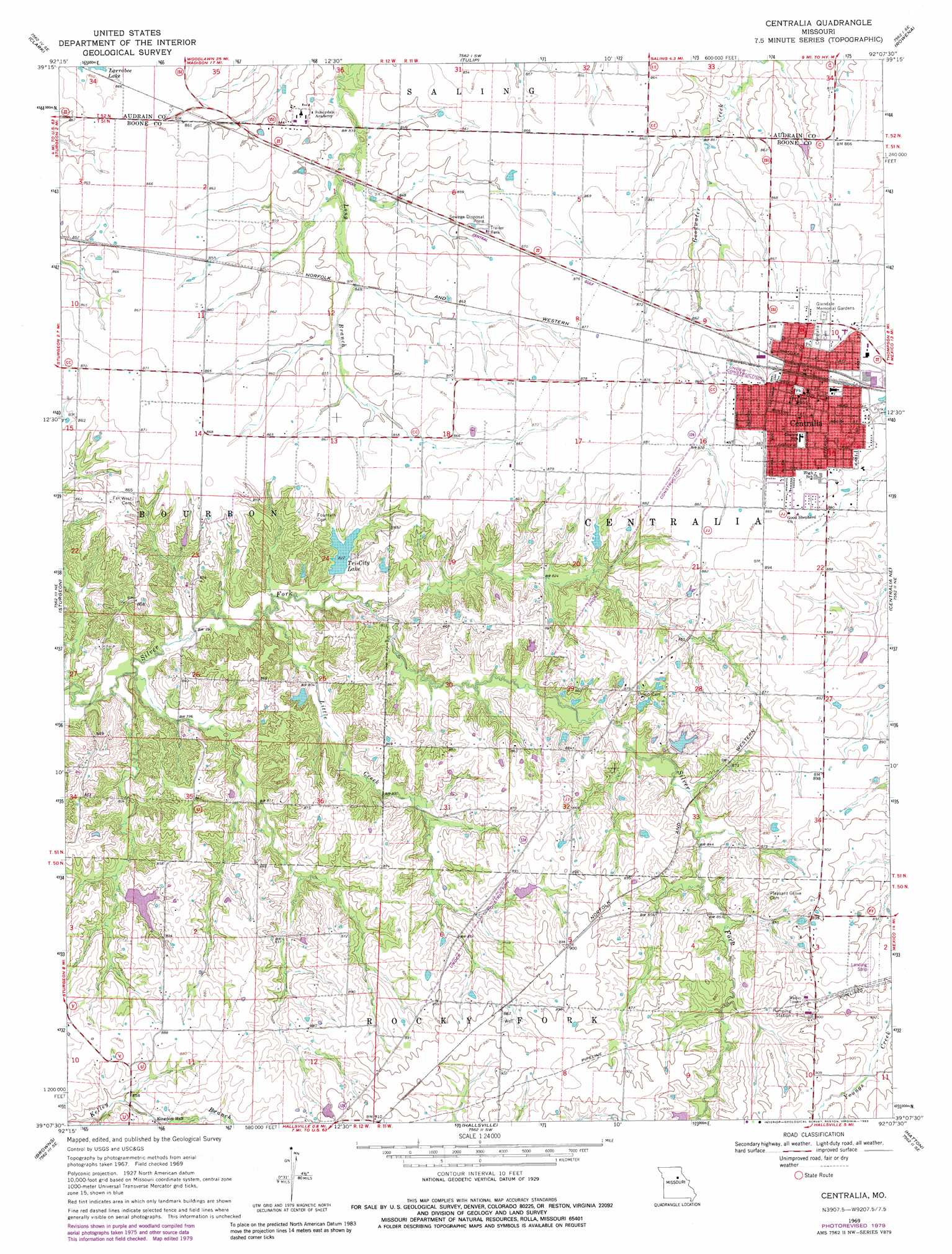
Centralia Topo Map Missouri
To zoom in, hover over the map of Centralia
USGS Topo Quad 39092b2 - 1:24,000 scale
| Topo Map Name: | Centralia |
| USGS Topo Quad ID: | 39092b2 |
| Print Size: | ca. 21 1/4" wide x 27" high |
| Southeast Coordinates: | 39.125° N latitude / 92.125° W longitude |
| Map Center Coordinates: | 39.1875° N latitude / 92.1875° W longitude |
| U.S. State: | MO |
| Filename: | o39092b2.jpg |
| Download Map JPG Image: | Centralia topo map 1:24,000 scale |
| Map Type: | Topographic |
| Topo Series: | 7.5´ |
| Map Scale: | 1:24,000 |
| Source of Map Images: | United States Geological Survey (USGS) |
| Alternate Map Versions: |
Centralia MO 1969, updated 1971 Download PDF Buy paper map Centralia MO 1969, updated 1979 Download PDF Buy paper map Centralia MO 1969, updated 1983 Download PDF Buy paper map Centralia MO 2012 Download PDF Buy paper map Centralia MO 2014 Download PDF Buy paper map |
1:24,000 Topo Quads surrounding Centralia
Moberly |
Middle Grove |
Madison |
Paris West |
Paris East |
Renick |
Clark |
Tulip |
Rowena |
Molino |
Harrisburg |
Sturgeon |
Centralia |
Centralia Ne |
Mexico West |
Sturgeon Sw |
Browns |
Hallsville |
Hatton |
Auxvasse |
Huntsdale |
Columbia |
Millersburg |
Millersburg Ne |
Kingdom City |
> Back to 39092a1 at 1:100,000 scale
> Back to 39092a1 at 1:250,000 scale
> Back to U.S. Topo Maps home
Centralia topo map: Gazetteer
Centralia: Airports
A B Chance Company Heliport elevation 266m 872′Chance Airport elevation 277m 908′
Centralia: Areas
Little Dixie elevation 276m 905′Centralia: Dams
Bunns Lake East Dam elevation 269m 882′Bunns Lake West Dam elevation 270m 885′
Forrest Lake Dam elevation 261m 856′
Fountain Lake Dam elevation 260m 853′
Lower Lake Chapparel Dam elevation 250m 820′
Montgomery Lake Dam elevation 251m 823′
Musgraves Lake Dam elevation 262m 859′
Roberts Lake Dam elevation 253m 830′
Roddy Lake Dam elevation 255m 836′
Schnarre Lake Section 23 Dam elevation 250m 820′
Schnarre Section 24 Dam elevation 255m 836′
Tri-City Community Lake Dam elevation 251m 823′
Upper Lake Chapperal Dam elevation 252m 826′
Centralia: Populated Places
Centralia elevation 269m 882′Larrabee elevation 265m 869′
Centralia: Reservoirs
Schnarre Lake elevation 250m 820′Tri-City Lake elevation 251m 823′
Upper Lake Chapperal elevation 252m 826′
Centralia: Streams
Little Creek elevation 241m 790′Centralia digital topo map on disk
Buy this Centralia topo map showing relief, roads, GPS coordinates and other geographical features, as a high-resolution digital map file on DVD: