Clark Topo Map Missouri
To zoom in, hover over the map of Clark
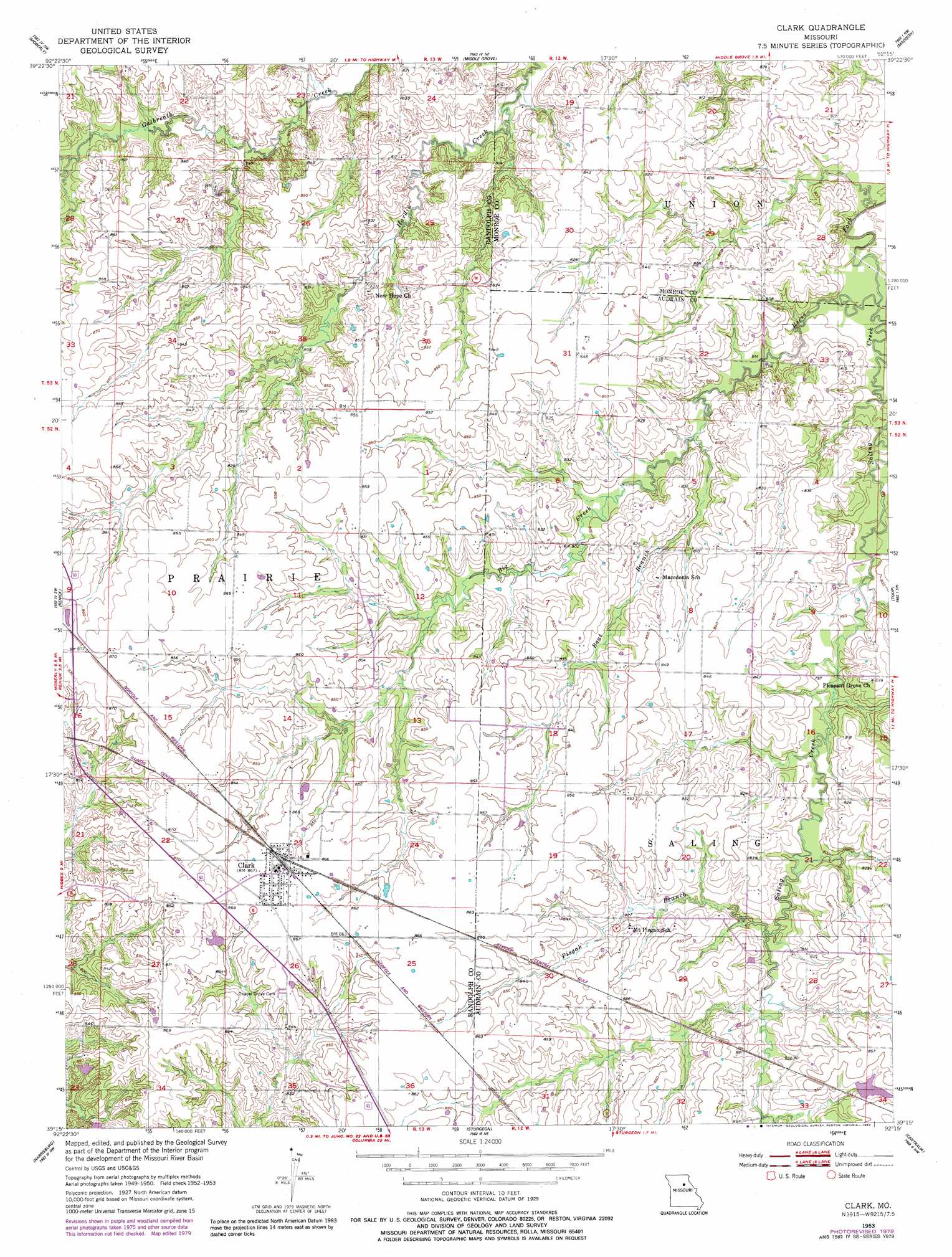
USGS Topo Quad 39092c3 - 1:24,000 scale
| Topo Map Name: | Clark |
| USGS Topo Quad ID: | 39092c3 |
| Print Size: | ca. 21 1/4" wide x 27" high |
| Southeast Coordinates: | 39.25° N latitude / 92.25° W longitude |
| Map Center Coordinates: | 39.3125° N latitude / 92.3125° W longitude |
| U.S. State: | MO |
| Filename: | o39092c3.jpg |
| Download Map JPG Image: | Clark topo map 1:24,000 scale |
| Map Type: | Topographic |
| Topo Series: | 7.5´ |
| Map Scale: | 1:24,000 |
| Source of Map Images: | United States Geological Survey (USGS) |
| Alternate Map Versions: |
Clark MO 1953, updated 1955 Download PDF Buy paper map Clark MO 1953, updated 1979 Download PDF Buy paper map Clark MO 1953, updated 1983 Download PDF Buy paper map Clark MO 2012 Download PDF Buy paper map Clark MO 2014 Download PDF Buy paper map |
1:24,000 Topo Quads surrounding Clark
College Mound |
Jacksonville |
Duncans Bridge |
Woodlawn |
Granville |
Huntsville |
Moberly |
Middle Grove |
Madison |
Paris West |
Higbee |
Renick |
Clark |
Tulip |
Rowena |
Burton |
Harrisburg |
Sturgeon |
Centralia |
Centralia Ne |
Hilldale |
Sturgeon Sw |
Browns |
Hallsville |
Hatton |
> Back to 39092a1 at 1:100,000 scale
> Back to 39092a1 at 1:250,000 scale
> Back to U.S. Topo Maps home
Clark topo map: Gazetteer
Clark: Dams
Bormet Lake Dam elevation 255m 836′Hanak Lake Dam elevation 255m 836′
Harry Freeman Dam elevation 250m 820′
Martin Lake Dam elevation 256m 839′
Milnes Lake Dam elevation 248m 813′
Clark: Populated Places
Clark elevation 263m 862′Clark: Post Offices
Davenport Post Office (historical) elevation 257m 843′Clark: Reservoirs
Cedarlane Farms Lake elevation 250m 820′Martin Lake elevation 256m 839′
Milnes Lake elevation 248m 813′
Clark: Streams
Big Creek elevation 243m 797′Boat Branch elevation 241m 790′
Pisgah Branch elevation 244m 800′
Saling Creek elevation 235m 770′
Clark digital topo map on disk
Buy this Clark topo map showing relief, roads, GPS coordinates and other geographical features, as a high-resolution digital map file on DVD: