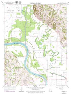
Cambridge Topo Map Missouri
To zoom in, hover over the map of Cambridge
USGS Topo Quad 39092c8 - 1:24,000 scale
| Topo Map Name: | Cambridge |
| USGS Topo Quad ID: | 39092c8 |
| Print Size: | ca. 21 1/4" wide x 27" high |
| Southeast Coordinates: | 39.25° N latitude / 92.875° W longitude |
| Map Center Coordinates: | 39.3125° N latitude / 92.9375° W longitude |
| U.S. State: | MO |
| Filename: | o39092c8.jpg |
| Download Map JPG Image: | Cambridge topo map 1:24,000 scale |
| Map Type: | Topographic |
| Topo Series: | 7.5´ |
| Map Scale: | 1:24,000 |
| Source of Map Images: | United States Geological Survey (USGS) |
| Alternate Map Versions: |
Cambridge MO 1956, updated 1957 Download PDF Buy paper map Cambridge MO 1956, updated 1979 Download PDF Buy paper map Cambridge MO 2012 Download PDF Buy paper map Cambridge MO 2014 Download PDF Buy paper map |
1:24,000 Topo Quads surrounding Cambridge
> Back to 39092a1 at 1:100,000 scale
> Back to 39092a1 at 1:250,000 scale
> Back to U.S. Topo Maps home
Cambridge topo map: Gazetteer
Cambridge: Bends
Big Cutoff elevation 188m 616′Gilliam Bend elevation 185m 606′
Hayes Cutoff elevation 188m 616′
Little Missouri Bend elevation 186m 610′
Wilhoite Bend elevation 185m 606′
Cambridge: Dams
C and S Lake Dam elevation 221m 725′Cott Lake Dam elevation 200m 656′
Kottman Lake Dam elevation 217m 711′
Summers Lake Dam elevation 206m 675′
Cambridge: Lakes
Smith Lake elevation 187m 613′Whiteside Lake elevation 189m 620′
Cambridge: Levees
Chariton River Main Stem Levee elevation 190m 623′Cambridge: Populated Places
Aholt elevation 189m 620′Cambridge elevation 212m 695′
Cazzell elevation 191m 626′
Namrash (historical) elevation 190m 623′
Rockford elevation 190m 623′
Cambridge: Reservoirs
C and S Lake elevation 221m 725′Cott Lake elevation 200m 656′
Kottman Lake elevation 217m 711′
Summers Lake elevation 206m 675′
Cambridge: Streams
Bear Creek elevation 185m 606′Buck Creek elevation 192m 629′
Palmer Creek elevation 190m 623′
Young Creek elevation 190m 623′
Cambridge digital topo map on disk
Buy this Cambridge topo map showing relief, roads, GPS coordinates and other geographical features, as a high-resolution digital map file on DVD:


