Huntsville Topo Map Missouri
To zoom in, hover over the map of Huntsville
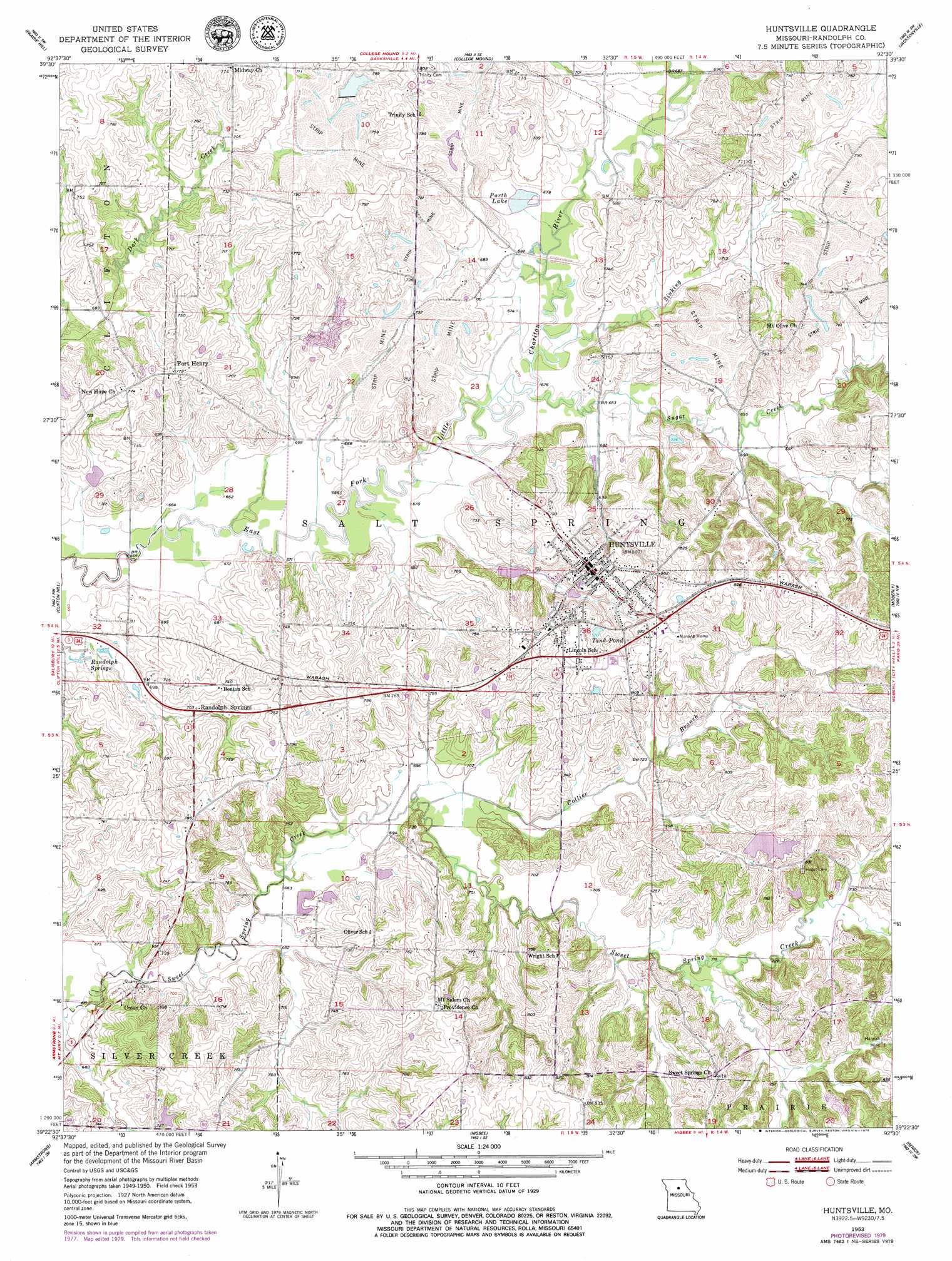
USGS Topo Quad 39092d5 - 1:24,000 scale
| Topo Map Name: | Huntsville |
| USGS Topo Quad ID: | 39092d5 |
| Print Size: | ca. 21 1/4" wide x 27" high |
| Southeast Coordinates: | 39.375° N latitude / 92.5° W longitude |
| Map Center Coordinates: | 39.4375° N latitude / 92.5625° W longitude |
| U.S. State: | MO |
| Filename: | o39092d5.jpg |
| Download Map JPG Image: | Huntsville topo map 1:24,000 scale |
| Map Type: | Topographic |
| Topo Series: | 7.5´ |
| Map Scale: | 1:24,000 |
| Source of Map Images: | United States Geological Survey (USGS) |
| Alternate Map Versions: |
Huntsville MO 1953, updated 1955 Download PDF Buy paper map Huntsville MO 1953, updated 1979 Download PDF Buy paper map Huntsville MO 1980, updated 1982 Download PDF Buy paper map Huntsville MO 2012 Download PDF Buy paper map Huntsville MO 2014 Download PDF Buy paper map |
1:24,000 Topo Quads surrounding Huntsville
Wien |
Lagonda |
Bevier South |
Macon |
Clarence |
Bynumville |
Prairie Hill |
College Mound |
Jacksonville |
Duncans Bridge |
Salisbury |
Clifton Hill |
Huntsville |
Moberly |
Middle Grove |
Forest Green |
Armstrong |
Higbee |
Renick |
Clark |
Glasgow |
Fayette |
Burton |
Harrisburg |
Sturgeon |
> Back to 39092a1 at 1:100,000 scale
> Back to 39092a1 at 1:250,000 scale
> Back to U.S. Topo Maps home
Huntsville topo map: Gazetteer
Huntsville: Dams
French Creek Farms Lake Dam elevation 228m 748′Kelley Lake Dam elevation 215m 705′
Lake Wata Dam elevation 241m 790′
Millers Lake Dam elevation 232m 761′
Vanderback Lake Section 21 Dam elevation 219m 718′
Wallace Ryals Lake Dam elevation 207m 679′
Huntsville: Lakes
Porth Lake elevation 206m 675′Tank Pond elevation 238m 780′
Huntsville: Mines
Hannah Mine elevation 240m 787′Huntsville: Populated Places
Fort Henry elevation 236m 774′Huntsville elevation 245m 803′
Randolph Springs elevation 213m 698′
Huntsville: Reservoirs
French Creek Farms Lake elevation 228m 748′Lake Wata elevation 241m 790′
Millers Lake elevation 232m 761′
Vanderback Lake Section 21 elevation 219m 718′
Wallace Ryals Lake elevation 207m 679′
Huntsville: Springs
Randolph Springs elevation 201m 659′Huntsville: Streams
Collier Branch elevation 210m 688′Sinking Creek elevation 204m 669′
Sugar Creek elevation 204m 669′
Huntsville digital topo map on disk
Buy this Huntsville topo map showing relief, roads, GPS coordinates and other geographical features, as a high-resolution digital map file on DVD: