Bucklin Topo Map Missouri
To zoom in, hover over the map of Bucklin
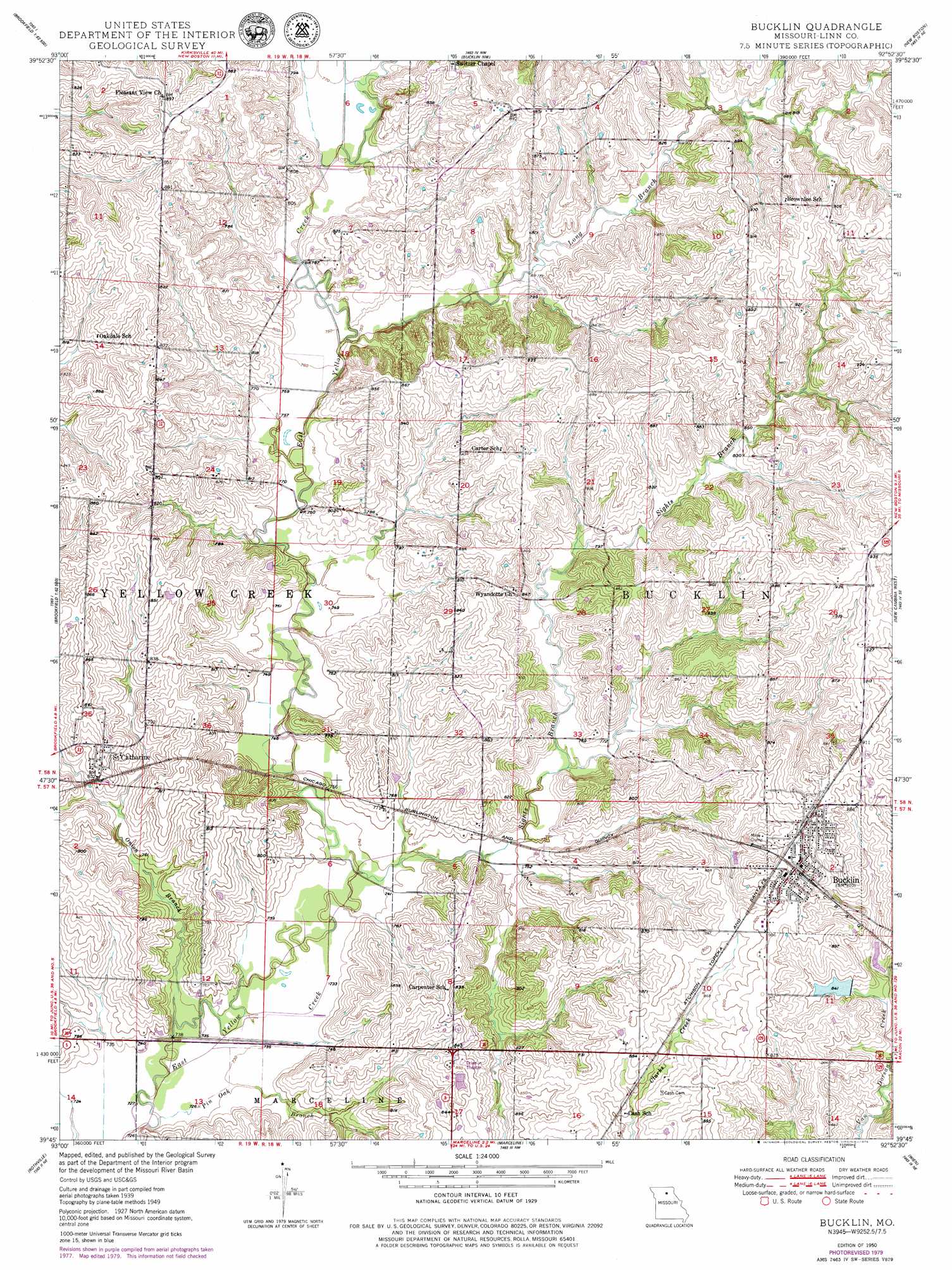
USGS Topo Quad 39092g8 - 1:24,000 scale
| Topo Map Name: | Bucklin |
| USGS Topo Quad ID: | 39092g8 |
| Print Size: | ca. 21 1/4" wide x 27" high |
| Southeast Coordinates: | 39.75° N latitude / 92.875° W longitude |
| Map Center Coordinates: | 39.8125° N latitude / 92.9375° W longitude |
| U.S. State: | MO |
| Filename: | o39092g8.jpg |
| Download Map JPG Image: | Bucklin topo map 1:24,000 scale |
| Map Type: | Topographic |
| Topo Series: | 7.5´ |
| Map Scale: | 1:24,000 |
| Source of Map Images: | United States Geological Survey (USGS) |
| Alternate Map Versions: |
Bucklin MO 1949, updated 1956 Download PDF Buy paper map Bucklin MO 1950, updated 1950 Download PDF Buy paper map Bucklin MO 2012 Download PDF Buy paper map Bucklin MO 2014 Download PDF Buy paper map |
1:24,000 Topo Quads surrounding Bucklin
Browning |
Milan Se |
Winigan |
Nind |
Gifford |
Linneus |
Shelby |
Bucklin Nw |
New Boston |
Elmer |
Laclede |
Brookfield |
Bucklin |
New Cambria West |
New Cambria East |
Sumner |
Rothville |
Marceline |
Wien |
Lagonda |
Mendon |
Indian Grove |
Mike |
Bynumville |
Prairie Hill |
> Back to 39092e1 at 1:100,000 scale
> Back to 39092a1 at 1:250,000 scale
> Back to U.S. Topo Maps home
Bucklin topo map: Gazetteer
Bucklin: Dams
Black Horse Dam elevation 242m 793′Bucklin City Lake Dam elevation 256m 839′
Hahn Lake Dam elevation 254m 833′
Bucklin: Populated Places
Bucklin elevation 274m 898′Saint Catharine elevation 254m 833′
Bucklin: Reservoirs
Bucklin Lake elevation 256m 839′Bucklin Reservoir elevation 256m 839′
Garys Lake elevation 242m 793′
Larrys Lake elevation 254m 833′
Bucklin: Streams
Long Branch elevation 232m 761′Onion Branch elevation 219m 718′
Pin Oak Branch elevation 219m 718′
Sights Branch elevation 223m 731′
Bucklin digital topo map on disk
Buy this Bucklin topo map showing relief, roads, GPS coordinates and other geographical features, as a high-resolution digital map file on DVD: