New Boston Topo Map Missouri
To zoom in, hover over the map of New Boston
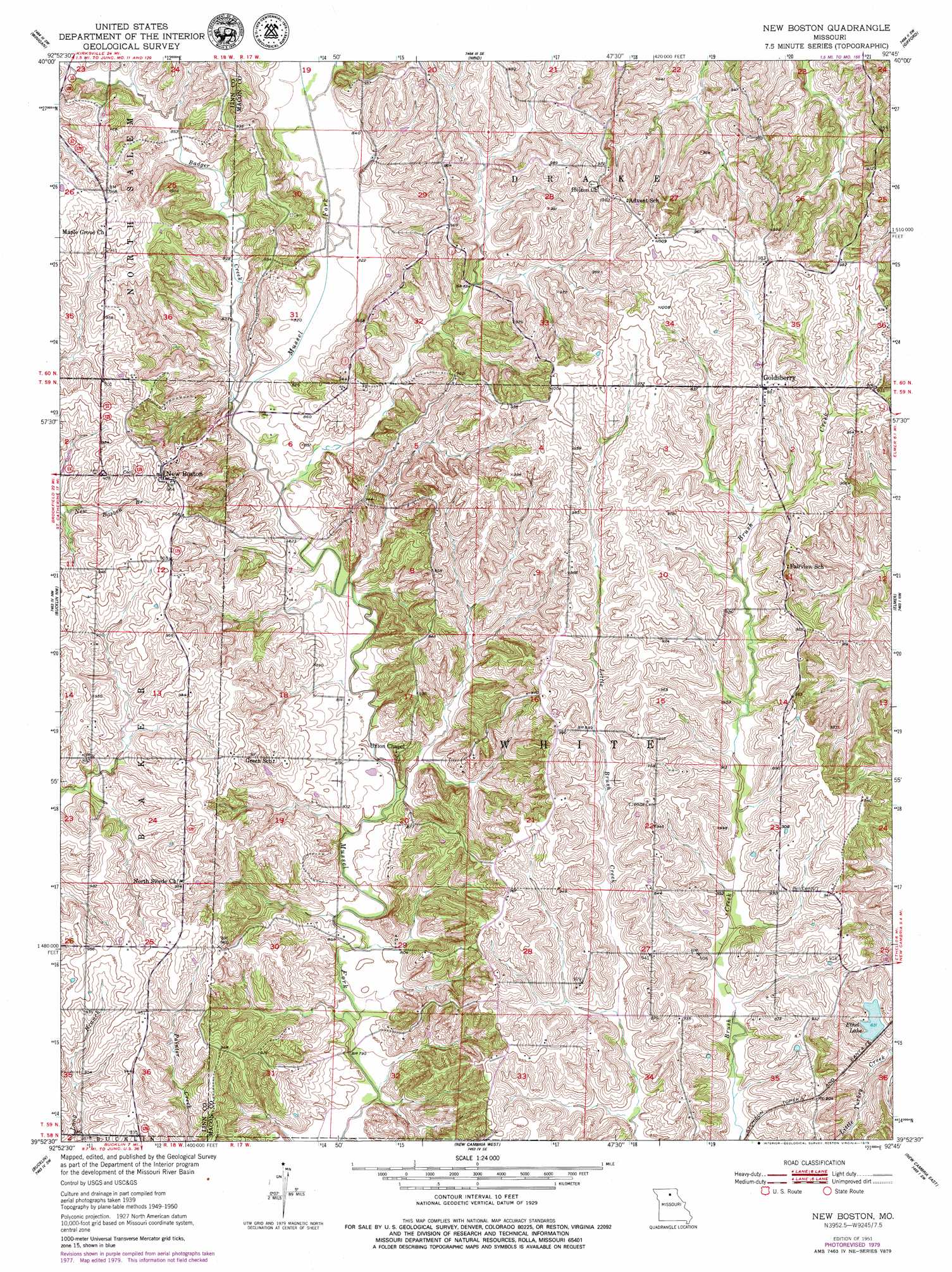
USGS Topo Quad 39092h7 - 1:24,000 scale
| Topo Map Name: | New Boston |
| USGS Topo Quad ID: | 39092h7 |
| Print Size: | ca. 21 1/4" wide x 27" high |
| Southeast Coordinates: | 39.875° N latitude / 92.75° W longitude |
| Map Center Coordinates: | 39.9375° N latitude / 92.8125° W longitude |
| U.S. State: | MO |
| Filename: | o39092h7.jpg |
| Download Map JPG Image: | New Boston topo map 1:24,000 scale |
| Map Type: | Topographic |
| Topo Series: | 7.5´ |
| Map Scale: | 1:24,000 |
| Source of Map Images: | United States Geological Survey (USGS) |
| Alternate Map Versions: |
New Boston MO 1951, updated 1951 Download PDF Buy paper map New Boston MO 1951, updated 1979 Download PDF Buy paper map New Boston MO 2012 Download PDF Buy paper map New Boston MO 2014 Download PDF Buy paper map |
1:24,000 Topo Quads surrounding New Boston
Milan East |
Mystic |
Pure Air |
Novinger |
Kirksville |
Milan Se |
Winigan |
Nind |
Gifford |
Millard |
Shelby |
Bucklin Nw |
New Boston |
Elmer |
Barnesville |
Brookfield |
Bucklin |
New Cambria West |
New Cambria East |
Bevier North |
Rothville |
Marceline |
Wien |
Lagonda |
Bevier South |
> Back to 39092e1 at 1:100,000 scale
> Back to 39092a1 at 1:250,000 scale
> Back to U.S. Topo Maps home
New Boston topo map: Gazetteer
New Boston: Dams
Ethel Lake Dam elevation 242m 793′New Boston: Populated Places
Benson elevation 292m 958′Goldsberry elevation 300m 984′
New Boston elevation 293m 961′
New Boston: Reservoirs
Ethel Lake elevation 242m 793′New Boston: Streams
Badger Creek elevation 248m 813′New Boston digital topo map on disk
Buy this New Boston topo map showing relief, roads, GPS coordinates and other geographical features, as a high-resolution digital map file on DVD: