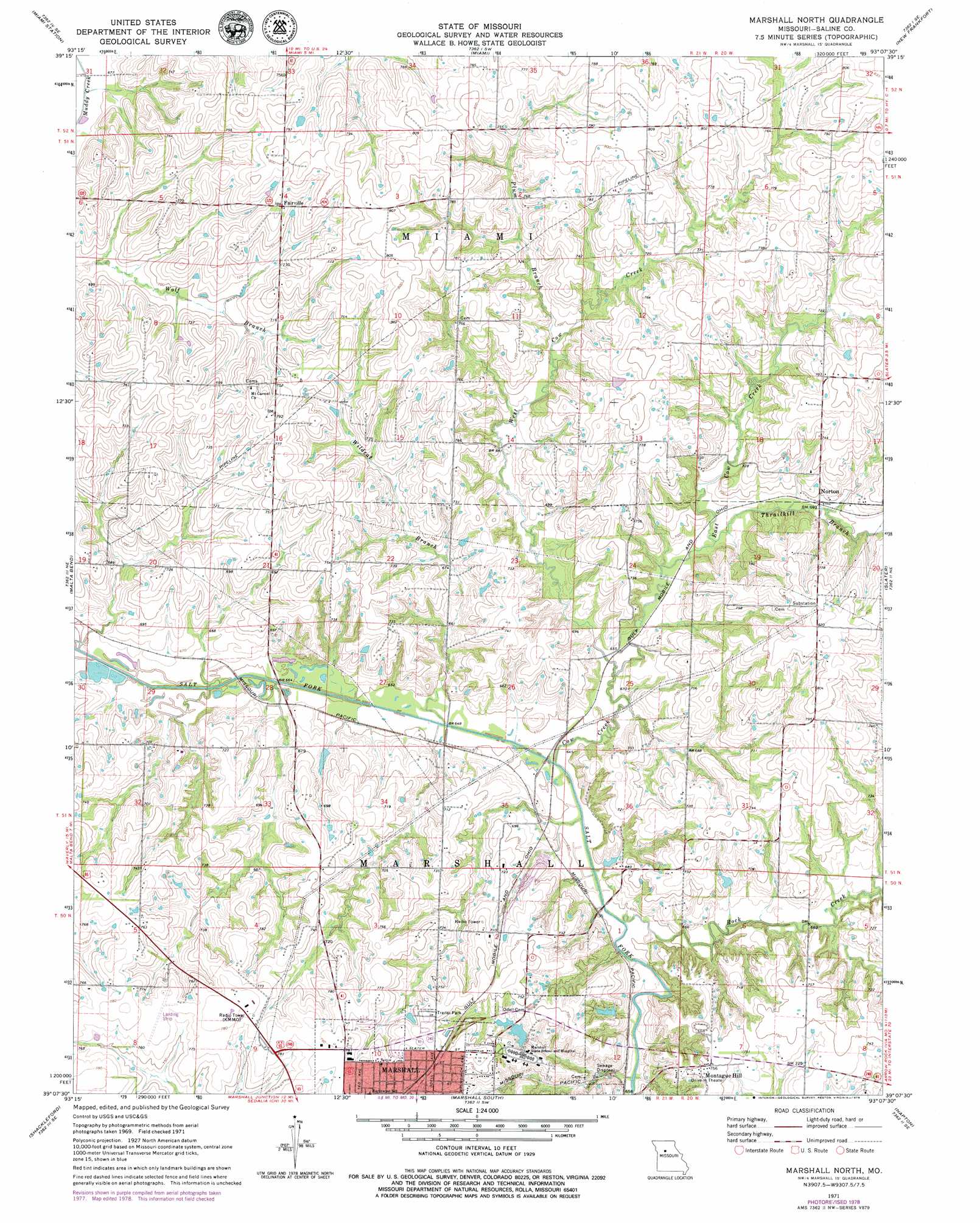
Marshall North Topo Map Missouri
To zoom in, hover over the map of Marshall North
USGS Topo Quad 39093b2 - 1:24,000 scale
| Topo Map Name: | Marshall North |
| USGS Topo Quad ID: | 39093b2 |
| Print Size: | ca. 21 1/4" wide x 27" high |
| Southeast Coordinates: | 39.125° N latitude / 93.125° W longitude |
| Map Center Coordinates: | 39.1875° N latitude / 93.1875° W longitude |
| U.S. State: | MO |
| Filename: | o39093b2.jpg |
| Download Map JPG Image: | Marshall North topo map 1:24,000 scale |
| Map Type: | Topographic |
| Topo Series: | 7.5´ |
| Map Scale: | 1:24,000 |
| Source of Map Images: | United States Geological Survey (USGS) |
| Alternate Map Versions: |
Marshall North MO 1971, updated 1973 Download PDF Buy paper map Marshall North MO 1971, updated 1979 Download PDF Buy paper map Marshall North MO 2012 Download PDF Buy paper map Marshall North MO 2015 Download PDF Buy paper map |
1:24,000 Topo Quads surrounding Marshall North
Standish |
Bosworth |
Brunswick West |
Brunswick East |
Keytesville |
Carrollton East |
Miami Station |
Miami |
New Frankfort |
Cambridge |
Grand Pass |
Malta Bend |
Marshall North |
Slater |
Saline City |
Blackburn |
Shackleford |
Marshall South |
Napton |
Arrow Rock |
Sweet Springs |
Houstonia |
Longwood |
Nelson |
Pilot Grove North |
> Back to 39093a1 at 1:100,000 scale
> Back to 39092a1 at 1:250,000 scale
> Back to U.S. Topo Maps home
Marshall North topo map: Gazetteer
Marshall North: Dams
Bryan Lake Dam elevation 208m 682′Marsh Lake Dam elevation 206m 675′
Marshall State School Lake Dam elevation 215m 705′
State School Dam B elevation 215m 705′
Wallys Lake Dam elevation 206m 675′
Marshall North: Populated Places
Fairville elevation 239m 784′Montague Hill elevation 229m 751′
Norton elevation 211m 692′
Marshall North: Reservoirs
Bryan Lake elevation 208m 682′Marsh Lake elevation 206m 675′
Marshall State School Lake elevation 215m 705′
State School Lake elevation 215m 705′
Wallys Lake elevation 206m 675′
Marshall North: Streams
Cow Creek elevation 195m 639′East Cow Creek elevation 198m 649′
Plum Branch elevation 210m 688′
Rock Creek elevation 195m 639′
Thrailkill Branch elevation 204m 669′
West Cow Creek elevation 198m 649′
Wildcat Branch elevation 195m 639′
Marshall North digital topo map on disk
Buy this Marshall North topo map showing relief, roads, GPS coordinates and other geographical features, as a high-resolution digital map file on DVD: