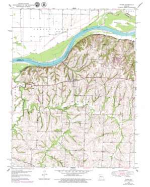
Dover Topo Map Missouri
To zoom in, hover over the map of Dover
USGS Topo Quad 39093b6 - 1:24,000 scale
| Topo Map Name: | Dover |
| USGS Topo Quad ID: | 39093b6 |
| Print Size: | ca. 21 1/4" wide x 27" high |
| Southeast Coordinates: | 39.125° N latitude / 93.625° W longitude |
| Map Center Coordinates: | 39.1875° N latitude / 93.6875° W longitude |
| U.S. State: | MO |
| Filename: | o39093b6.jpg |
| Download Map JPG Image: | Dover topo map 1:24,000 scale |
| Map Type: | Topographic |
| Topo Series: | 7.5´ |
| Map Scale: | 1:24,000 |
| Source of Map Images: | United States Geological Survey (USGS) |
| Alternate Map Versions: |
Dover MO 1950, updated 1977 Download PDF Buy paper map Dover MO 1950, updated 1979 Download PDF Buy paper map Dover MO 1951 Download PDF Buy paper map Dover MO 2012 Download PDF Buy paper map Dover MO 2015 Download PDF Buy paper map |
1:24,000 Topo Quads surrounding Dover
> Back to 39093a1 at 1:100,000 scale
> Back to 39092a1 at 1:250,000 scale
> Back to U.S. Topo Maps home
Dover topo map: Gazetteer
Dover: Bends
Baltimore Bend elevation 203m 666′Berun Bend elevation 204m 669′
Dover: Channels
Baltimore Island Chute elevation 203m 666′Dover: Dams
Amer Lake Dam elevation 229m 751′Fischer Lake Dam elevation 220m 721′
Ketner Lake Dam elevation 225m 738′
Knoche Lake Dam elevation 258m 846′
Number 144 Dam elevation 228m 748′
Robert Rasa Lake Dam elevation 223m 731′
Ruehter Lake Dam elevation 227m 744′
Tabo Creek Watershed Dam E-39 elevation 235m 770′
Tabo Creek Watershed Dam E-40 elevation 234m 767′
Tabo Creek Watershed Dam Number E-35 elevation 239m 784′
Tabo Creek Watershed Structure 1-24b Dam elevation 220m 721′
Tabo Creek Watershed Structure A-23 Dam elevation 217m 711′
Tabo Creek Watershed Structure E-20 Dam elevation 227m 744′
Tabo Creek Watershed Structure E-21 Dam elevation 244m 800′
Tabo Creek Watershed Structure E-22 Dam elevation 229m 751′
Tabo Creek Watershed Structure E-23 Dam elevation 238m 780′
Tabo Creek Watershed Structure E-24 Dam elevation 247m 810′
Tabo Creek Watershed Structure E-26 Dam elevation 236m 774′
Tabo Creek Watershed Structure E-28 Dam elevation 218m 715′
Tabo Creek Watershed Structure E-29 Dam elevation 232m 761′
Tabo Creek Watershed Structure E-33 Dam elevation 236m 774′
Tabo Creek Watershed Structure E-34 Dam elevation 215m 705′
Tabo Creek Watershed Structure F-20 Dam elevation 239m 784′
Tabo Creek Watershed Structure F-21 Dam elevation 239m 784′
Tabo Creek Watershed Structure F-27 Dam elevation 230m 754′
Tabo Creek Watershed Structure Number E-38 Dam elevation 240m 787′
Dover: Islands
Baltimore Island elevation 205m 672′Dover: Populated Places
Dover elevation 250m 820′Dover Station elevation 206m 675′
Hodge elevation 211m 692′
Miles Point elevation 205m 672′
Page City elevation 235m 770′
Tabeau elevation 217m 711′
Dover: Reservoirs
Lafayette A-23 Lake elevation 217m 711′Lafayette County Number E-40 Reservoir elevation 234m 767′
Lafayette E-20 Lake elevation 227m 744′
Lafayette E-34 Lake elevation 215m 705′
Lafayette E-38 Lake elevation 240m 787′
Luehrman Lake elevation 230m 754′
Number 145 Reservoir elevation 247m 810′
Number 189 Reservoir elevation 229m 751′
Number 190 Reservoir elevation 235m 770′
Number 191 Reservoir elevation 218m 715′
Ritter Lake elevation 236m 774′
Dover: Streams
Cottonwood Creek elevation 210m 688′Little Tabo Creek elevation 204m 669′
Rocky Ford Branch elevation 219m 718′
Tabo Creek elevation 207m 679′
Dover digital topo map on disk
Buy this Dover topo map showing relief, roads, GPS coordinates and other geographical features, as a high-resolution digital map file on DVD:


