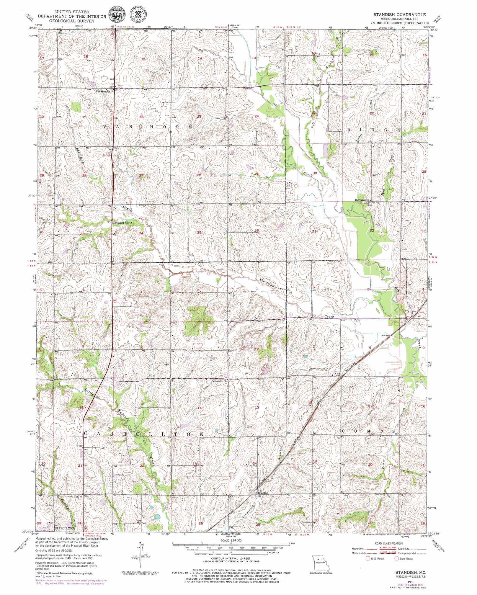
Standish Topo Map Missouri
To zoom in, hover over the map of Standish
USGS Topo Quad 39093d4 - 1:24,000 scale
| Topo Map Name: | Standish |
| USGS Topo Quad ID: | 39093d4 |
| Print Size: | ca. 21 1/4" wide x 27" high |
| Southeast Coordinates: | 39.375° N latitude / 93.375° W longitude |
| Map Center Coordinates: | 39.4375° N latitude / 93.4375° W longitude |
| U.S. State: | MO |
| Filename: | o39093d4.jpg |
| Download Map JPG Image: | Standish topo map 1:24,000 scale |
| Map Type: | Topographic |
| Topo Series: | 7.5´ |
| Map Scale: | 1:24,000 |
| Source of Map Images: | United States Geological Survey (USGS) |
| Alternate Map Versions: |
Standish MO 1951, updated 1952 Download PDF Buy paper map Standish MO 1951, updated 1979 Download PDF Buy paper map Standish MO 2012 Download PDF Buy paper map Standish MO 2015 Download PDF Buy paper map |
1:24,000 Topo Quads surrounding Standish
Utica West |
Utica East |
Avalon |
Fountain Grove |
Sumner |
Plymouth |
Coloma |
Tina |
Hale |
Mendon |
Roads |
Bogard |
Standish |
Bosworth |
Brunswick West |
Norborne |
Carrollton West |
Carrollton East |
Miami Station |
Miami |
Dover |
Waverly |
Grand Pass |
Malta Bend |
Marshall North |
> Back to 39093a1 at 1:100,000 scale
> Back to 39092a1 at 1:250,000 scale
> Back to U.S. Topo Maps home
Standish topo map: Gazetteer
Standish: Dams
Johnson Lake Dam elevation 220m 721′Pence Dam elevation 223m 731′
Standish: Populated Places
Standish elevation 213m 698′Standish: Reservoirs
Johnson Lake elevation 220m 721′Pence Lake elevation 223m 731′
Standish: Streams
Mud Branch elevation 204m 669′Parker Branch elevation 201m 659′
Shootman Creek elevation 201m 659′
Turkey Creek elevation 204m 669′
Wolf Branch elevation 207m 679′
Standish digital topo map on disk
Buy this Standish topo map showing relief, roads, GPS coordinates and other geographical features, as a high-resolution digital map file on DVD: