Tina Topo Map Missouri
To zoom in, hover over the map of Tina
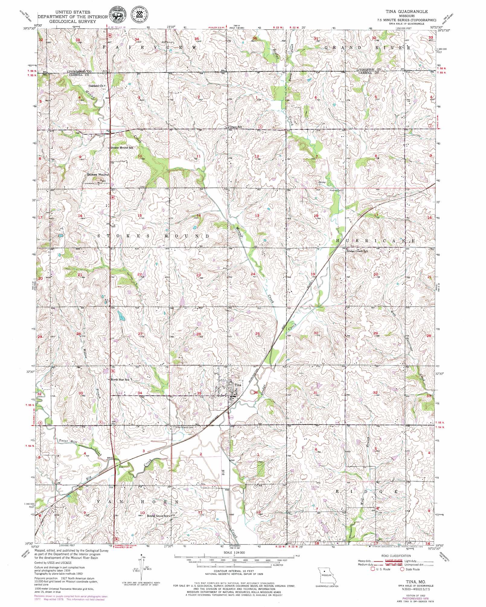
USGS Topo Quad 39093e4 - 1:24,000 scale
| Topo Map Name: | Tina |
| USGS Topo Quad ID: | 39093e4 |
| Print Size: | ca. 21 1/4" wide x 27" high |
| Southeast Coordinates: | 39.5° N latitude / 93.375° W longitude |
| Map Center Coordinates: | 39.5625° N latitude / 93.4375° W longitude |
| U.S. State: | MO |
| Filename: | o39093e4.jpg |
| Download Map JPG Image: | Tina topo map 1:24,000 scale |
| Map Type: | Topographic |
| Topo Series: | 7.5´ |
| Map Scale: | 1:24,000 |
| Source of Map Images: | United States Geological Survey (USGS) |
| Alternate Map Versions: |
Tina MO 1952 Download PDF Buy paper map Tina MO 1952, updated 1979 Download PDF Buy paper map Tina MO 2012 Download PDF Buy paper map Tina MO 2015 Download PDF Buy paper map |
1:24,000 Topo Quads surrounding Tina
Sampsel |
Chillicothe |
Wheeling |
Meadville |
Laclede |
Utica West |
Utica East |
Avalon |
Fountain Grove |
Sumner |
Plymouth |
Coloma |
Tina |
Hale |
Mendon |
Roads |
Bogard |
Standish |
Bosworth |
Brunswick West |
Norborne |
Carrollton West |
Carrollton East |
Miami Station |
Miami |
> Back to 39093e1 at 1:100,000 scale
> Back to 39092a1 at 1:250,000 scale
> Back to U.S. Topo Maps home
Tina topo map: Gazetteer
Tina: Dams
Miller Lake Dam elevation 225m 738′Tina: Populated Places
Asper elevation 236m 774′Bridge Creek elevation 248m 813′
Grace elevation 240m 787′
Tina elevation 220m 721′
Tina: Streams
Bridge Creek elevation 210m 688′Buris Creek elevation 225m 738′
Mound Creek elevation 215m 705′
Rock Branch elevation 210m 688′
Tater Hill Creek elevation 213m 698′
Willow Branch elevation 213m 698′
Tina: Summits
Stokes Mound elevation 277m 908′Tina digital topo map on disk
Buy this Tina topo map showing relief, roads, GPS coordinates and other geographical features, as a high-resolution digital map file on DVD: