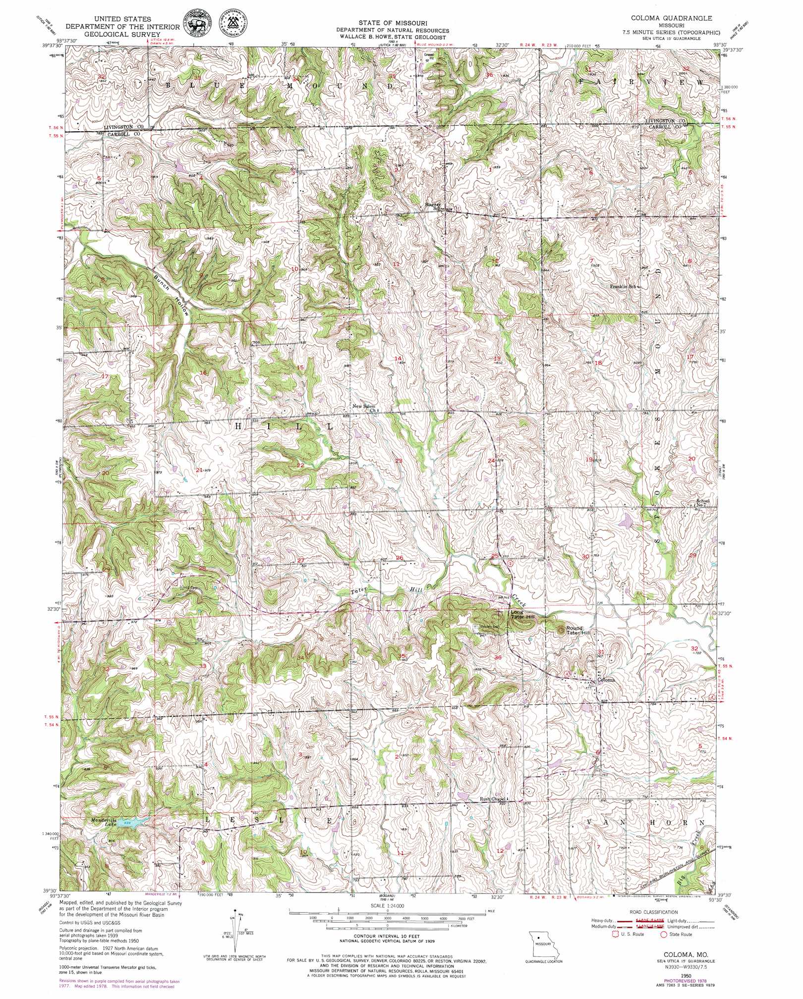
Coloma Topo Map Missouri
To zoom in, hover over the map of Coloma
USGS Topo Quad 39093e5 - 1:24,000 scale
| Topo Map Name: | Coloma |
| USGS Topo Quad ID: | 39093e5 |
| Print Size: | ca. 21 1/4" wide x 27" high |
| Southeast Coordinates: | 39.5° N latitude / 93.5° W longitude |
| Map Center Coordinates: | 39.5625° N latitude / 93.5625° W longitude |
| U.S. State: | MO |
| Filename: | o39093e5.jpg |
| Download Map JPG Image: | Coloma topo map 1:24,000 scale |
| Map Type: | Topographic |
| Topo Series: | 7.5´ |
| Map Scale: | 1:24,000 |
| Source of Map Images: | United States Geological Survey (USGS) |
| Alternate Map Versions: |
Coloma MO 1950, updated 1952 Download PDF Buy paper map Coloma MO 1950, updated 1979 Download PDF Buy paper map Coloma MO 2012 Download PDF Buy paper map Coloma MO 2015 Download PDF Buy paper map |
1:24,000 Topo Quads surrounding Coloma
Breckenridge |
Sampsel |
Chillicothe |
Wheeling |
Meadville |
Flat Creek |
Utica West |
Utica East |
Avalon |
Fountain Grove |
Braymer |
Plymouth |
Coloma |
Tina |
Hale |
Stet |
Roads |
Bogard |
Standish |
Bosworth |
Hardin |
Norborne |
Carrollton West |
Carrollton East |
Miami Station |
> Back to 39093e1 at 1:100,000 scale
> Back to 39092a1 at 1:250,000 scale
> Back to U.S. Topo Maps home
Coloma topo map: Gazetteer
Coloma: Dams
Harts Lake Dam elevation 258m 846′Henry Lake Dam elevation 238m 780′
Maberry Lake Dam elevation 245m 803′
Mandeville Lake Dam elevation 250m 820′
Susewine Lake Dam elevation 272m 892′
Sykes Lake Dam elevation 267m 875′
Waitman Lake Section 30 Dam elevation 232m 761′
Coloma: Populated Places
Coloma elevation 252m 826′Fisher (historical) elevation 297m 974′
Coloma: Post Offices
Fisher Post Office elevation 297m 974′Coloma: Reservoirs
Harts Lake elevation 258m 846′Henry Lake elevation 238m 780′
Maberry Lake elevation 245m 803′
Mandeville Lake elevation 256m 839′
Mandville Lake elevation 250m 820′
Susewine Lake elevation 272m 892′
Sykes Lake elevation 267m 875′
Waitman Lake Section 30 elevation 232m 761′
Coloma: Summits
Long Tater Hill elevation 273m 895′Round Tater Hill elevation 252m 826′
Coloma: Valleys
Bunch Hollow elevation 236m 774′Coloma digital topo map on disk
Buy this Coloma topo map showing relief, roads, GPS coordinates and other geographical features, as a high-resolution digital map file on DVD: