Plymouth Topo Map Missouri
To zoom in, hover over the map of Plymouth
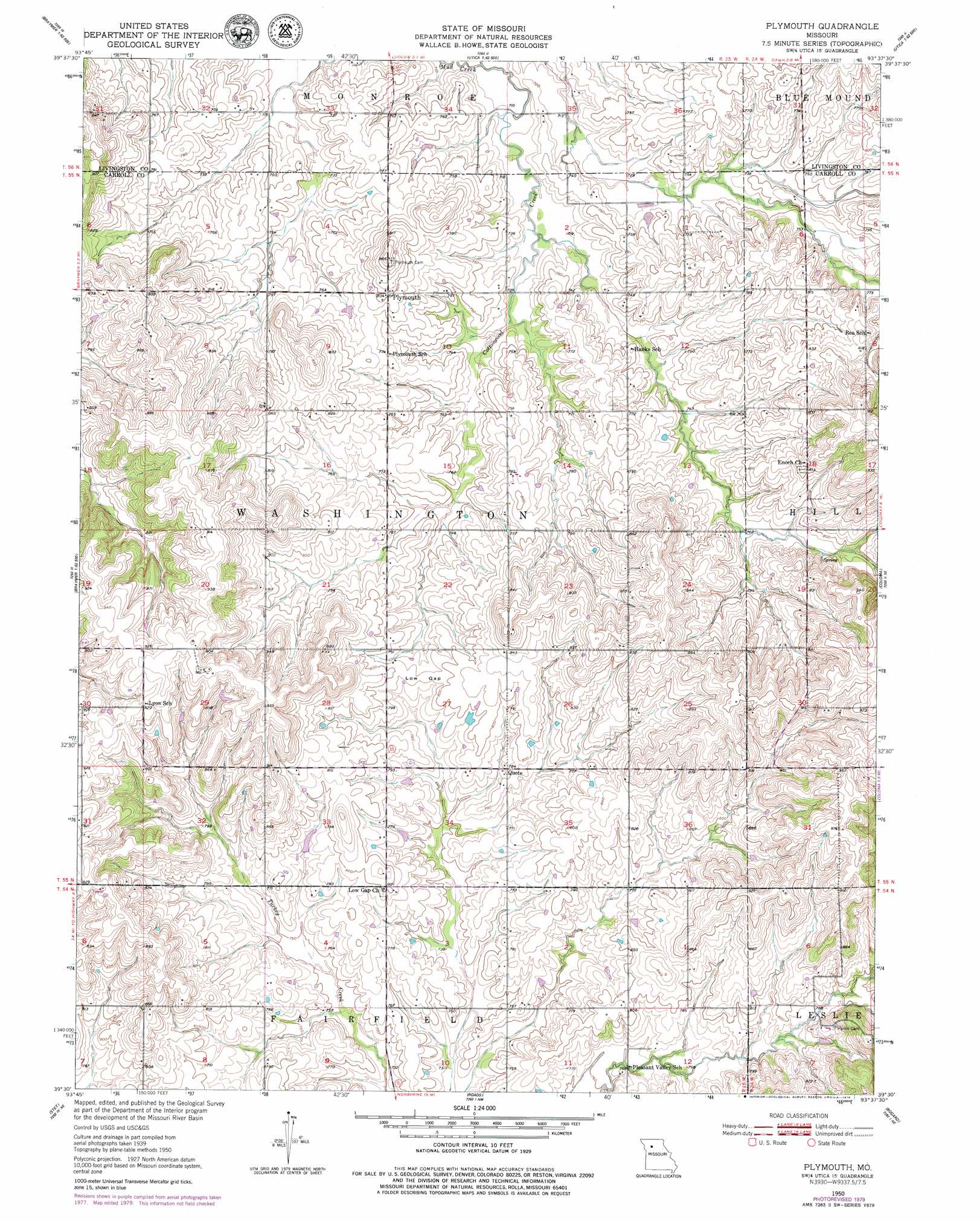
USGS Topo Quad 39093e6 - 1:24,000 scale
| Topo Map Name: | Plymouth |
| USGS Topo Quad ID: | 39093e6 |
| Print Size: | ca. 21 1/4" wide x 27" high |
| Southeast Coordinates: | 39.5° N latitude / 93.625° W longitude |
| Map Center Coordinates: | 39.5625° N latitude / 93.6875° W longitude |
| U.S. State: | MO |
| Filename: | o39093e6.jpg |
| Download Map JPG Image: | Plymouth topo map 1:24,000 scale |
| Map Type: | Topographic |
| Topo Series: | 7.5´ |
| Map Scale: | 1:24,000 |
| Source of Map Images: | United States Geological Survey (USGS) |
| Alternate Map Versions: |
Plymouth MO 1950, updated 1952 Download PDF Buy paper map Plymouth MO 1950, updated 1979 Download PDF Buy paper map Plymouth MO 2012 Download PDF Buy paper map Plymouth MO 2015 Download PDF Buy paper map |
1:24,000 Topo Quads surrounding Plymouth
Nettleton |
Breckenridge |
Sampsel |
Chillicothe |
Wheeling |
Hamilton East |
Flat Creek |
Utica West |
Utica East |
Avalon |
Cowgill |
Braymer |
Plymouth |
Coloma |
Tina |
Millville |
Stet |
Roads |
Bogard |
Standish |
Richmond |
Hardin |
Norborne |
Carrollton West |
Carrollton East |
> Back to 39093e1 at 1:100,000 scale
> Back to 39092a1 at 1:250,000 scale
> Back to U.S. Topo Maps home
Plymouth topo map: Gazetteer
Plymouth: Dams
Cowan Lake Dam elevation 236m 774′Davies Lake Dam elevation 224m 734′
McLaughlin Lake Dam elevation 274m 898′
Ulrich Lake Dam elevation 228m 748′
Wallace Lake Section 6 Dam elevation 244m 800′
Wallace Lake Section 9 Dam elevation 233m 764′
Plymouth: Gaps
Low Gap elevation 241m 790′Plymouth: Populated Places
Latoh (historical) elevation 249m 816′Plymouth elevation 245m 803′
Quote elevation 238m 780′
Plymouth: Post Offices
Latoh Post Office elevation 249m 816′Plymouth: Reservoirs
Cowan Lake elevation 236m 774′Davies Lake elevation 224m 734′
McLaughlin Lake elevation 274m 898′
Ulrich Lake elevation 228m 748′
Wallace Lake Section 6 elevation 244m 800′
Wallace Lake Section 9 elevation 233m 764′
Plymouth: Streams
Cottonwood Creek elevation 214m 702′Plymouth: Valleys
Low Gap Valley elevation 219m 718′Plymouth digital topo map on disk
Buy this Plymouth topo map showing relief, roads, GPS coordinates and other geographical features, as a high-resolution digital map file on DVD: