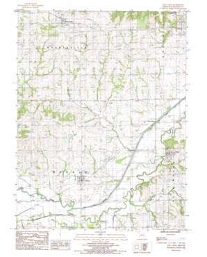
Utica West Topo Map Missouri
To zoom in, hover over the map of Utica West
USGS Topo Quad 39093f6 - 1:24,000 scale
| Topo Map Name: | Utica West |
| USGS Topo Quad ID: | 39093f6 |
| Print Size: | ca. 21 1/4" wide x 27" high |
| Southeast Coordinates: | 39.625° N latitude / 93.625° W longitude |
| Map Center Coordinates: | 39.6875° N latitude / 93.6875° W longitude |
| U.S. State: | MO |
| Filename: | o39093f6.jpg |
| Download Map JPG Image: | Utica West topo map 1:24,000 scale |
| Map Type: | Topographic |
| Topo Series: | 7.5´ |
| Map Scale: | 1:24,000 |
| Source of Map Images: | United States Geological Survey (USGS) |
| Alternate Map Versions: |
Utica West MO 1984, updated 1985 Download PDF Buy paper map Utica West MO 2012 Download PDF Buy paper map Utica West MO 2015 Download PDF Buy paper map |
1:24,000 Topo Quads surrounding Utica West
> Back to 39093e1 at 1:100,000 scale
> Back to 39092a1 at 1:250,000 scale
> Back to U.S. Topo Maps home
Utica West topo map: Gazetteer
Utica West: Canals
Mud Creek Drainage Ditch elevation 212m 695′Shoal Creek Drainage Ditch elevation 212m 695′
Utica West: Dams
Gilliland Lake Dam North elevation 239m 784′Gilliland Lake Dam South elevation 257m 843′
Johnson Lake Dam elevation 260m 853′
Jones Lake Dam elevation 230m 754′
Paul Jones Lake Dam elevation 224m 734′
Watkin Lake Dam elevation 225m 738′
Utica West: Populated Places
Dawn elevation 222m 728′Ludlow elevation 227m 744′
Mooresville elevation 280m 918′
Utica elevation 232m 761′
Utica West: Reservoirs
Melvin Watkins Lake elevation 225m 738′Utica West: Streams
Clear Creek elevation 212m 695′Mud Creek elevation 213m 698′
Rattlesnake Creek elevation 211m 692′
Utica West digital topo map on disk
Buy this Utica West topo map showing relief, roads, GPS coordinates and other geographical features, as a high-resolution digital map file on DVD:


