Hamilton East Topo Map Missouri
To zoom in, hover over the map of Hamilton East
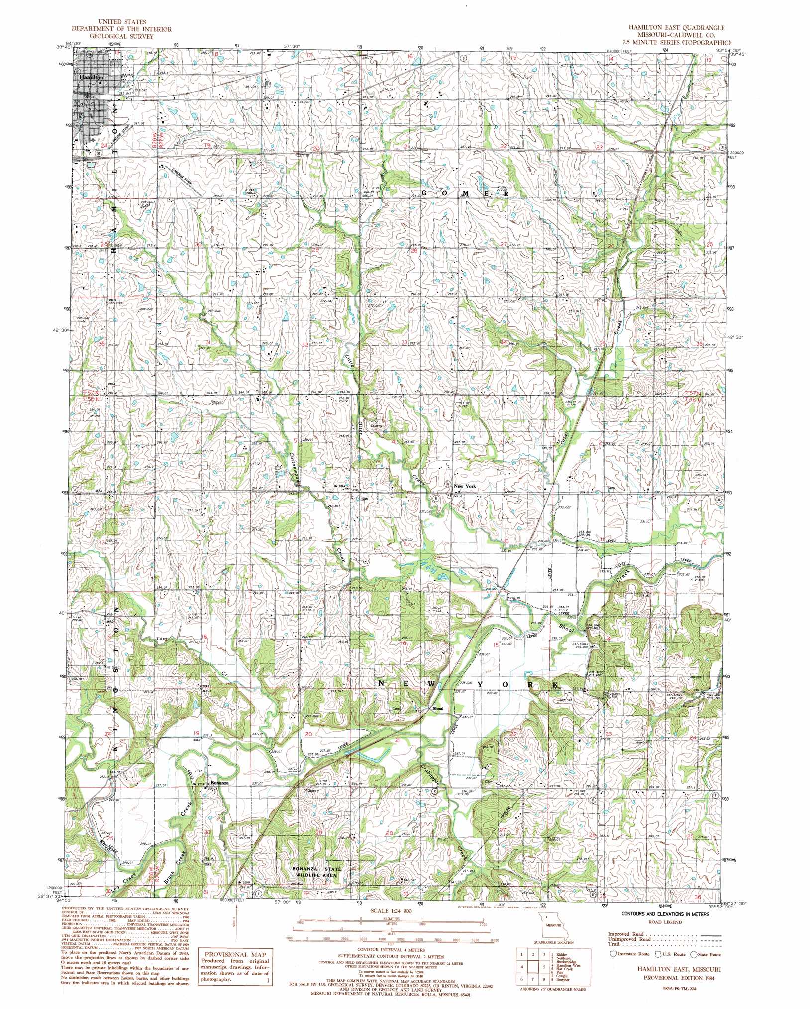
USGS Topo Quad 39093f8 - 1:24,000 scale
| Topo Map Name: | Hamilton East |
| USGS Topo Quad ID: | 39093f8 |
| Print Size: | ca. 21 1/4" wide x 27" high |
| Southeast Coordinates: | 39.625° N latitude / 93.875° W longitude |
| Map Center Coordinates: | 39.6875° N latitude / 93.9375° W longitude |
| U.S. State: | MO |
| Filename: | o39093f8.jpg |
| Download Map JPG Image: | Hamilton East topo map 1:24,000 scale |
| Map Type: | Topographic |
| Topo Series: | 7.5´ |
| Map Scale: | 1:24,000 |
| Source of Map Images: | United States Geological Survey (USGS) |
| Alternate Map Versions: |
Hamilton East MO 1984, updated 1985 Download PDF Buy paper map Hamilton East MO 2012 Download PDF Buy paper map Hamilton East MO 2015 Download PDF Buy paper map |
1:24,000 Topo Quads surrounding Hamilton East
Weatherby |
Altamont |
Gallatin |
Jamesport |
Shearwood |
Winston |
Kidder |
Nettleton |
Breckenridge |
Sampsel |
Cameron East |
Hamilton West |
Hamilton East |
Flat Creek |
Utica West |
Elmira |
Polo |
Cowgill |
Braymer |
Plymouth |
Lawson |
Knoxville |
Millville |
Stet |
Roads |
> Back to 39093e1 at 1:100,000 scale
> Back to 39092a1 at 1:250,000 scale
> Back to U.S. Topo Maps home
Hamilton East topo map: Gazetteer
Hamilton East: Airports
Cliff Scott Airport elevation 299m 980′Hamilton East: Bridges
Gould Farm Bridge elevation 232m 761′Hamilton East: Populated Places
Bonanza elevation 236m 774′Easterville elevation 281m 921′
Gould Farm elevation 252m 826′
Hamilton elevation 301m 987′
New York elevation 244m 800′
Shoal elevation 240m 787′
Hamilton East: Streams
Brush Creek elevation 236m 774′Cottonwood Creek elevation 232m 761′
Crabapple Creek elevation 232m 761′
Little Otter Creek elevation 232m 761′
Log Creek elevation 236m 774′
Tom Creek elevation 235m 770′
Hamilton East digital topo map on disk
Buy this Hamilton East topo map showing relief, roads, GPS coordinates and other geographical features, as a high-resolution digital map file on DVD: