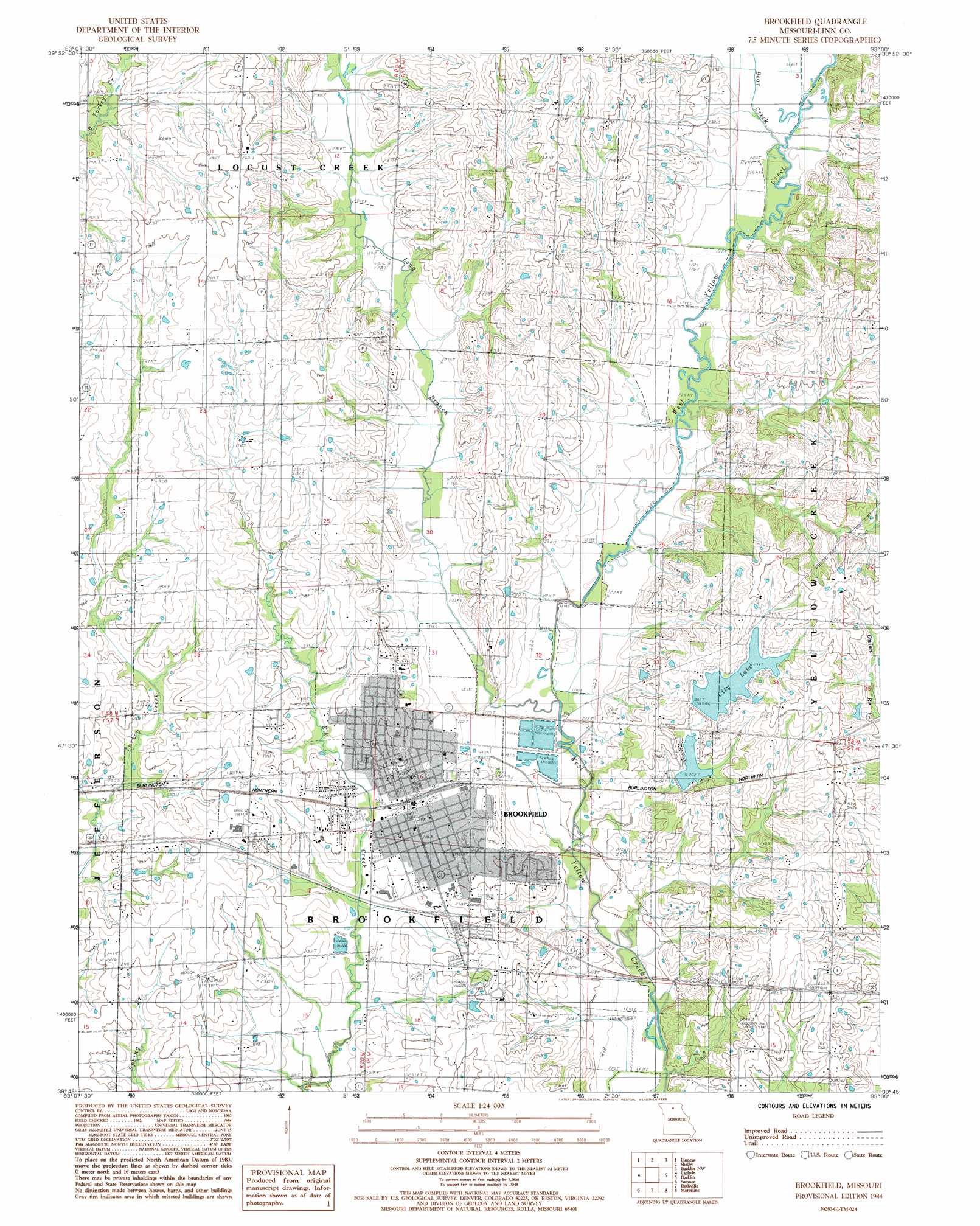
Brookfield Topo Map Missouri
To zoom in, hover over the map of Brookfield
USGS Topo Quad 39093g1 - 1:24,000 scale
| Topo Map Name: | Brookfield |
| USGS Topo Quad ID: | 39093g1 |
| Print Size: | ca. 21 1/4" wide x 27" high |
| Southeast Coordinates: | 39.75° N latitude / 93° W longitude |
| Map Center Coordinates: | 39.8125° N latitude / 93.0625° W longitude |
| U.S. State: | MO |
| Filename: | o39093g1.jpg |
| Download Map JPG Image: | Brookfield topo map 1:24,000 scale |
| Map Type: | Topographic |
| Topo Series: | 7.5´ |
| Map Scale: | 1:24,000 |
| Source of Map Images: | United States Geological Survey (USGS) |
| Alternate Map Versions: |
Brookfield MO 1984, updated 1985 Download PDF Buy paper map Brookfield MO 2012 Download PDF Buy paper map Brookfield MO 2015 Download PDF Buy paper map |
1:24,000 Topo Quads surrounding Brookfield
Lindley |
Browning |
Milan Se |
Winigan |
Nind |
Eversonville |
Linneus |
Shelby |
Bucklin Nw |
New Boston |
Meadville |
Laclede |
Brookfield |
Bucklin |
New Cambria West |
Fountain Grove |
Sumner |
Rothville |
Marceline |
Wien |
Hale |
Mendon |
Indian Grove |
Mike |
Bynumville |
> Back to 39093e1 at 1:100,000 scale
> Back to 39092a1 at 1:250,000 scale
> Back to U.S. Topo Maps home
Brookfield topo map: Gazetteer
Brookfield: Airports
General John J Pershing Memorial Airport elevation 241m 790′General John J Pershing Memorial Hospital Heliport elevation 238m 780′
North Central Missouri Regional Airport elevation 253m 830′
North Central Missouri Regional Airport elevation 251m 823′
Troutman Airport elevation 240m 787′
Brookfield: Dams
Brookfield City Dam elevation 244m 800′Brookfield Country Club Dam elevation 233m 764′
Brookfield Reservoir Dam elevation 220m 721′
Brookfield: Populated Places
Brookfield elevation 232m 761′Brookfield: Reservoirs
Brookfield City Lake elevation 244m 800′Brookfield Country Club Lake elevation 233m 764′
Brookfield Lake elevation 226m 741′
Brookfield Reservoir elevation 220m 721′
City Lake elevation 244m 800′
Brookfield: Streams
Bear Creek elevation 228m 748′Long Branch elevation 220m 721′
Brookfield digital topo map on disk
Buy this Brookfield topo map showing relief, roads, GPS coordinates and other geographical features, as a high-resolution digital map file on DVD: