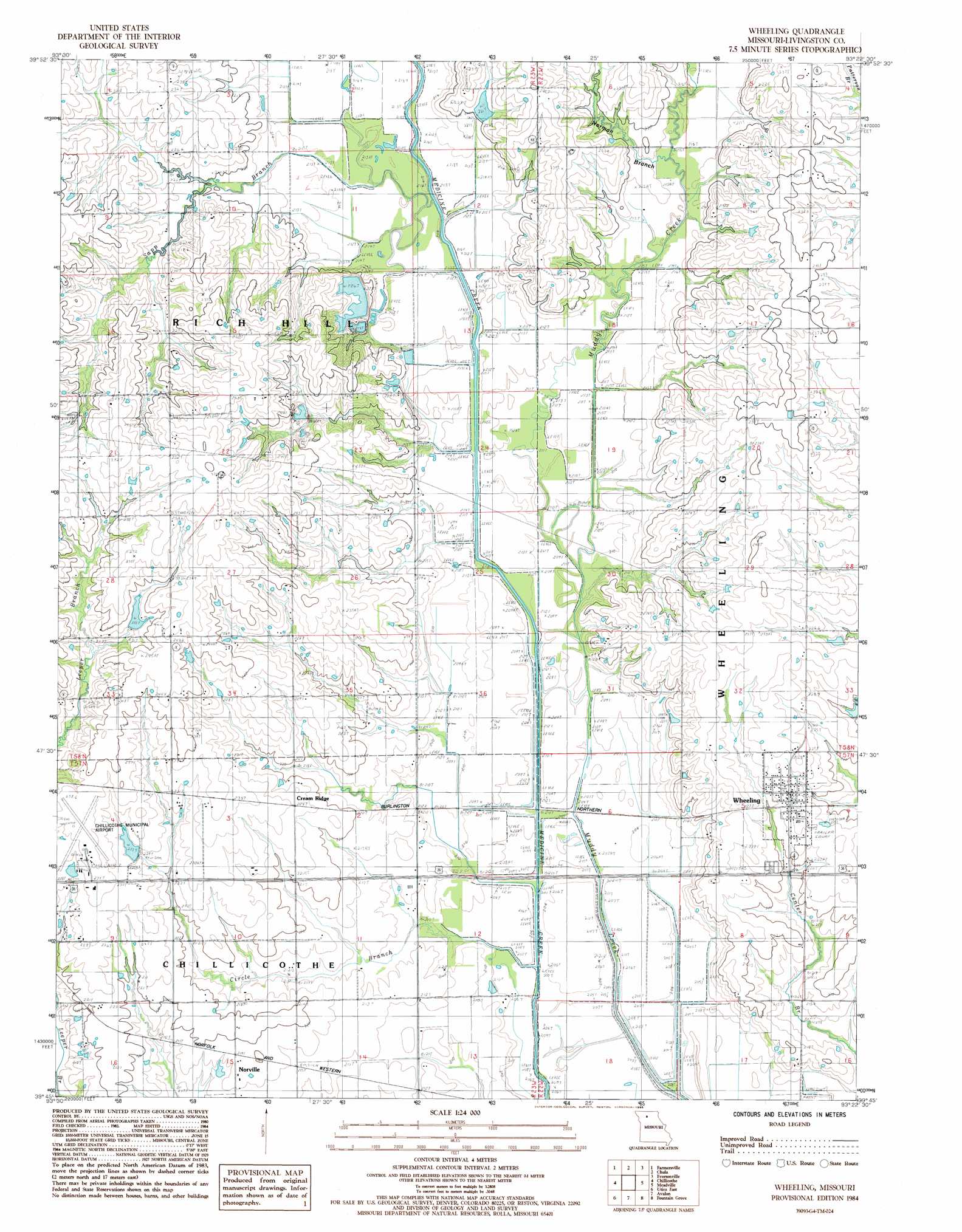
Wheeling Topo Map Missouri
To zoom in, hover over the map of Wheeling
USGS Topo Quad 39093g4 - 1:24,000 scale
| Topo Map Name: | Wheeling |
| USGS Topo Quad ID: | 39093g4 |
| Print Size: | ca. 21 1/4" wide x 27" high |
| Southeast Coordinates: | 39.75° N latitude / 93.375° W longitude |
| Map Center Coordinates: | 39.8125° N latitude / 93.4375° W longitude |
| U.S. State: | MO |
| Filename: | o39093g4.jpg |
| Download Map JPG Image: | Wheeling topo map 1:24,000 scale |
| Map Type: | Topographic |
| Topo Series: | 7.5´ |
| Map Scale: | 1:24,000 |
| Source of Map Images: | United States Geological Survey (USGS) |
| Alternate Map Versions: |
Wheeling MO 1984, updated 1985 Download PDF Buy paper map Wheeling MO 2012 Download PDF Buy paper map Wheeling MO 2015 Download PDF Buy paper map |
1:24,000 Topo Quads surrounding Wheeling
Trenton West |
Trenton East |
Laredo |
Lindley |
Browning |
Shearwood |
Farmersville |
Chula |
Eversonville |
Linneus |
Sampsel |
Chillicothe |
Wheeling |
Meadville |
Laclede |
Utica West |
Utica East |
Avalon |
Fountain Grove |
Sumner |
Plymouth |
Coloma |
Tina |
Hale |
Mendon |
> Back to 39093e1 at 1:100,000 scale
> Back to 39092a1 at 1:250,000 scale
> Back to U.S. Topo Maps home
Wheeling topo map: Gazetteer
Wheeling: Dams
Campbell Dam elevation 224m 734′Cooke Lake Dam South elevation 213m 698′
Cooke Lake North Dam elevation 216m 708′
Demitt Lake Dam elevation 219m 718′
Hall Lake Dam elevation 225m 738′
Trager Lake East Dam elevation 237m 777′
Wheeling: Populated Places
Cream Ridge elevation 227m 744′Leopolis (historical) elevation 232m 761′
Norville elevation 217m 711′
Wheeling elevation 228m 748′
Wheeling: Post Offices
Cream Ridge Post Office elevation 226m 741′Wheeling: Reservoirs
Campbell Lake elevation 224m 734′Cooke Recreation Lake elevation 216m 708′
Mononame 57 Lake elevation 225m 738′
Wheeling: Streams
Circle Branch elevation 207m 679′Muddy Creek elevation 210m 688′
Norman Branch elevation 212m 695′
Sapp Branch elevation 212m 695′
Wheeling digital topo map on disk
Buy this Wheeling topo map showing relief, roads, GPS coordinates and other geographical features, as a high-resolution digital map file on DVD: