Linneus Topo Map Missouri
To zoom in, hover over the map of Linneus
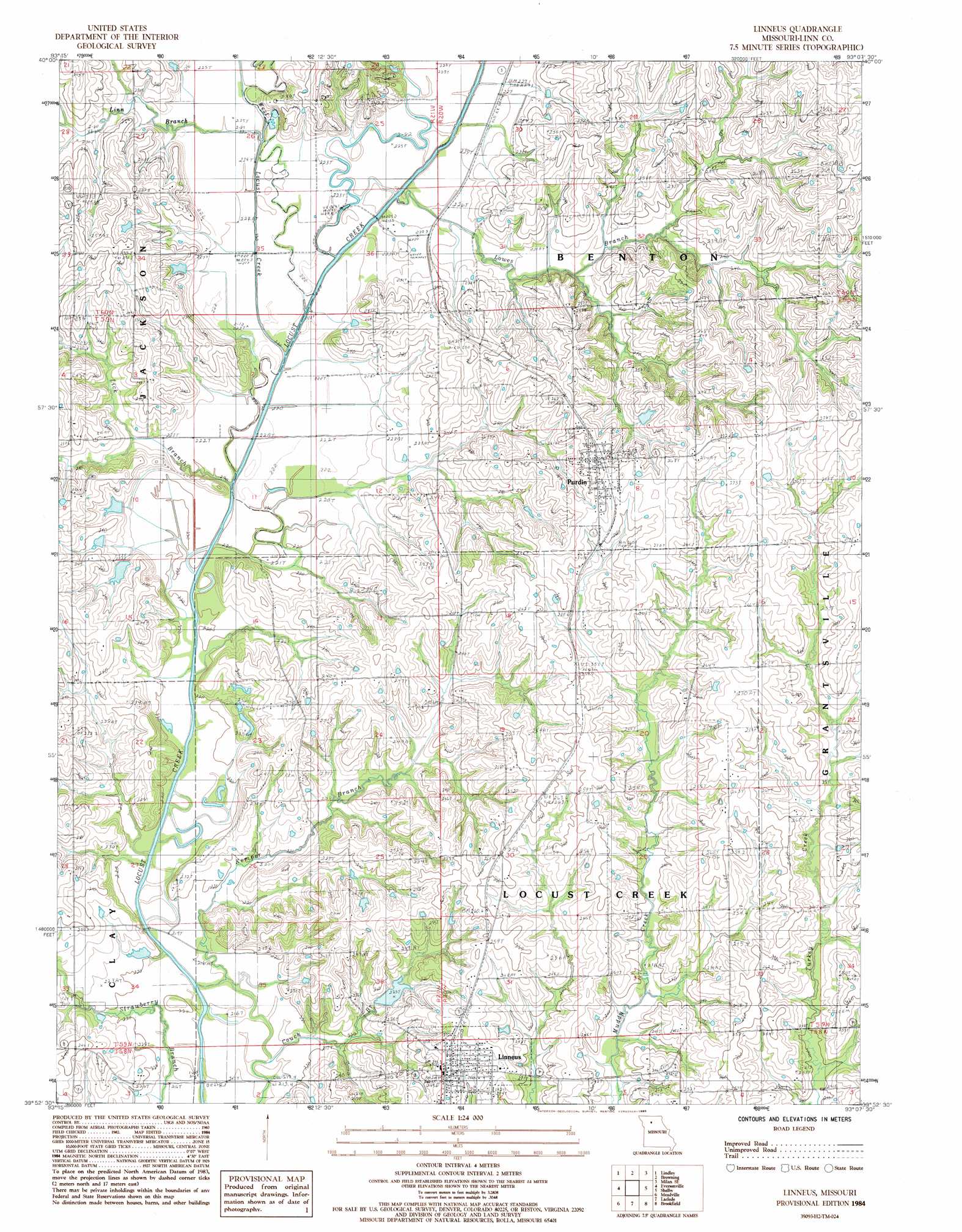
USGS Topo Quad 39093h2 - 1:24,000 scale
| Topo Map Name: | Linneus |
| USGS Topo Quad ID: | 39093h2 |
| Print Size: | ca. 21 1/4" wide x 27" high |
| Southeast Coordinates: | 39.875° N latitude / 93.125° W longitude |
| Map Center Coordinates: | 39.9375° N latitude / 93.1875° W longitude |
| U.S. State: | MO |
| Filename: | o39093h2.jpg |
| Download Map JPG Image: | Linneus topo map 1:24,000 scale |
| Map Type: | Topographic |
| Topo Series: | 7.5´ |
| Map Scale: | 1:24,000 |
| Source of Map Images: | United States Geological Survey (USGS) |
| Alternate Map Versions: |
Linneus MO 1984, updated 1985 Download PDF Buy paper map Linneus MO 2012 Download PDF Buy paper map Linneus MO 2015 Download PDF Buy paper map |
1:24,000 Topo Quads surrounding Linneus
Galt |
Osgood |
Milan West |
Milan East |
Mystic |
Laredo |
Lindley |
Browning |
Milan Se |
Winigan |
Chula |
Eversonville |
Linneus |
Shelby |
Bucklin Nw |
Wheeling |
Meadville |
Laclede |
Brookfield |
Bucklin |
Avalon |
Fountain Grove |
Sumner |
Rothville |
Marceline |
> Back to 39093e1 at 1:100,000 scale
> Back to 39092a1 at 1:250,000 scale
> Back to U.S. Topo Maps home
Linneus topo map: Gazetteer
Linneus: Dams
Hale Lake Dam elevation 248m 813′Henning Lake Dam elevation 231m 757′
Linneus Lake Dam elevation 228m 748′
Linneus: Populated Places
Linneus elevation 252m 826′Purdin elevation 270m 885′
Linneus: Reservoirs
Linneus Reservoir elevation 228m 748′Number 217 Reservoir elevation 248m 813′
Linneus: Streams
Couch Branch elevation 216m 708′Lick Branch elevation 220m 721′
Linn Branch elevation 221m 725′
Lowes Branch elevation 224m 734′
West Locust Creek elevation 218m 715′
Linneus digital topo map on disk
Buy this Linneus topo map showing relief, roads, GPS coordinates and other geographical features, as a high-resolution digital map file on DVD: