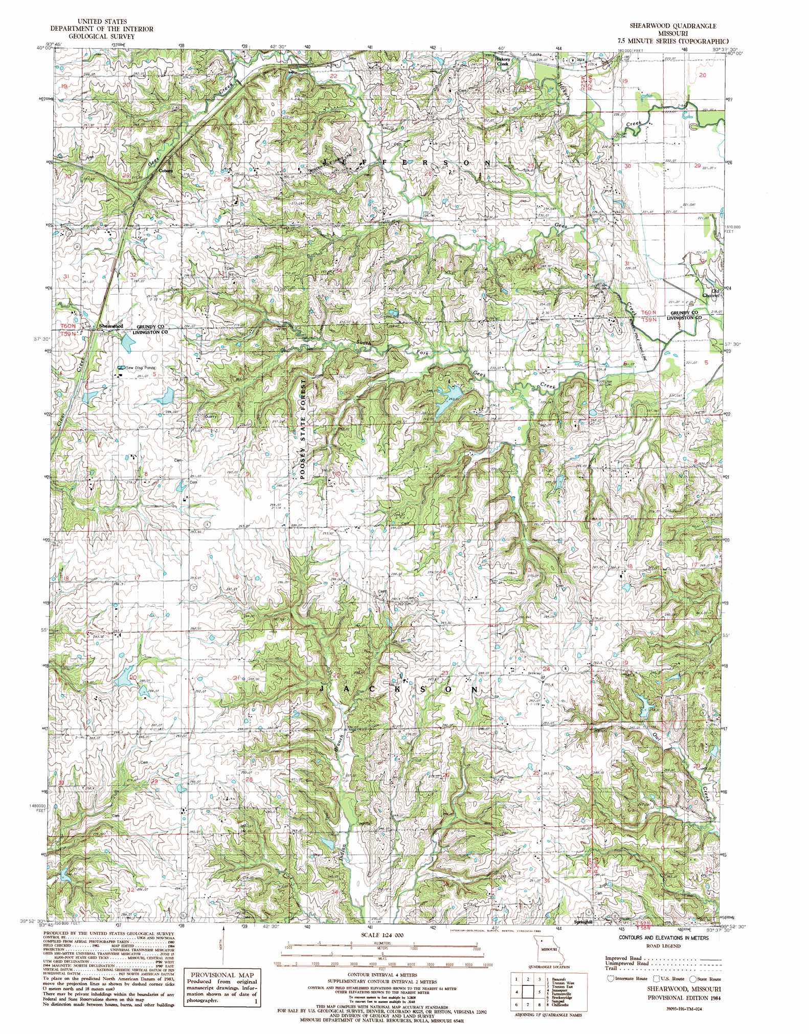
Shearwood Topo Map Missouri
To zoom in, hover over the map of Shearwood
USGS Topo Quad 39093h6 - 1:24,000 scale
| Topo Map Name: | Shearwood |
| USGS Topo Quad ID: | 39093h6 |
| Print Size: | ca. 21 1/4" wide x 27" high |
| Southeast Coordinates: | 39.875° N latitude / 93.625° W longitude |
| Map Center Coordinates: | 39.9375° N latitude / 93.6875° W longitude |
| U.S. State: | MO |
| Filename: | o39093h6.jpg |
| Download Map JPG Image: | Shearwood topo map 1:24,000 scale |
| Map Type: | Topographic |
| Topo Series: | 7.5´ |
| Map Scale: | 1:24,000 |
| Source of Map Images: | United States Geological Survey (USGS) |
| Alternate Map Versions: |
Shearwood MO 1984, updated 1985 Download PDF Buy paper map Shearwood MO 2012 Download PDF Buy paper map Shearwood MO 2015 Download PDF Buy paper map |
1:24,000 Topo Quads surrounding Shearwood
Gilman City West |
Gilman City East |
Brimson |
Spickard |
Galt |
Jameson |
Bancroft |
Trenton West |
Trenton East |
Laredo |
Gallatin |
Jamesport |
Shearwood |
Farmersville |
Chula |
Nettleton |
Breckenridge |
Sampsel |
Chillicothe |
Wheeling |
Hamilton East |
Flat Creek |
Utica West |
Utica East |
Avalon |
> Back to 39093e1 at 1:100,000 scale
> Back to 39092a1 at 1:250,000 scale
> Back to U.S. Topo Maps home
Shearwood topo map: Gazetteer
Shearwood: Dams
Fair Lake Dam elevation 246m 807′Fender Farms Lake Dam North elevation 282m 925′
Fender Farms Lake East Dam elevation 283m 928′
Fender Farms Lake West Dam elevation 281m 921′
Haynes Lake Dam elevation 246m 807′
McDonnal Lake Dam elevation 242m 793′
Pike Lake Dam elevation 234m 767′
Reeter Lake Dam elevation 281m 921′
Rinehart Lake Dam elevation 260m 853′
Trager Lake West Dam elevation 255m 836′
Shearwood: Forests
Poosey State Forest elevation 280m 918′Shearwood: Populated Places
Genova elevation 282m 925′Hickory Creek elevation 238m 780′
Shearwood: Post Offices
Cisco Post Office elevation 241m 790′Genova Post Office elevation 283m 928′
Shearwood: Reservoirs
Fender Farms Lake elevation 281m 921′Pike Lake elevation 234m 767′
Rinehart Lake elevation 260m 853′
Trager Lake elevation 255m 836′
Shearwood: Streams
South Fork Gees Creek elevation 220m 721′Shearwood digital topo map on disk
Buy this Shearwood topo map showing relief, roads, GPS coordinates and other geographical features, as a high-resolution digital map file on DVD: