Gallatin Topo Map Missouri
To zoom in, hover over the map of Gallatin
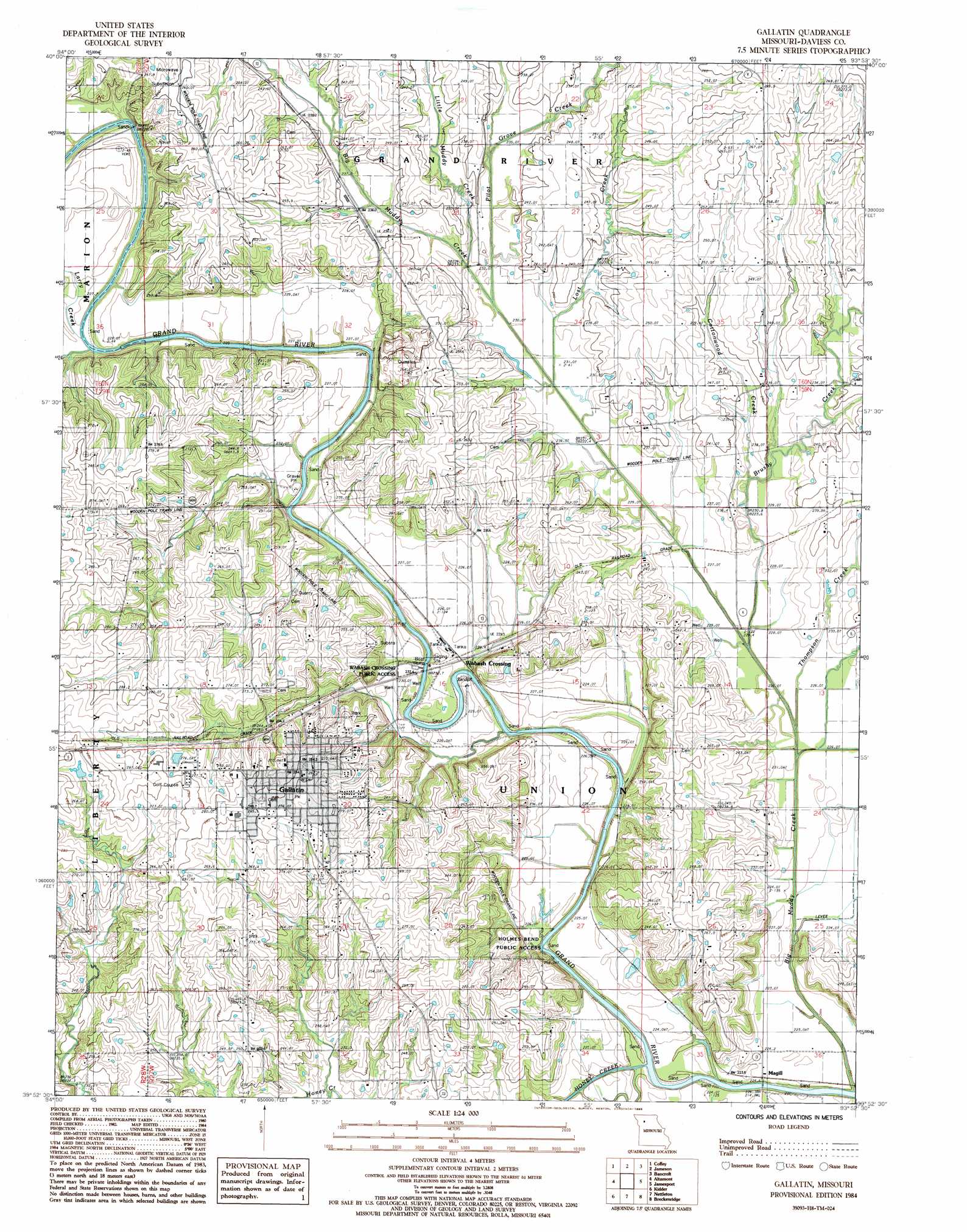
USGS Topo Quad 39093h8 - 1:24,000 scale
| Topo Map Name: | Gallatin |
| USGS Topo Quad ID: | 39093h8 |
| Print Size: | ca. 21 1/4" wide x 27" high |
| Southeast Coordinates: | 39.875° N latitude / 93.875° W longitude |
| Map Center Coordinates: | 39.9375° N latitude / 93.9375° W longitude |
| U.S. State: | MO |
| Filename: | o39093h8.jpg |
| Download Map JPG Image: | Gallatin topo map 1:24,000 scale |
| Map Type: | Topographic |
| Topo Series: | 7.5´ |
| Map Scale: | 1:24,000 |
| Source of Map Images: | United States Geological Survey (USGS) |
| Alternate Map Versions: |
Gallatin MO 1984, updated 1985 Download PDF Buy paper map Gallatin MO 2012 Download PDF Buy paper map Gallatin MO 2015 Download PDF Buy paper map |
1:24,000 Topo Quads surrounding Gallatin
Matkin |
Mitchellville |
Gilman City West |
Gilman City East |
Brimson |
Pattonsburg |
Coffey |
Jameson |
Bancroft |
Trenton West |
Weatherby |
Altamont |
Gallatin |
Jamesport |
Shearwood |
Winston |
Kidder |
Nettleton |
Breckenridge |
Sampsel |
Cameron East |
Hamilton West |
Hamilton East |
Flat Creek |
Utica West |
> Back to 39093e1 at 1:100,000 scale
> Back to 39092a1 at 1:250,000 scale
> Back to U.S. Topo Maps home
Gallatin topo map: Gazetteer
Gallatin: Populated Places
Gallatin elevation 281m 921′Magill elevation 224m 734′
Wabash Crossing elevation 228m 748′
Gallatin: Reservoirs
Pattonsburg Lake elevation 229m 751′Gallatin: Streams
Brushy Creek elevation 223m 731′Cottonwood Creek elevation 227m 744′
Honey Creek elevation 216m 708′
Larry Creek elevation 228m 748′
Little Muddy Creek elevation 230m 754′
Lost Creek elevation 228m 748′
Pilot Grove Creek elevation 232m 761′
Thompson Creek elevation 221m 725′
Gallatin digital topo map on disk
Buy this Gallatin topo map showing relief, roads, GPS coordinates and other geographical features, as a high-resolution digital map file on DVD: