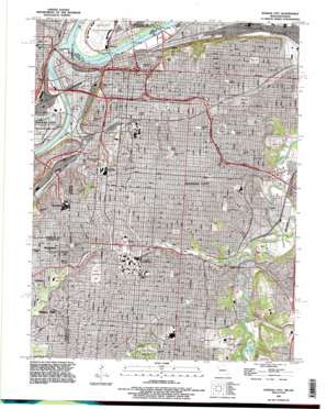
Kansas City Topo Map Missouri
To zoom in, hover over the map of Kansas City
USGS Topo Quad 39094a5 - 1:24,000 scale
| Topo Map Name: | Kansas City |
| USGS Topo Quad ID: | 39094a5 |
| Print Size: | ca. 21 1/4" wide x 27" high |
| Southeast Coordinates: | 39° N latitude / 94.5° W longitude |
| Map Center Coordinates: | 39.0625° N latitude / 94.5625° W longitude |
| U.S. States: | MO, KS |
| Filename: | o39094a5.jpg |
| Download Map JPG Image: | Kansas City topo map 1:24,000 scale |
| Map Type: | Topographic |
| Topo Series: | 7.5´ |
| Map Scale: | 1:24,000 |
| Source of Map Images: | United States Geological Survey (USGS) |
| Alternate Map Versions: |
Kansas City MO 1935 Download PDF Buy paper map Kansas City MO 1935, updated 1955 Download PDF Buy paper map Kansas City MO 1957, updated 1958 Download PDF Buy paper map Kansas City MO 1964, updated 1965 Download PDF Buy paper map Kansas City MO 1964, updated 1971 Download PDF Buy paper map Kansas City MO 1964, updated 1976 Download PDF Buy paper map Kansas City MO 1991, updated 1995 Download PDF Buy paper map Kansas City MO 1996, updated 2002 Download PDF Buy paper map Kansas City MO 2009 Download PDF Buy paper map Kansas City MO 2012 Download PDF Buy paper map Kansas City MO 2015 Download PDF Buy paper map |
1:24,000 Topo Quads surrounding Kansas City
> Back to 39094a1 at 1:100,000 scale
> Back to 39094a1 at 1:250,000 scale
> Back to U.S. Topo Maps home
Kansas City topo map: Gazetteer
Kansas City: Airports
Heart Airport elevation 223m 731′Kansas City Downtown Airport elevation 226m 741′
Research Medical Center Heliport elevation 287m 941′
Saint Lukes Hospital Heliport elevation 274m 898′
UHS-University Hospital Heliport elevation 286m 938′
Va Medical Center Heliport elevation 286m 938′
Kansas City: Bends
Kansas River Bend elevation 219m 718′Kansas City: Bridges
ASB Bridge elevation 220m 721′Broadway Bridge elevation 220m 721′
Paseo Bridge elevation 219m 718′
Kansas City: Canals
Lewis and Clark Viaduct elevation 219m 718′Kansas City: Cliffs
Toad-a-Loop elevation 291m 954′Kansas City: Crossings
Interchange 1A and 1B elevation 249m 816′Interchange 1A and 1B elevation 229m 751′
Interchange 1A and 1B and 1C elevation 239m 784′
Interchange 1C elevation 239m 784′
Interchange 234 elevation 242m 793′
Interchange 235 elevation 247m 810′
Interchange 2B and 2C elevation 264m 866′
Interchange 2D elevation 257m 843′
Interchange 2U elevation 266m 872′
Interchange 2U elevation 268m 879′
Interchange 2V elevation 266m 872′
Interchange 2V elevation 270m 885′
Interchange 2W elevation 269m 882′
Interchange 2W elevation 264m 866′
Interchange 3A elevation 258m 846′
Interchange 3B elevation 266m 872′
Interchange 3C elevation 259m 849′
Interchange 422C and 422D elevation 241m 790′
Interchange 422D elevation 233m 764′
Interchange 4A elevation 258m 846′
Interchange 4B elevation 227m 744′
Interchange 4B elevation 270m 885′
Interchange 4C elevation 263m 862′
Interchange 5A elevation 282m 925′
Interchange 5B elevation 275m 902′
Interchange 5C elevation 264m 866′
Interchange 6 elevation 244m 800′
Interchange 65 elevation 266m 872′
Interchange 7A elevation 236m 774′
Kansas City: Flats
French Bottom elevation 229m 751′Kansas City: Lakes
Bales Lake elevation 251m 823′The Lagoon elevation 239m 784′
Kansas City: Levees
Central Industrial District Levee Unit elevation 231m 757′North Kansas City Levee Unit elevation 227m 744′
Kansas City: Parks
Allis Plaza elevation 280m 918′Arbor Villa Park elevation 282m 925′
Ashland Square elevation 273m 895′
Blenheim Park elevation 289m 948′
Blue Valley Park elevation 262m 859′
Brooklyn Park elevation 277m 908′
Brush Creek Park elevation 228m 748′
Budd Park elevation 270m 885′
Central Park elevation 280m 918′
Chelsea Park elevation 256m 839′
Crews Square elevation 273m 895′
Dunn Park elevation 276m 905′
Eastwood Park elevation 273m 895′
Helm Park elevation 225m 738′
Holmes Park elevation 295m 967′
Holmes Square elevation 245m 803′
Hubbs Park elevation 241m 790′
Hyde Park elevation 279m 915′
Kansas City Zoo elevation 256m 839′
Kaw Point Riverfront Park elevation 228m 748′
Kemp Playground elevation 292m 958′
Kiely Park elevation 245m 803′
Liberty Memorial elevation 272m 892′
Lykins Square elevation 258m 846′
Maple Park elevation 284m 931′
Montgall Playground elevation 275m 902′
North Terrace Park elevation 253m 830′
Oak Park elevation 271m 889′
Observation Park elevation 288m 944′
Penn Valley Park elevation 276m 905′
Roanoke Park elevation 262m 859′
Rosedale Park elevation 288m 944′
Seven Oaks Park elevation 256m 839′
Shawnee Mission State Park elevation 281m 921′
Sheffield Park elevation 238m 780′
South Moreland Park elevation 265m 869′
Spring Valley Park elevation 276m 905′
West Terrace Park elevation 279m 915′
Westwood Park elevation 271m 889′
World War II Memorial elevation 301m 987′
Kansas City: Populated Places
Eastwood elevation 282m 925′Harlem elevation 226m 741′
Kansas City elevation 274m 898′
Leeds elevation 232m 761′
Manchester School elevation 253m 830′
Mission Hills elevation 284m 931′
Mission Woods elevation 277m 908′
Westport elevation 275m 902′
Westwood elevation 290m 951′
Westwood Hills elevation 274m 898′
Kansas City: Post Offices
Center Square Post Office elevation 270m 885′Civic Center Post Office elevation 247m 810′
Civic Center Post Office elevation 275m 902′
Country Club Post Office elevation 286m 938′
James Crews Post Office elevation 260m 853′
Kansas City Main Office Post Office elevation 242m 793′
Kansas City Stockyards Post Office elevation 229m 751′
Leon Mercer Jordan Post Office elevation 297m 974′
Northeast Post Office elevation 260m 853′
Packers Post Office elevation 228m 748′
Rosedale Post Office elevation 274m 898′
William M Chick Post Office elevation 290m 951′
Kansas City: Streams
Brush Creek elevation 225m 738′Brush Creek elevation 225m 738′
Jersey Creek elevation 220m 721′
Kansas River elevation 219m 718′
Mill Creek elevation 229m 751′
Round Grove Creek elevation 231m 757′
Turkey Creek elevation 220m 721′
Kansas City digital topo map on disk
Buy this Kansas City topo map showing relief, roads, GPS coordinates and other geographical features, as a high-resolution digital map file on DVD:


