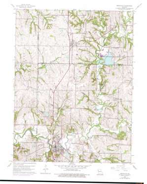
Smithville Topo Map Missouri
To zoom in, hover over the map of Smithville
USGS Topo Quad 39094d5 - 1:24,000 scale
| Topo Map Name: | Smithville |
| USGS Topo Quad ID: | 39094d5 |
| Print Size: | ca. 21 1/4" wide x 27" high |
| Southeast Coordinates: | 39.375° N latitude / 94.5° W longitude |
| Map Center Coordinates: | 39.4375° N latitude / 94.5625° W longitude |
| U.S. State: | MO |
| Filename: | o39094d5.jpg |
| Download Map JPG Image: | Smithville topo map 1:24,000 scale |
| Map Type: | Topographic |
| Topo Series: | 7.5´ |
| Map Scale: | 1:24,000 |
| Source of Map Images: | United States Geological Survey (USGS) |
| Alternate Map Versions: |
Smithville MO 1951 Download PDF Buy paper map Smithville MO 1961, updated 1962 Download PDF Buy paper map Smithville MO 1961, updated 1970 Download PDF Buy paper map Smithville MO 1961, updated 1976 Download PDF Buy paper map Smithville MO 2012 Download PDF Buy paper map Smithville MO 2015 Download PDF Buy paper map |
1:24,000 Topo Quads surrounding Smithville
> Back to 39094a1 at 1:100,000 scale
> Back to 39094a1 at 1:250,000 scale
> Back to U.S. Topo Maps home
Smithville topo map: Gazetteer
Smithville: Airports
Norman Fann Farm Airport elevation 264m 866′Smithville: Bridges
Linn Branch Bridge elevation 264m 866′Smithville: Dams
Bainbridge Lake Dam elevation 270m 885′H and H Lake Dam elevation 269m 882′
Helvely Park Dam elevation 256m 839′
Johnson Dam elevation 295m 967′
Mononame 162 Dam elevation 248m 813′
Mononame 163 Dam elevation 264m 866′
Smithville Dam elevation 244m 800′
Trimble Wildlife Dam elevation 264m 866′
Smithville: Lakes
Lake Remote elevation 249m 816′Smithville: Parks
Trimble Wildlife Management Area elevation 269m 882′Smithville: Populated Places
Mecca elevation 264m 866′Paradise elevation 285m 935′
Smithville elevation 248m 813′
Trimble elevation 285m 935′
Smithville: Reservoirs
H and H Lake elevation 269m 882′H and H Lakes elevation 263m 862′
Helvely Park Lake elevation 256m 839′
J C Ranch Lake elevation 295m 967′
Kings Lake elevation 269m 882′
Lake Wahoo Waters elevation 264m 866′
Miller Lake elevation 264m 866′
Mononame 160 Reservoir elevation 270m 885′
Shady Hollow Lakes elevation 264m 866′
Smithville Lake elevation 244m 800′
Trimble Wildlife Lake elevation 264m 866′
Smithville: Streams
Camp Branch elevation 264m 866′Crows Creek elevation 264m 866′
Duncan Branch elevation 264m 866′
Lingenfelter Branch elevation 264m 866′
Linn Branch elevation 264m 866′
Mitchell Branch elevation 264m 866′
Owens Branch elevation 241m 790′
Roberts Branch elevation 264m 866′
Rock Branch elevation 264m 866′
Second Creek elevation 241m 790′
Wilkerson Creek elevation 246m 807′
Smithville digital topo map on disk
Buy this Smithville topo map showing relief, roads, GPS coordinates and other geographical features, as a high-resolution digital map file on DVD:


