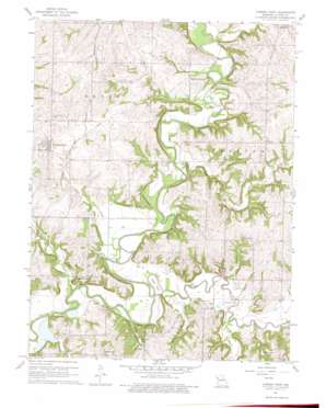
Camden Point Topo Map Missouri
To zoom in, hover over the map of Camden Point
USGS Topo Quad 39094d6 - 1:24,000 scale
| Topo Map Name: | Camden Point |
| USGS Topo Quad ID: | 39094d6 |
| Print Size: | ca. 21 1/4" wide x 27" high |
| Southeast Coordinates: | 39.375° N latitude / 94.625° W longitude |
| Map Center Coordinates: | 39.4375° N latitude / 94.6875° W longitude |
| U.S. State: | MO |
| Filename: | o39094d6.jpg |
| Download Map JPG Image: | Camden Point topo map 1:24,000 scale |
| Map Type: | Topographic |
| Topo Series: | 7.5´ |
| Map Scale: | 1:24,000 |
| Source of Map Images: | United States Geological Survey (USGS) |
| Alternate Map Versions: |
Camden Point MO 1951 Download PDF Buy paper map Camden Point MO 1961, updated 1962 Download PDF Buy paper map Camden Point MO 1961, updated 1975 Download PDF Buy paper map Camden Point MO 2012 Download PDF Buy paper map Camden Point MO 2014 Download PDF Buy paper map |
1:24,000 Topo Quads surrounding Camden Point
> Back to 39094a1 at 1:100,000 scale
> Back to 39094a1 at 1:250,000 scale
> Back to U.S. Topo Maps home
Camden Point topo map: Gazetteer
Camden Point: Airports
K-Farm Airport elevation 244m 800′Camden Point: Bridges
Junction Bridge (historical) elevation 238m 780′Mellon Bridge elevation 235m 770′
Skinner Bridge elevation 236m 774′
Camden Point: Capes
Goose Neck elevation 238m 780′Camden Point: Lakes
Cockerill Lake elevation 278m 912′Hughes Lake elevation 254m 833′
Junction Lake (historical) elevation 241m 790′
Malcolm Lake (historical) elevation 241m 790′
Skinner Lake elevation 236m 774′
Turners Lake elevation 241m 790′
Camden Point: Populated Places
Camden Point elevation 281m 921′Edgerton Junction elevation 263m 862′
Kerrville elevation 256m 839′
Ridgely elevation 292m 958′
Camden Point: Streams
Alger Creek elevation 235m 770′Bell Creek elevation 238m 780′
Clear Branch elevation 232m 761′
Dicks Creek elevation 235m 770′
Grove Creek elevation 238m 780′
Little Platte River elevation 235m 770′
Muddy Branch elevation 235m 770′
Owl Creek elevation 241m 790′
Shanks Branch elevation 236m 774′
Todd Creek elevation 238m 780′
Camden Point: Valleys
Slash Valley elevation 238m 780′Camden Point digital topo map on disk
Buy this Camden Point topo map showing relief, roads, GPS coordinates and other geographical features, as a high-resolution digital map file on DVD:


