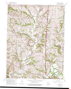
Tracy Topo Map Missouri
To zoom in, hover over the map of Tracy
USGS Topo Quad 39094d7 - 1:24,000 scale
| Topo Map Name: | Tracy |
| USGS Topo Quad ID: | 39094d7 |
| Print Size: | ca. 21 1/4" wide x 27" high |
| Southeast Coordinates: | 39.375° N latitude / 94.75° W longitude |
| Map Center Coordinates: | 39.4375° N latitude / 94.8125° W longitude |
| U.S. State: | MO |
| Filename: | o39094d7.jpg |
| Download Map JPG Image: | Tracy topo map 1:24,000 scale |
| Map Type: | Topographic |
| Topo Series: | 7.5´ |
| Map Scale: | 1:24,000 |
| Source of Map Images: | United States Geological Survey (USGS) |
| Alternate Map Versions: |
Tracy MO 1951 Download PDF Buy paper map Tracy MO 1961, updated 1962 Download PDF Buy paper map Tracy MO 1961, updated 1976 Download PDF Buy paper map Tracy MO 2012 Download PDF Buy paper map Tracy MO 2014 Download PDF Buy paper map |
1:24,000 Topo Quads surrounding Tracy
> Back to 39094a1 at 1:100,000 scale
> Back to 39094a1 at 1:250,000 scale
> Back to U.S. Topo Maps home
Tracy topo map: Gazetteer
Tracy: Airports
Flintlock Field elevation 283m 928′North Platte Airpark elevation 303m 994′
Schaback Strip elevation 291m 954′
Tracy: Dams
Folck Lake Dam elevation 254m 833′Hiatt Lake Dam elevation 256m 839′
Rogers Lake Dam elevation 271m 889′
Tracy: Populated Places
Haydite elevation 260m 853′Stubbs elevation 249m 816′
Tracy elevation 238m 780′
West Platte elevation 242m 793′
Woodruff elevation 250m 820′
Tracy: Reservoirs
Folck Lake elevation 254m 833′Hiatt Lake elevation 256m 839′
Rogers Lake elevation 271m 889′
Tracy: Streams
Bonnell Branch elevation 250m 820′Hardesty Branch elevation 248m 813′
Jordan Branch elevation 253m 830′
Jowler Creek elevation 247m 810′
Little Jordan Branch elevation 256m 839′
Murray Branch elevation 232m 761′
Owl Creek elevation 244m 800′
Singleton Branch elevation 254m 833′
Tracy digital topo map on disk
Buy this Tracy topo map showing relief, roads, GPS coordinates and other geographical features, as a high-resolution digital map file on DVD:


