Lathrop Topo Map Missouri
To zoom in, hover over the map of Lathrop
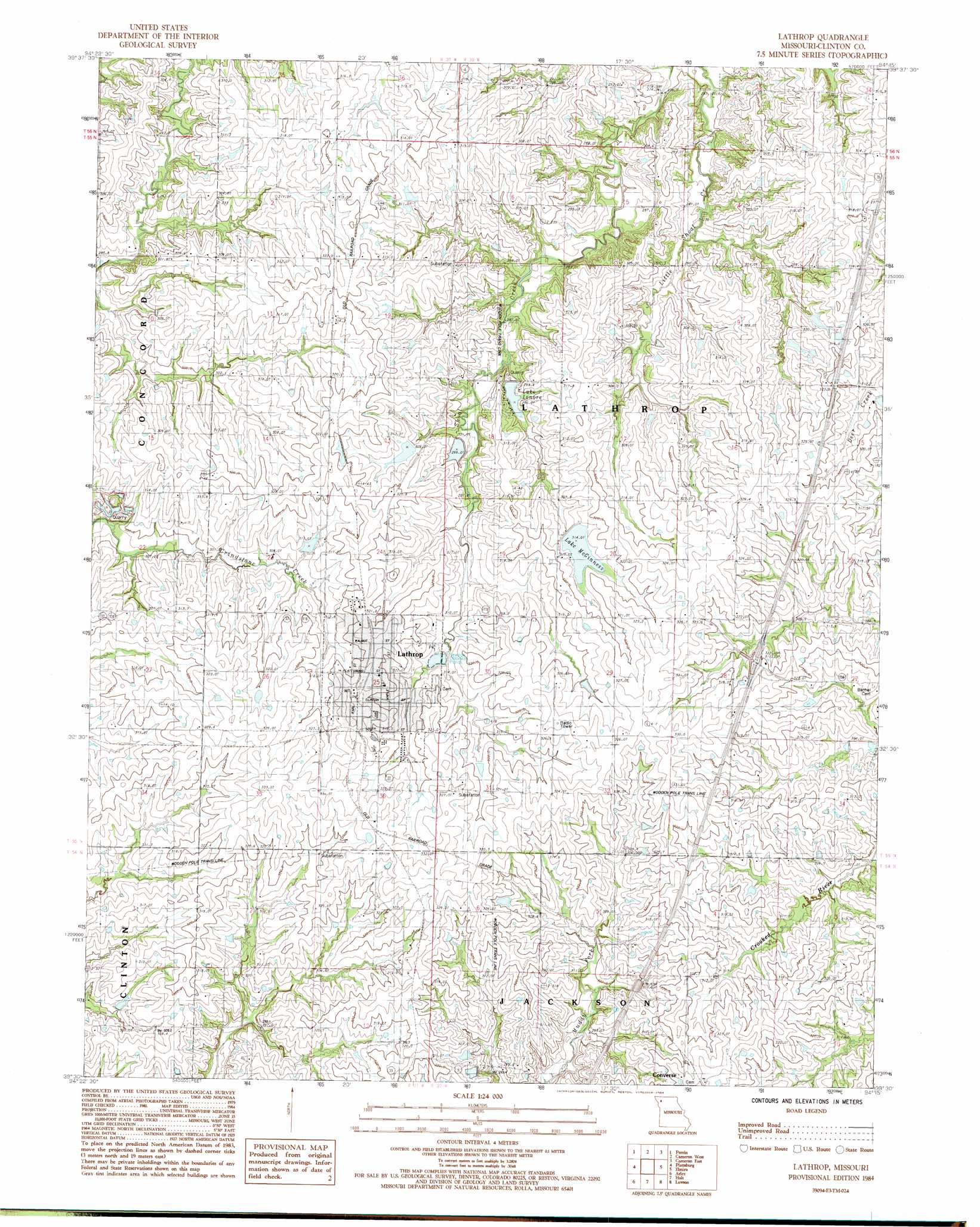
USGS Topo Quad 39094e3 - 1:24,000 scale
| Topo Map Name: | Lathrop |
| USGS Topo Quad ID: | 39094e3 |
| Print Size: | ca. 21 1/4" wide x 27" high |
| Southeast Coordinates: | 39.5° N latitude / 94.25° W longitude |
| Map Center Coordinates: | 39.5625° N latitude / 94.3125° W longitude |
| U.S. State: | MO |
| Filename: | o39094e3.jpg |
| Download Map JPG Image: | Lathrop topo map 1:24,000 scale |
| Map Type: | Topographic |
| Topo Series: | 7.5´ |
| Map Scale: | 1:24,000 |
| Source of Map Images: | United States Geological Survey (USGS) |
| Alternate Map Versions: |
Lathrop MO 1984, updated 1984 Download PDF Buy paper map Lathrop MO 2012 Download PDF Buy paper map Lathrop MO 2014 Download PDF Buy paper map |
1:24,000 Topo Quads surrounding Lathrop
Clarksdale |
Amity |
Fordham |
Winston |
Kidder |
Hemple |
Perrin |
Cameron West |
Cameron East |
Hamilton West |
Gower |
Plattsburg |
Lathrop |
Elmira |
Polo |
Smithville |
Arley |
Holt |
Lawson |
Knoxville |
Nashua |
Kearney Sw |
Kearney |
Excelsior Springs |
Rayville |
> Back to 39094e1 at 1:100,000 scale
> Back to 39094a1 at 1:250,000 scale
> Back to U.S. Topo Maps home
Lathrop topo map: Gazetteer
Lathrop: Airports
Lathrop Family Practice Heliport elevation 322m 1056′Lathrop: Dams
Crouch Lake East Dam elevation 300m 984′Crouch Lake West Dam elevation 309m 1013′
Lathrop Lake and Forest Club Dam elevation 301m 987′
McGinness Lake Dam elevation 308m 1010′
Lathrop: Lakes
Lake Lenore elevation 295m 967′Lathrop: Populated Places
Guyton elevation 325m 1066′Lathrop elevation 324m 1062′
Lathrop: Reservoirs
Lake McGinness elevation 308m 1010′Lathrop Lake elevation 301m 987′
Lathrop digital topo map on disk
Buy this Lathrop topo map showing relief, roads, GPS coordinates and other geographical features, as a high-resolution digital map file on DVD: