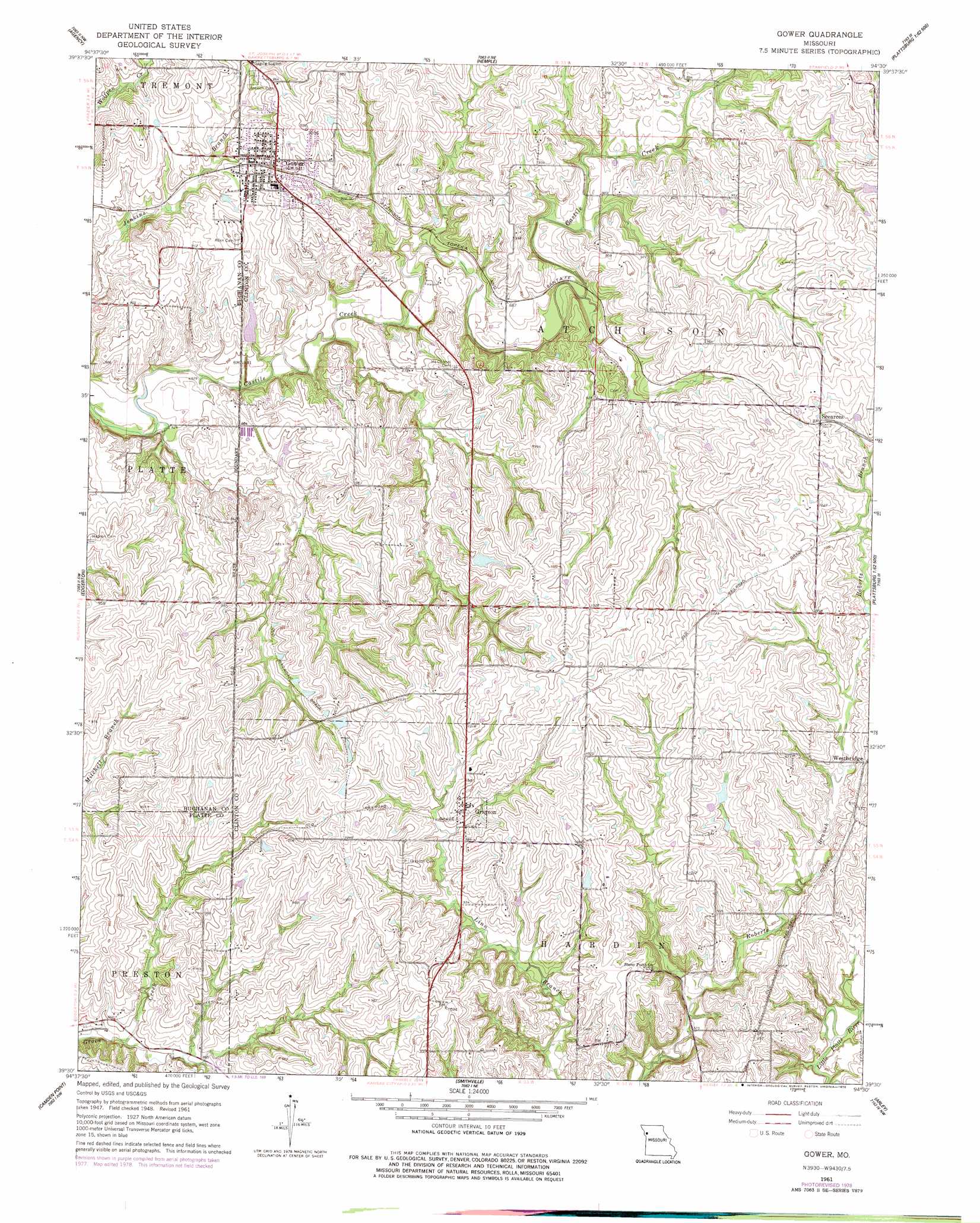
Gower Topo Map Missouri
To zoom in, hover over the map of Gower
USGS Topo Quad 39094e5 - 1:24,000 scale
| Topo Map Name: | Gower |
| USGS Topo Quad ID: | 39094e5 |
| Print Size: | ca. 21 1/4" wide x 27" high |
| Southeast Coordinates: | 39.5° N latitude / 94.5° W longitude |
| Map Center Coordinates: | 39.5625° N latitude / 94.5625° W longitude |
| U.S. State: | MO |
| Filename: | o39094e5.jpg |
| Download Map JPG Image: | Gower topo map 1:24,000 scale |
| Map Type: | Topographic |
| Topo Series: | 7.5´ |
| Map Scale: | 1:24,000 |
| Source of Map Images: | United States Geological Survey (USGS) |
| Alternate Map Versions: |
Gower MO 1951 Download PDF Buy paper map Gower MO 1961, updated 1962 Download PDF Buy paper map Gower MO 1961, updated 1978 Download PDF Buy paper map Gower MO 2012 Download PDF Buy paper map Gower MO 2015 Download PDF Buy paper map |
1:24,000 Topo Quads surrounding Gower
Saint Joseph North |
Cosby |
Clarksdale |
Amity |
Fordham |
Saint Joseph South |
Agency |
Hemple |
Perrin |
Cameron West |
Dearborn |
Edgerton |
Gower |
Plattsburg |
Lathrop |
Tracy |
Camden Point |
Smithville |
Arley |
Holt |
Platte City |
Ferrelview |
Nashua |
Kearney Sw |
Kearney |
> Back to 39094e1 at 1:100,000 scale
> Back to 39094a1 at 1:250,000 scale
> Back to U.S. Topo Maps home
Gower topo map: Gazetteer
Gower: Dams
Gower Reservoir Dam elevation 264m 866′Morse Lake Dam elevation 299m 980′
Woods Dam elevation 312m 1023′
Zurbuchen Lake Dam elevation 276m 905′
Gower: Populated Places
Gower elevation 288m 944′Grayson elevation 298m 977′
Scearces elevation 308m 1010′
Westbridge elevation 296m 971′
Gower: Reservoirs
Bill Woods Ranch Lake elevation 312m 1023′Morse Lake elevation 299m 980′
Weakley Lake elevation 276m 905′
Gower digital topo map on disk
Buy this Gower topo map showing relief, roads, GPS coordinates and other geographical features, as a high-resolution digital map file on DVD: