Amazonia Topo Map Missouri
To zoom in, hover over the map of Amazonia
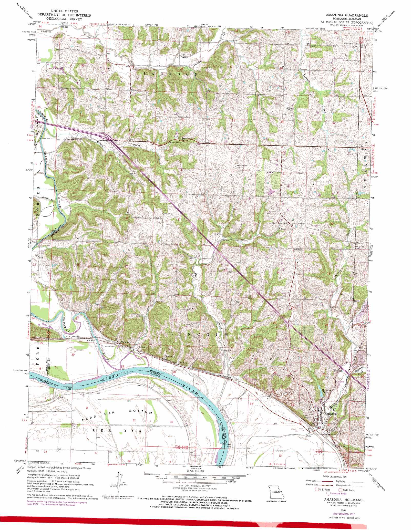
USGS Topo Quad 39094h8 - 1:24,000 scale
| Topo Map Name: | Amazonia |
| USGS Topo Quad ID: | 39094h8 |
| Print Size: | ca. 21 1/4" wide x 27" high |
| Southeast Coordinates: | 39.875° N latitude / 94.875° W longitude |
| Map Center Coordinates: | 39.9375° N latitude / 94.9375° W longitude |
| U.S. States: | MO, KS |
| Filename: | o39094h8.jpg |
| Download Map JPG Image: | Amazonia topo map 1:24,000 scale |
| Map Type: | Topographic |
| Topo Series: | 7.5´ |
| Map Scale: | 1:24,000 |
| Source of Map Images: | United States Geological Survey (USGS) |
| Alternate Map Versions: |
Amazonia MO 1961, updated 1963 Download PDF Buy paper map Amazonia MO 1961, updated 1973 Download PDF Buy paper map Amazonia MO 2010 Download PDF Buy paper map Amazonia MO 2012 Download PDF Buy paper map Amazonia MO 2015 Download PDF Buy paper map |
1:24,000 Topo Quads surrounding Amazonia
Mound City |
Maitland |
Bolckow Nw |
Barnard |
Guilford |
Kimsey Creek |
New Point |
Fillmore |
Blockow |
Whitesville |
Oregon |
Forbes |
Amazonia |
Savannah |
Helena |
Sparks |
Troy |
Wathena |
Saint Joseph North |
Cosby |
Bendena |
Atchison Ne |
Halls |
Saint Joseph South |
Agency |
> Back to 39094e1 at 1:100,000 scale
> Back to 39094a1 at 1:250,000 scale
> Back to U.S. Topo Maps home
Amazonia topo map: Gazetteer
Amazonia: Bends
Burr Oak Bottom elevation 251m 823′Amazonia: Dams
Paradise Lake Dam elevation 260m 853′Schweizer Lake Dam elevation 322m 1056′
Thompson Lake Dam elevation 316m 1036′
Amazonia: Lakes
Garlich Lake (historical) elevation 248m 813′Sollars Lake (historical) elevation 249m 816′
Amazonia: Parks
Davis Roadside Park elevation 303m 994′Amazonia: Populated Places
Amazonia elevation 255m 836′Nodaway elevation 254m 833′
Amazonia: Reservoirs
Paradise Lake elevation 263m 862′Schweizer Lake elevation 322m 1056′
Thompson Lake elevation 316m 1036′
Amazonia: Streams
Caples Creek elevation 267m 875′Honey Creek elevation 249m 816′
Hopkins Creek elevation 260m 853′
Mill Creek elevation 250m 820′
Nodaway River elevation 252m 826′
Smith Creek elevation 249m 816′
Amazonia digital topo map on disk
Buy this Amazonia topo map showing relief, roads, GPS coordinates and other geographical features, as a high-resolution digital map file on DVD: