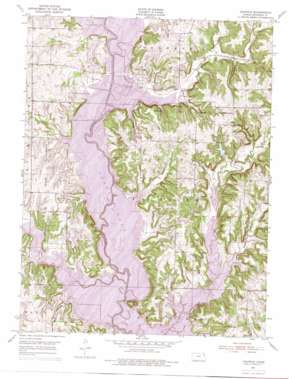
Ozawkie Topo Map Kansas
To zoom in, hover over the map of Ozawkie
USGS Topo Quad 39095b4 - 1:24,000 scale
| Topo Map Name: | Ozawkie |
| USGS Topo Quad ID: | 39095b4 |
| Print Size: | ca. 21 1/4" wide x 27" high |
| Southeast Coordinates: | 39.125° N latitude / 95.375° W longitude |
| Map Center Coordinates: | 39.1875° N latitude / 95.4375° W longitude |
| U.S. State: | KS |
| Filename: | o39095b4.jpg |
| Download Map JPG Image: | Ozawkie topo map 1:24,000 scale |
| Map Type: | Topographic |
| Topo Series: | 7.5´ |
| Map Scale: | 1:24,000 |
| Source of Map Images: | United States Geological Survey (USGS) |
| Alternate Map Versions: |
Ozawkie KS 1951, updated 1952 Download PDF Buy paper map Ozawkie KS 1951, updated 1969 Download PDF Buy paper map Ozawkie KS 1951, updated 1971 Download PDF Buy paper map Ozawkie KS 1951, updated 1976 Download PDF Buy paper map Ozawkie KS 2010 Download PDF Buy paper map Ozawkie KS 2012 Download PDF Buy paper map Ozawkie KS 2015 Download PDF Buy paper map |
1:24,000 Topo Quads surrounding Ozawkie
> Back to 39095a1 at 1:100,000 scale
> Back to 39094a1 at 1:250,000 scale
> Back to U.S. Topo Maps home
Ozawkie topo map: Gazetteer
Ozawkie: Parks
Delaware State Park elevation 293m 961′Longview Public Use Area elevation 310m 1017′
Old Town Public Use Area elevation 278m 912′
Perry Public Use Area elevation 313m 1026′
Perry State Park elevation 296m 971′
Slough Creek Public Use Area elevation 305m 1000′
Slough Creek Public Use Area elevation 310m 1017′
Ozawkie: Pillars
Round Mound elevation 309m 1013′Ozawkie: Populated Places
Hilldale elevation 310m 1017′Hilldale South elevation 299m 980′
Indian Ridge elevation 297m 974′
Lake Ridge elevation 306m 1003′
Lake Shore elevation 313m 1026′
Lakeside Village elevation 331m 1085′
Ozawkie elevation 304m 997′
West Shore elevation 292m 958′
Ozawkie: Post Offices
Ozawkie Post Office elevation 331m 1085′Ozawkie: Streams
Evans Creek elevation 272m 892′Fishpond Creek elevation 279m 915′
Little Slough Creek elevation 272m 892′
Ozawkie digital topo map on disk
Buy this Ozawkie topo map showing relief, roads, GPS coordinates and other geographical features, as a high-resolution digital map file on DVD:


