Valley Falls Topo Map Kansas
To zoom in, hover over the map of Valley Falls
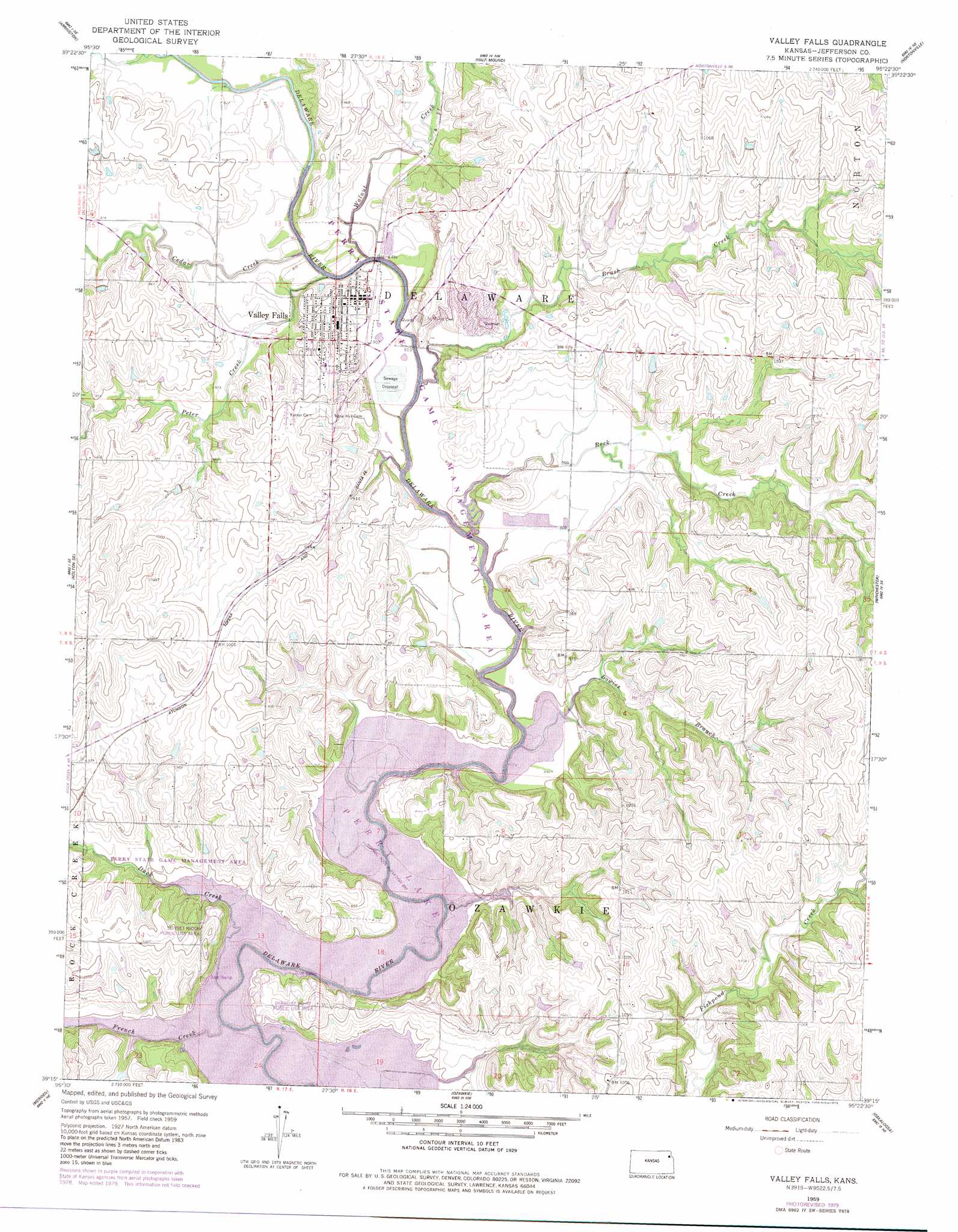
USGS Topo Quad 39095c4 - 1:24,000 scale
| Topo Map Name: | Valley Falls |
| USGS Topo Quad ID: | 39095c4 |
| Print Size: | ca. 21 1/4" wide x 27" high |
| Southeast Coordinates: | 39.25° N latitude / 95.375° W longitude |
| Map Center Coordinates: | 39.3125° N latitude / 95.4375° W longitude |
| U.S. State: | KS |
| Filename: | o39095c4.jpg |
| Download Map JPG Image: | Valley Falls topo map 1:24,000 scale |
| Map Type: | Topographic |
| Topo Series: | 7.5´ |
| Map Scale: | 1:24,000 |
| Source of Map Images: | United States Geological Survey (USGS) |
| Alternate Map Versions: |
Valley Falls KS 1959, updated 1961 Download PDF Buy paper map Valley Falls KS 1959, updated 1979 Download PDF Buy paper map Valley Falls KS 2009 Download PDF Buy paper map Valley Falls KS 2012 Download PDF Buy paper map Valley Falls KS 2016 Download PDF Buy paper map |
1:24,000 Topo Quads surrounding Valley Falls
Netawaka |
Whiting |
Effingham |
Lancaster |
Atchison West |
Holton |
Arrington |
Half Mound |
Nortonville |
Potter |
Mayetta |
Holton Se |
Valley Falls |
Winchester |
Easton Sw |
Elmont |
Meriden |
Ozawkie |
Oskaloosa |
Mclouth |
Topeka |
Grantville |
Perry |
Williamstown |
Midland |
> Back to 39095a1 at 1:100,000 scale
> Back to 39094a1 at 1:250,000 scale
> Back to U.S. Topo Maps home
Valley Falls topo map: Gazetteer
Valley Falls: Parks
Paradise Point Public Use Area elevation 290m 951′Perry Wildlife Area elevation 275m 902′
Sunset Ridge Public Use Area elevation 289m 948′
Valley Falls: Populated Places
Valley Falls elevation 288m 944′Valley Falls: Post Offices
Valley Falls Post Office elevation 289m 948′Valley Falls: Streams
Bowies Branch elevation 272m 892′Brush Creek elevation 276m 905′
Cedar Creek elevation 276m 905′
Duck Creek elevation 273m 895′
French Creek elevation 273m 895′
Peter Creek elevation 274m 898′
Rock Creek elevation 272m 892′
Walnut Creek elevation 276m 905′
Valley Falls digital topo map on disk
Buy this Valley Falls topo map showing relief, roads, GPS coordinates and other geographical features, as a high-resolution digital map file on DVD: