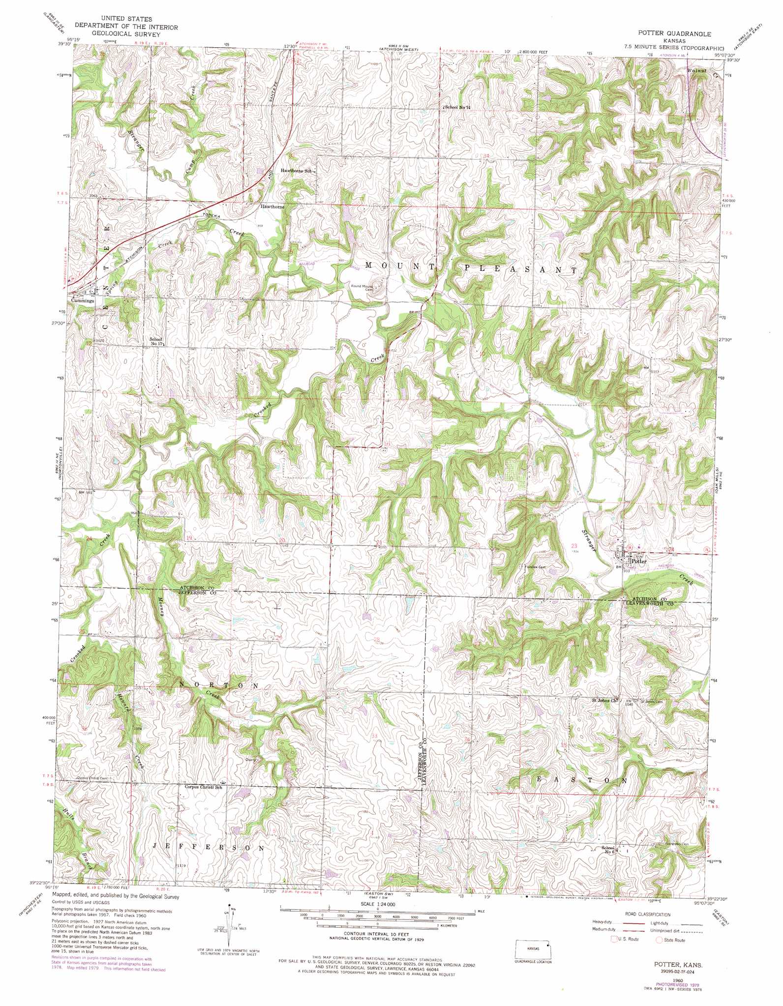
Potter Topo Map Kansas
To zoom in, hover over the map of Potter
USGS Topo Quad 39095d2 - 1:24,000 scale
| Topo Map Name: | Potter |
| USGS Topo Quad ID: | 39095d2 |
| Print Size: | ca. 21 1/4" wide x 27" high |
| Southeast Coordinates: | 39.375° N latitude / 95.125° W longitude |
| Map Center Coordinates: | 39.4375° N latitude / 95.1875° W longitude |
| U.S. State: | KS |
| Filename: | o39095d2.jpg |
| Download Map JPG Image: | Potter topo map 1:24,000 scale |
| Map Type: | Topographic |
| Topo Series: | 7.5´ |
| Map Scale: | 1:24,000 |
| Source of Map Images: | United States Geological Survey (USGS) |
| Alternate Map Versions: |
Potter KS 1960, updated 1961 Download PDF Buy paper map Potter KS 1960, updated 1976 Download PDF Buy paper map Potter KS 1960, updated 1979 Download PDF Buy paper map Potter KS 1960, updated 1986 Download PDF Buy paper map Potter KS 2009 Download PDF Buy paper map Potter KS 2012 Download PDF Buy paper map Potter KS 2015 Download PDF Buy paper map |
1:24,000 Topo Quads surrounding Potter
Everest |
Denton |
Bendena |
Atchison Ne |
Halls |
Effingham |
Lancaster |
Atchison West |
Atchison East |
De Kalb |
Half Mound |
Nortonville |
Potter |
Oak Mills |
Weston |
Valley Falls |
Winchester |
Easton Sw |
Easton |
Leavenworth |
Ozawkie |
Oskaloosa |
Mclouth |
Jarbalo |
Basehor |
> Back to 39095a1 at 1:100,000 scale
> Back to 39094a1 at 1:250,000 scale
> Back to U.S. Topo Maps home
Potter topo map: Gazetteer
Potter: Populated Places
Cummings elevation 302m 990′Hawthorne elevation 293m 961′
Potter elevation 294m 964′
Potter: Streams
Camp Creek elevation 293m 961′Crooked Creek elevation 283m 928′
Howard Creek elevation 298m 977′
Mooney Creek elevation 293m 961′
Spring Creek elevation 286m 938′
Potter digital topo map on disk
Buy this Potter topo map showing relief, roads, GPS coordinates and other geographical features, as a high-resolution digital map file on DVD: