Nortonville Topo Map Kansas
To zoom in, hover over the map of Nortonville
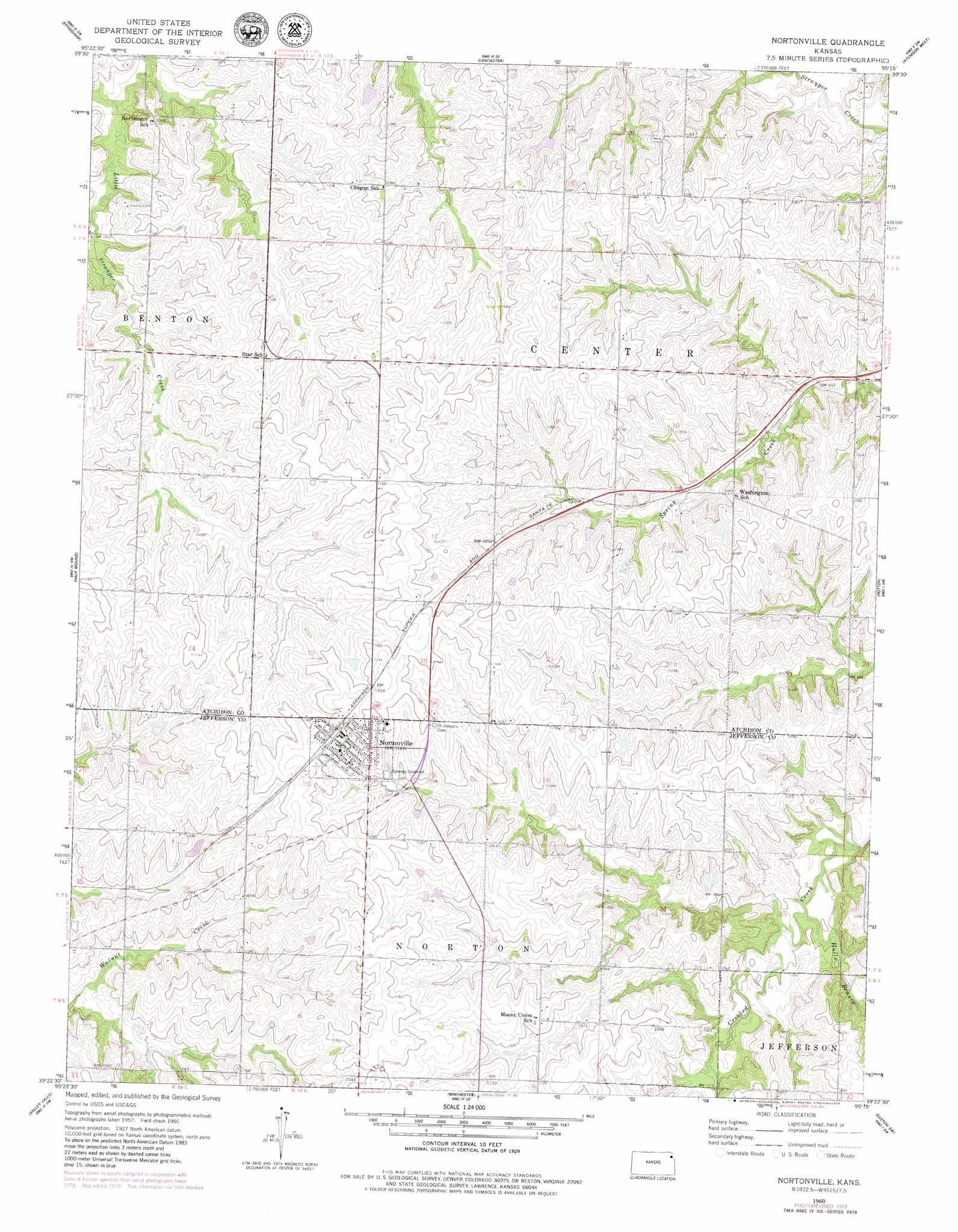
USGS Topo Quad 39095d3 - 1:24,000 scale
| Topo Map Name: | Nortonville |
| USGS Topo Quad ID: | 39095d3 |
| Print Size: | ca. 21 1/4" wide x 27" high |
| Southeast Coordinates: | 39.375° N latitude / 95.25° W longitude |
| Map Center Coordinates: | 39.4375° N latitude / 95.3125° W longitude |
| U.S. State: | KS |
| Filename: | o39095d3.jpg |
| Download Map JPG Image: | Nortonville topo map 1:24,000 scale |
| Map Type: | Topographic |
| Topo Series: | 7.5´ |
| Map Scale: | 1:24,000 |
| Source of Map Images: | United States Geological Survey (USGS) |
| Alternate Map Versions: |
Nortonville KS 1960, updated 1961 Download PDF Buy paper map Nortonville KS 1960, updated 1979 Download PDF Buy paper map Nortonville KS 1960, updated 1986 Download PDF Buy paper map Nortonville KS 2009 Download PDF Buy paper map Nortonville KS 2012 Download PDF Buy paper map Nortonville KS 2015 Download PDF Buy paper map |
1:24,000 Topo Quads surrounding Nortonville
Horton |
Everest |
Denton |
Bendena |
Atchison Ne |
Whiting |
Effingham |
Lancaster |
Atchison West |
Atchison East |
Arrington |
Half Mound |
Nortonville |
Potter |
Oak Mills |
Holton Se |
Valley Falls |
Winchester |
Easton Sw |
Easton |
Meriden |
Ozawkie |
Oskaloosa |
Mclouth |
Jarbalo |
> Back to 39095a1 at 1:100,000 scale
> Back to 39094a1 at 1:250,000 scale
> Back to U.S. Topo Maps home
Nortonville topo map: Gazetteer
Nortonville: Populated Places
Nortonville elevation 354m 1161′Nortonville: Post Offices
Nortonville Post Office elevation 355m 1164′Nortonville: Streams
Hulls Branch elevation 297m 974′Nortonville digital topo map on disk
Buy this Nortonville topo map showing relief, roads, GPS coordinates and other geographical features, as a high-resolution digital map file on DVD: