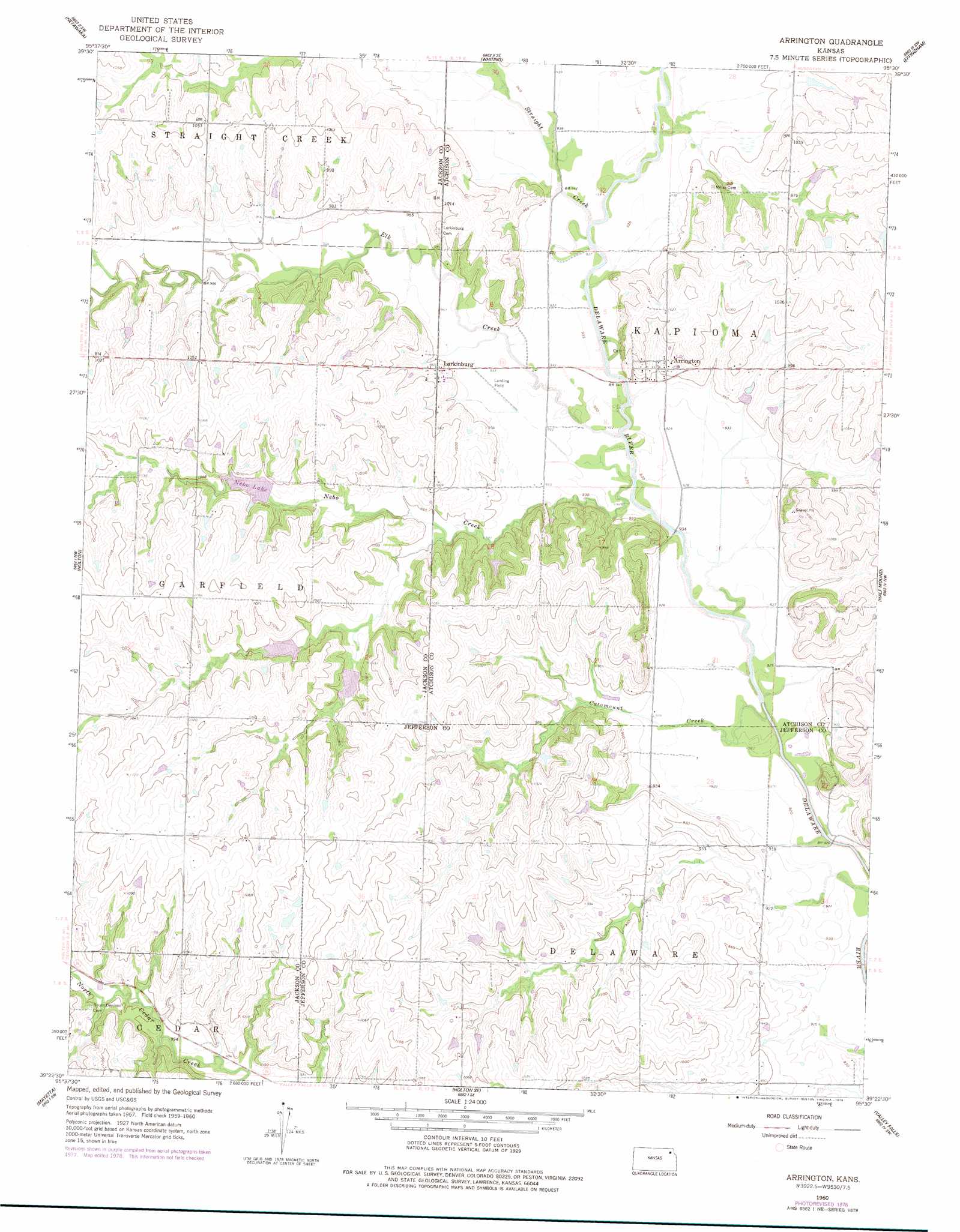
Arrington Topo Map Kansas
To zoom in, hover over the map of Arrington
USGS Topo Quad 39095d5 - 1:24,000 scale
| Topo Map Name: | Arrington |
| USGS Topo Quad ID: | 39095d5 |
| Print Size: | ca. 21 1/4" wide x 27" high |
| Southeast Coordinates: | 39.375° N latitude / 95.5° W longitude |
| Map Center Coordinates: | 39.4375° N latitude / 95.5625° W longitude |
| U.S. State: | KS |
| Filename: | o39095d5.jpg |
| Download Map JPG Image: | Arrington topo map 1:24,000 scale |
| Map Type: | Topographic |
| Topo Series: | 7.5´ |
| Map Scale: | 1:24,000 |
| Source of Map Images: | United States Geological Survey (USGS) |
| Alternate Map Versions: |
Arrington KS 1960, updated 1961 Download PDF Buy paper map Arrington KS 1960, updated 1977 Download PDF Buy paper map Arrington KS 1960, updated 1978 Download PDF Buy paper map Arrington KS 2009 Download PDF Buy paper map Arrington KS 2012 Download PDF Buy paper map Arrington KS 2015 Download PDF Buy paper map |
1:24,000 Topo Quads surrounding Arrington
Wetmore |
Horton Nw |
Horton |
Everest |
Denton |
Circleville |
Netawaka |
Whiting |
Effingham |
Lancaster |
Soldier Creek Ne |
Holton |
Arrington |
Half Mound |
Nortonville |
Soldier Creek Se |
Mayetta |
Holton Se |
Valley Falls |
Winchester |
Grove |
Elmont |
Meriden |
Ozawkie |
Oskaloosa |
> Back to 39095a1 at 1:100,000 scale
> Back to 39094a1 at 1:250,000 scale
> Back to U.S. Topo Maps home
Arrington topo map: Gazetteer
Arrington: Parks
Nebo State Fishing Lake and Wildlife Area elevation 300m 984′Arrington: Populated Places
Arrington elevation 289m 948′Carbon (historical) elevation 289m 948′
Larkinburg elevation 295m 967′
Arrington: Post Offices
Carbon Post Office (historical) elevation 289m 948′Arrington: Reservoirs
Nebo Lake elevation 300m 984′Arrington: Streams
Catamount Creek elevation 282m 925′Elk Creek elevation 280m 918′
Nebo Creek elevation 277m 908′
Straight Creek elevation 280m 918′
Arrington digital topo map on disk
Buy this Arrington topo map showing relief, roads, GPS coordinates and other geographical features, as a high-resolution digital map file on DVD: