Atchison Ne Topo Map Kansas
To zoom in, hover over the map of Atchison Ne
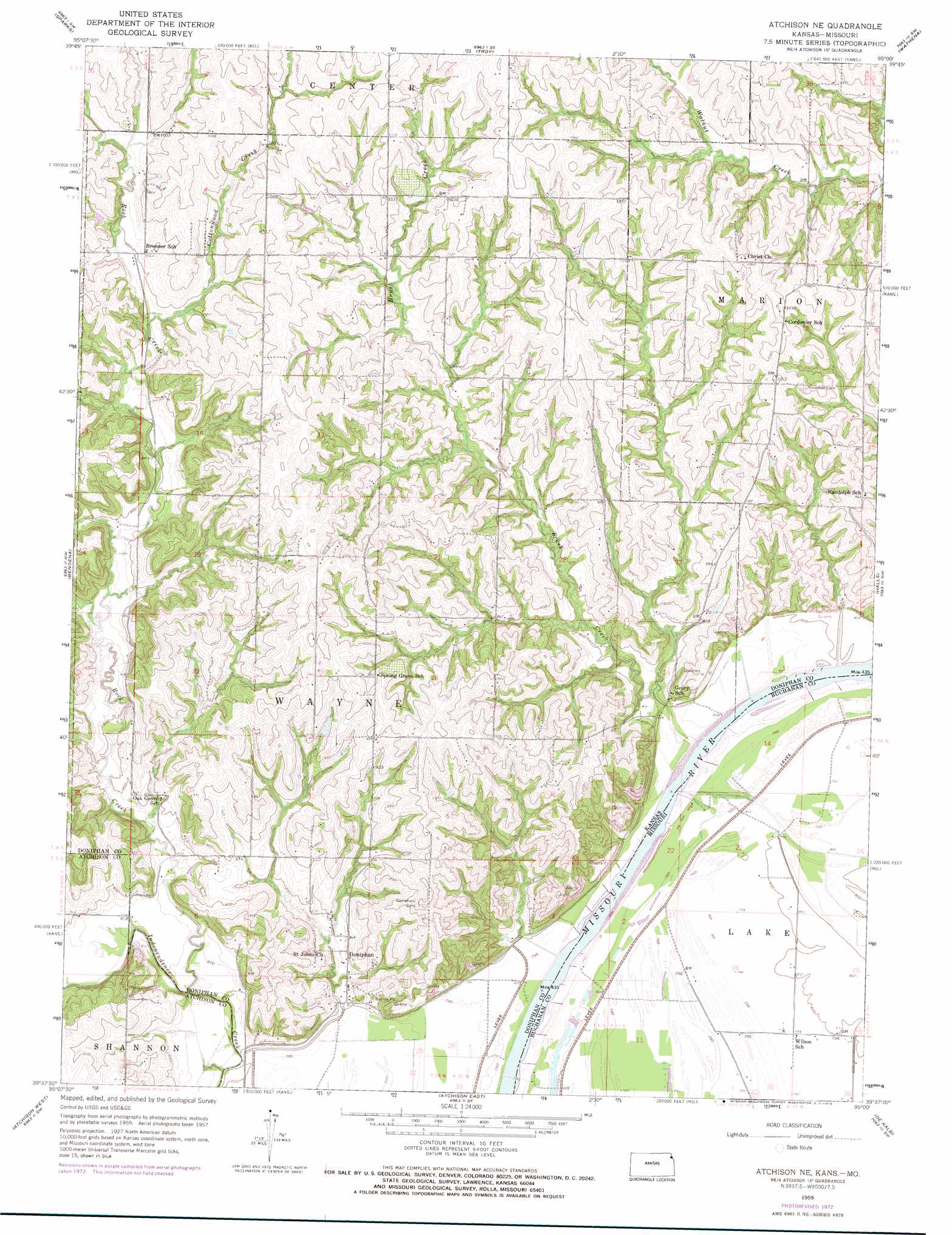
USGS Topo Quad 39095f1 - 1:24,000 scale
| Topo Map Name: | Atchison Ne |
| USGS Topo Quad ID: | 39095f1 |
| Print Size: | ca. 21 1/4" wide x 27" high |
| Southeast Coordinates: | 39.625° N latitude / 95° W longitude |
| Map Center Coordinates: | 39.6875° N latitude / 95.0625° W longitude |
| U.S. States: | KS, MO |
| Filename: | o39095f1.jpg |
| Download Map JPG Image: | Atchison Ne topo map 1:24,000 scale |
| Map Type: | Topographic |
| Topo Series: | 7.5´ |
| Map Scale: | 1:24,000 |
| Source of Map Images: | United States Geological Survey (USGS) |
| Alternate Map Versions: |
Atchison NE KS 1959, updated 1960 Download PDF Buy paper map Atchison NE KS 1959, updated 1973 Download PDF Buy paper map Atchison NE KS 2009 Download PDF Buy paper map Atchison NE KS 2012 Download PDF Buy paper map Atchison NE KS 2016 Download PDF Buy paper map |
1:24,000 Topo Quads surrounding Atchison Ne
White Cloud |
Oregon |
Forbes |
Amazonia |
Savannah |
Highland |
Sparks |
Troy |
Wathena |
Saint Joseph North |
Denton |
Bendena |
Atchison Ne |
Halls |
Saint Joseph South |
Lancaster |
Atchison West |
Atchison East |
De Kalb |
Dearborn |
Nortonville |
Potter |
Oak Mills |
Weston |
Tracy |
> Back to 39095e1 at 1:100,000 scale
> Back to 39094a1 at 1:250,000 scale
> Back to U.S. Topo Maps home
Atchison Ne topo map: Gazetteer
Atchison Ne: Airports
Booze Island Airport elevation 243m 797′Atchison Ne: Lakes
Singleton Lake (historical) elevation 242m 793′Atchison Ne: Populated Places
Brenner elevation 295m 967′Doniphan elevation 262m 859′
Atchison Ne: Streams
Brush Creek elevation 245m 803′Cottonwood Creek elevation 279m 915′
Rock Creek elevation 246m 807′
Atchison Ne digital topo map on disk
Buy this Atchison Ne topo map showing relief, roads, GPS coordinates and other geographical features, as a high-resolution digital map file on DVD: