Hiawatha Topo Map Kansas
To zoom in, hover over the map of Hiawatha
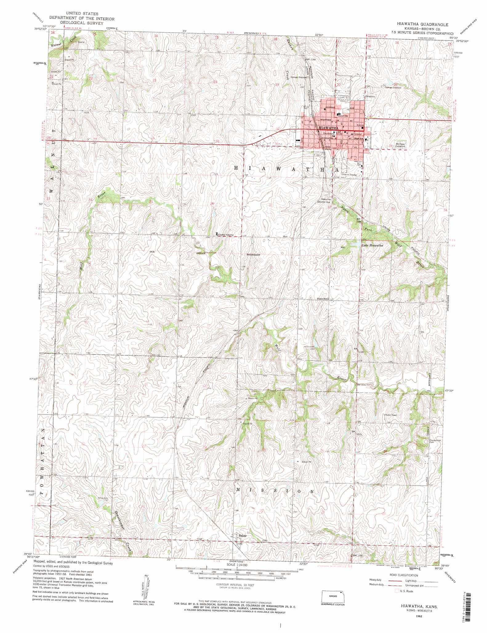
USGS Topo Quad 39095g5 - 1:24,000 scale
| Topo Map Name: | Hiawatha |
| USGS Topo Quad ID: | 39095g5 |
| Print Size: | ca. 21 1/4" wide x 27" high |
| Southeast Coordinates: | 39.75° N latitude / 95.5° W longitude |
| Map Center Coordinates: | 39.8125° N latitude / 95.5625° W longitude |
| U.S. State: | KS |
| Filename: | o39095g5.jpg |
| Download Map JPG Image: | Hiawatha topo map 1:24,000 scale |
| Map Type: | Topographic |
| Topo Series: | 7.5´ |
| Map Scale: | 1:24,000 |
| Source of Map Images: | United States Geological Survey (USGS) |
| Alternate Map Versions: |
Hiawatha KS 1961, updated 1962 Download PDF Buy paper map Hiawatha KS 2009 Download PDF Buy paper map Hiawatha KS 2012 Download PDF Buy paper map Hiawatha KS 2015 Download PDF Buy paper map |
1:24,000 Topo Quads surrounding Hiawatha
Humboldt Se |
Salem |
Falls City |
Rulo |
Big Lake |
Sabetha |
Morrill |
Reserve |
Highland Nw |
White Cloud |
Woodlawn |
Fairview |
Hiawatha |
Robinson |
Highland |
Wetmore |
Horton Nw |
Horton |
Everest |
Denton |
Circleville |
Netawaka |
Whiting |
Effingham |
Lancaster |
> Back to 39095e1 at 1:100,000 scale
> Back to 39094a1 at 1:250,000 scale
> Back to U.S. Topo Maps home
Hiawatha topo map: Gazetteer
Hiawatha: Dams
Hiawatha City Dam elevation 321m 1053′Hiawatha: Populated Places
Baker elevation 360m 1181′Hiawatha elevation 345m 1131′
Hiawatha: Reservoirs
Lake Hiawatha elevation 321m 1053′Hiawatha digital topo map on disk
Buy this Hiawatha topo map showing relief, roads, GPS coordinates and other geographical features, as a high-resolution digital map file on DVD: