Saint George Topo Map Kansas
To zoom in, hover over the map of Saint George
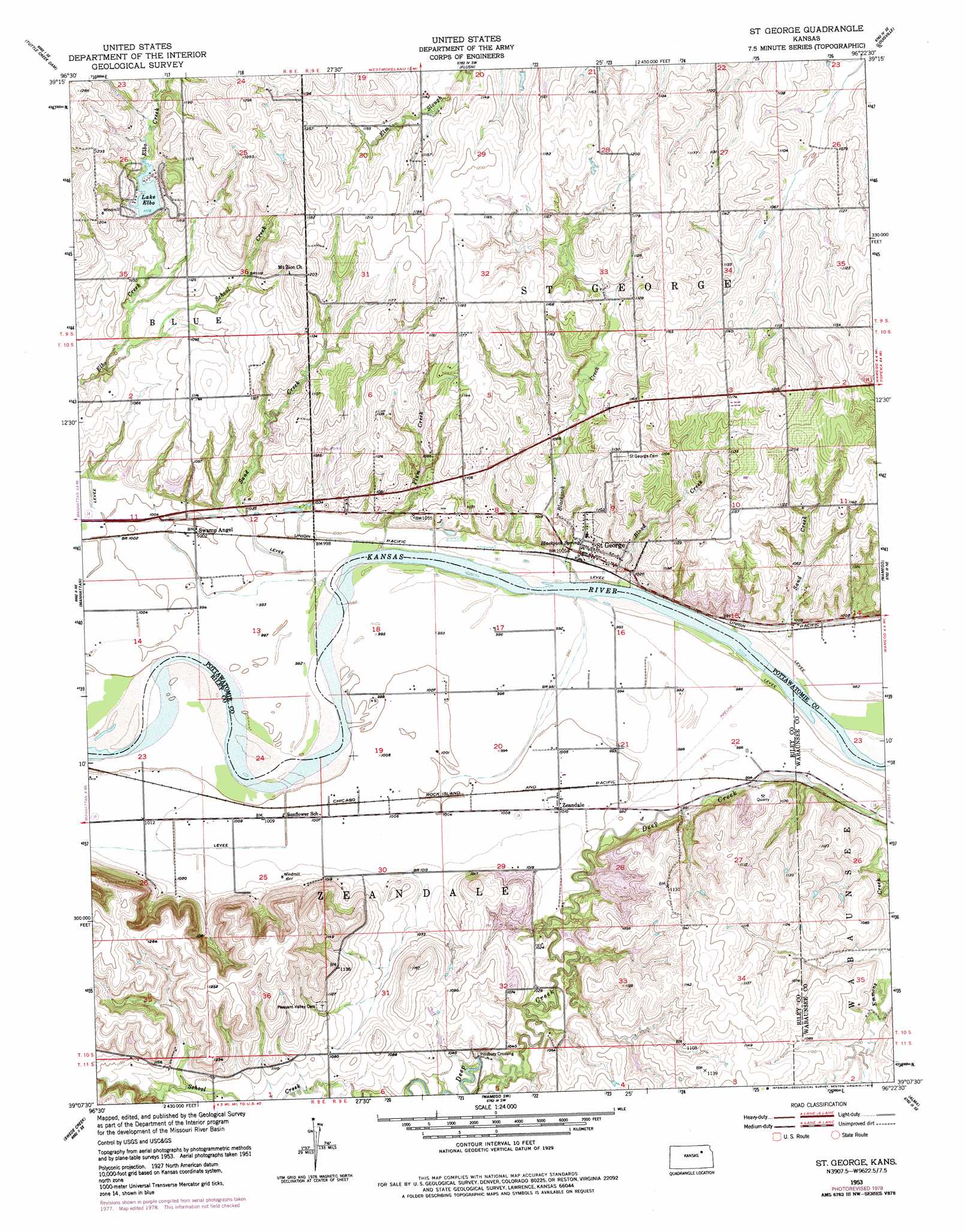
USGS Topo Quad 39096b4 - 1:24,000 scale
| Topo Map Name: | Saint George |
| USGS Topo Quad ID: | 39096b4 |
| Print Size: | ca. 21 1/4" wide x 27" high |
| Southeast Coordinates: | 39.125° N latitude / 96.375° W longitude |
| Map Center Coordinates: | 39.1875° N latitude / 96.4375° W longitude |
| U.S. State: | KS |
| Filename: | o39096b4.jpg |
| Download Map JPG Image: | Saint George topo map 1:24,000 scale |
| Map Type: | Topographic |
| Topo Series: | 7.5´ |
| Map Scale: | 1:24,000 |
| Source of Map Images: | United States Geological Survey (USGS) |
| Alternate Map Versions: |
St George KS 1953, updated 1954 Download PDF Buy paper map St. George KS 1953, updated 1973 Download PDF Buy paper map St George KS 1953, updated 1978 Download PDF Buy paper map Saint George KS 2009 Download PDF Buy paper map Saint George KS 2012 Download PDF Buy paper map Saint George KS 2016 Download PDF Buy paper map |
1:24,000 Topo Quads surrounding Saint George
Olsburg Nw |
Olsburg |
Westmoreland |
Westmoreland Ne |
Onaga |
Olsburg Sw |
Tuttle Creek Dam |
Flush |
Louisville |
Laclede |
Keats |
Manhattan |
Saint George |
Wamego |
Belvue |
Ogden |
Swede Creek |
Wamego Sw |
Alma |
Mcfarland |
White City Nw |
White City Ne |
Volland |
Allendorph |
Hessdale |
> Back to 39096a1 at 1:100,000 scale
> Back to 39096a1 at 1:250,000 scale
> Back to U.S. Topo Maps home
Saint George topo map: Gazetteer
Saint George: Populated Places
Pillsbury Crossing elevation 311m 1020′Saint George elevation 312m 1023′
Swamp Angel elevation 305m 1000′
Zeandale elevation 308m 1010′
Saint George: Reservoirs
Lake Elbo elevation 340m 1115′Saint George: Springs
Blackjack Spring elevation 307m 1007′Saint George: Streams
Blackjack Creek elevation 297m 974′Blood Creek elevation 300m 984′
Emmons Creek elevation 303m 994′
Plum Creek elevation 297m 974′
Sand Creek elevation 302m 990′
Sand Creek elevation 296m 971′
School Creek elevation 319m 1046′
Saint George digital topo map on disk
Buy this Saint George topo map showing relief, roads, GPS coordinates and other geographical features, as a high-resolution digital map file on DVD: