Flush Topo Map Kansas
To zoom in, hover over the map of Flush
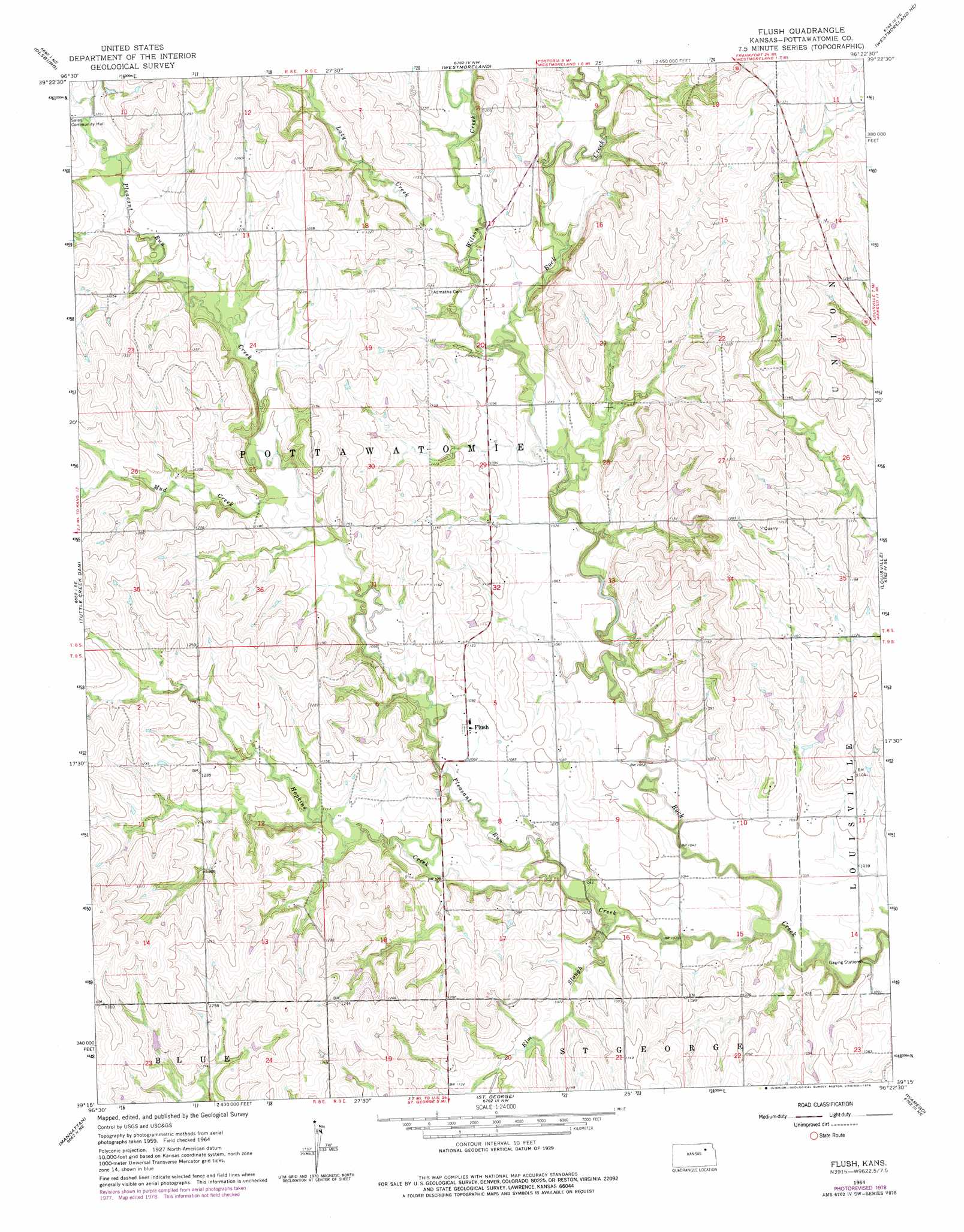
USGS Topo Quad 39096c4 - 1:24,000 scale
| Topo Map Name: | Flush |
| USGS Topo Quad ID: | 39096c4 |
| Print Size: | ca. 21 1/4" wide x 27" high |
| Southeast Coordinates: | 39.25° N latitude / 96.375° W longitude |
| Map Center Coordinates: | 39.3125° N latitude / 96.4375° W longitude |
| U.S. State: | KS |
| Filename: | o39096c4.jpg |
| Download Map JPG Image: | Flush topo map 1:24,000 scale |
| Map Type: | Topographic |
| Topo Series: | 7.5´ |
| Map Scale: | 1:24,000 |
| Source of Map Images: | United States Geological Survey (USGS) |
| Alternate Map Versions: |
Flush KS 1964, updated 1965 Download PDF Buy paper map Flush KS 1964, updated 1978 Download PDF Buy paper map Flush KS 2009 Download PDF Buy paper map Flush KS 2012 Download PDF Buy paper map Flush KS 2015 Download PDF Buy paper map |
1:24,000 Topo Quads surrounding Flush
Blue Rapids Sw |
Blue Rapids Se |
Frankfort Sw |
Wheaton |
Duluth |
Olsburg Nw |
Olsburg |
Westmoreland |
Westmoreland Ne |
Onaga |
Olsburg Sw |
Tuttle Creek Dam |
Flush |
Louisville |
Laclede |
Keats |
Manhattan |
Saint George |
Wamego |
Belvue |
Ogden |
Swede Creek |
Wamego Sw |
Alma |
Mcfarland |
> Back to 39096a1 at 1:100,000 scale
> Back to 39096a1 at 1:250,000 scale
> Back to U.S. Topo Maps home
Flush topo map: Gazetteer
Flush: Populated Places
Flush elevation 332m 1089′Flush: Streams
Elm Slough elevation 318m 1043′Hopkins Creek elevation 320m 1049′
Lazy Creek elevation 334m 1095′
Mud Creek elevation 342m 1122′
Pleasant Run Creek elevation 308m 1010′
Wilson Creek elevation 326m 1069′
Flush digital topo map on disk
Buy this Flush topo map showing relief, roads, GPS coordinates and other geographical features, as a high-resolution digital map file on DVD: