Tuttle Creek Dam Topo Map Kansas
To zoom in, hover over the map of Tuttle Creek Dam
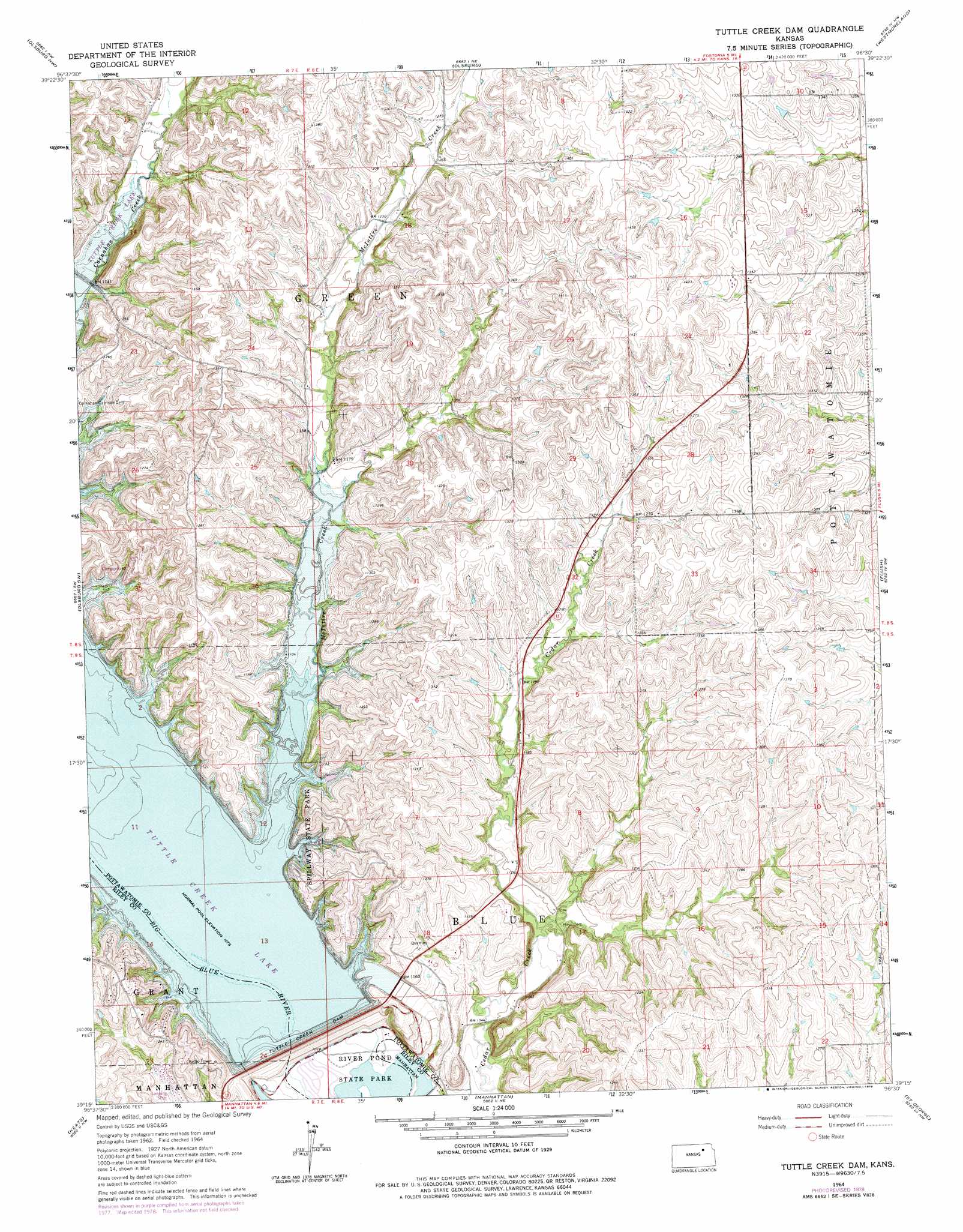
USGS Topo Quad 39096c5 - 1:24,000 scale
| Topo Map Name: | Tuttle Creek Dam |
| USGS Topo Quad ID: | 39096c5 |
| Print Size: | ca. 21 1/4" wide x 27" high |
| Southeast Coordinates: | 39.25° N latitude / 96.5° W longitude |
| Map Center Coordinates: | 39.3125° N latitude / 96.5625° W longitude |
| U.S. State: | KS |
| Filename: | o39096c5.jpg |
| Download Map JPG Image: | Tuttle Creek Dam topo map 1:24,000 scale |
| Map Type: | Topographic |
| Topo Series: | 7.5´ |
| Map Scale: | 1:24,000 |
| Source of Map Images: | United States Geological Survey (USGS) |
| Alternate Map Versions: |
Tuttle Creek Dam KS 1964, updated 1965 Download PDF Buy paper map Tuttle Creek Dam KS 1964, updated 1978 Download PDF Buy paper map Tuttle Creek Dam KS 2009 Download PDF Buy paper map Tuttle Creek Dam KS 2012 Download PDF Buy paper map Tuttle Creek Dam KS 2015 Download PDF Buy paper map |
1:24,000 Topo Quads surrounding Tuttle Creek Dam
Greenleaf Se |
Blue Rapids Sw |
Blue Rapids Se |
Frankfort Sw |
Wheaton |
Randolph |
Olsburg Nw |
Olsburg |
Westmoreland |
Westmoreland Ne |
Riley |
Olsburg Sw |
Tuttle Creek Dam |
Flush |
Louisville |
Fort Riley Ne |
Keats |
Manhattan |
Saint George |
Wamego |
Junction City |
Ogden |
Swede Creek |
Wamego Sw |
Alma |
> Back to 39096a1 at 1:100,000 scale
> Back to 39096a1 at 1:250,000 scale
> Back to U.S. Topo Maps home
Tuttle Creek Dam topo map: Gazetteer
Tuttle Creek Dam: Dams
Tuttle Creek Dam elevation 353m 1158′Tuttle Creek Dam: Parks
Spillway State Park elevation 379m 1243′Tuttle Creek State Park elevation 310m 1017′
Tuttle Creek Dam: Reservoirs
Tuttle Creek Lake elevation 353m 1158′Tuttle Creek Dam: Streams
McIntire Creek elevation 327m 1072′Tuttle Creek Dam digital topo map on disk
Buy this Tuttle Creek Dam topo map showing relief, roads, GPS coordinates and other geographical features, as a high-resolution digital map file on DVD: