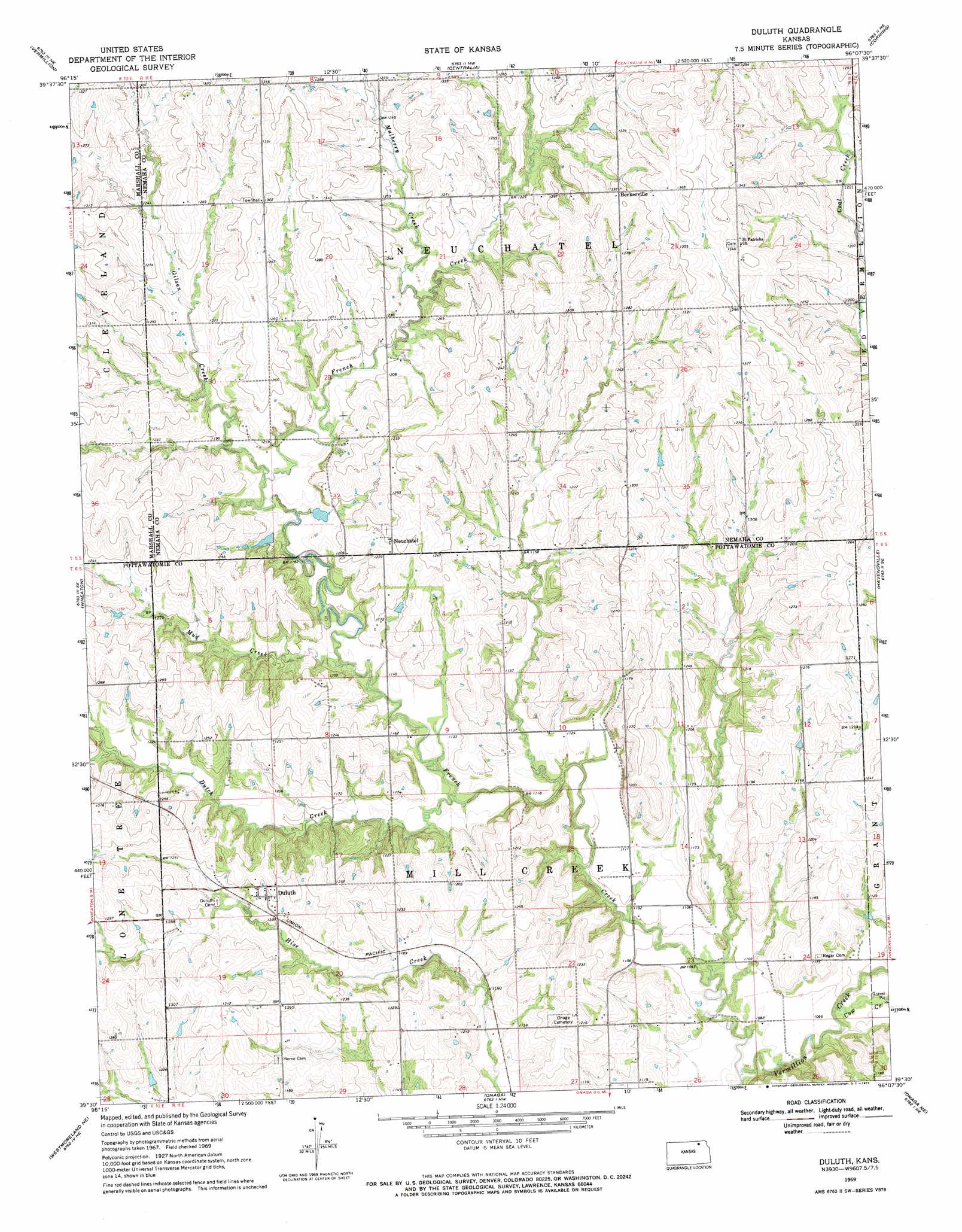
Duluth Topo Map Kansas
To zoom in, hover over the map of Duluth
USGS Topo Quad 39096e2 - 1:24,000 scale
| Topo Map Name: | Duluth |
| USGS Topo Quad ID: | 39096e2 |
| Print Size: | ca. 21 1/4" wide x 27" high |
| Southeast Coordinates: | 39.5° N latitude / 96.125° W longitude |
| Map Center Coordinates: | 39.5625° N latitude / 96.1875° W longitude |
| U.S. State: | KS |
| Filename: | o39096e2.jpg |
| Download Map JPG Image: | Duluth topo map 1:24,000 scale |
| Map Type: | Topographic |
| Topo Series: | 7.5´ |
| Map Scale: | 1:24,000 |
| Source of Map Images: | United States Geological Survey (USGS) |
| Alternate Map Versions: |
Duluth KS 1969, updated 1971 Download PDF Buy paper map Duluth KS 2009 Download PDF Buy paper map Duluth KS 2012 Download PDF Buy paper map Duluth KS 2016 Download PDF Buy paper map |
1:24,000 Topo Quads surrounding Duluth
Beattie |
Axtell |
Baileyville |
Seneca |
Oneida |
Frankfort |
Vermillon |
Centralia |
Corning |
Goff |
Frankfort Sw |
Wheaton |
Duluth |
Havenville |
Soldier |
Westmoreland |
Westmoreland Ne |
Onaga |
Onaga Ne |
Soldier Creek Nw |
Flush |
Louisville |
Laclede |
Emmett |
Soldier Creek Sw |
> Back to 39096e1 at 1:100,000 scale
> Back to 39096a1 at 1:250,000 scale
> Back to U.S. Topo Maps home
Duluth topo map: Gazetteer
Duluth: Populated Places
Beckerville elevation 406m 1332′Duluth elevation 377m 1236′
Neuchatel elevation 382m 1253′
Duluth: Streams
Cow Creek elevation 326m 1069′Dutch Creek elevation 340m 1115′
French Creek elevation 325m 1066′
Gilson Creek elevation 353m 1158′
Mud Creek elevation 342m 1122′
Mulberry Creek elevation 364m 1194′
Duluth digital topo map on disk
Buy this Duluth topo map showing relief, roads, GPS coordinates and other geographical features, as a high-resolution digital map file on DVD: