Barnes Topo Map Kansas
To zoom in, hover over the map of Barnes
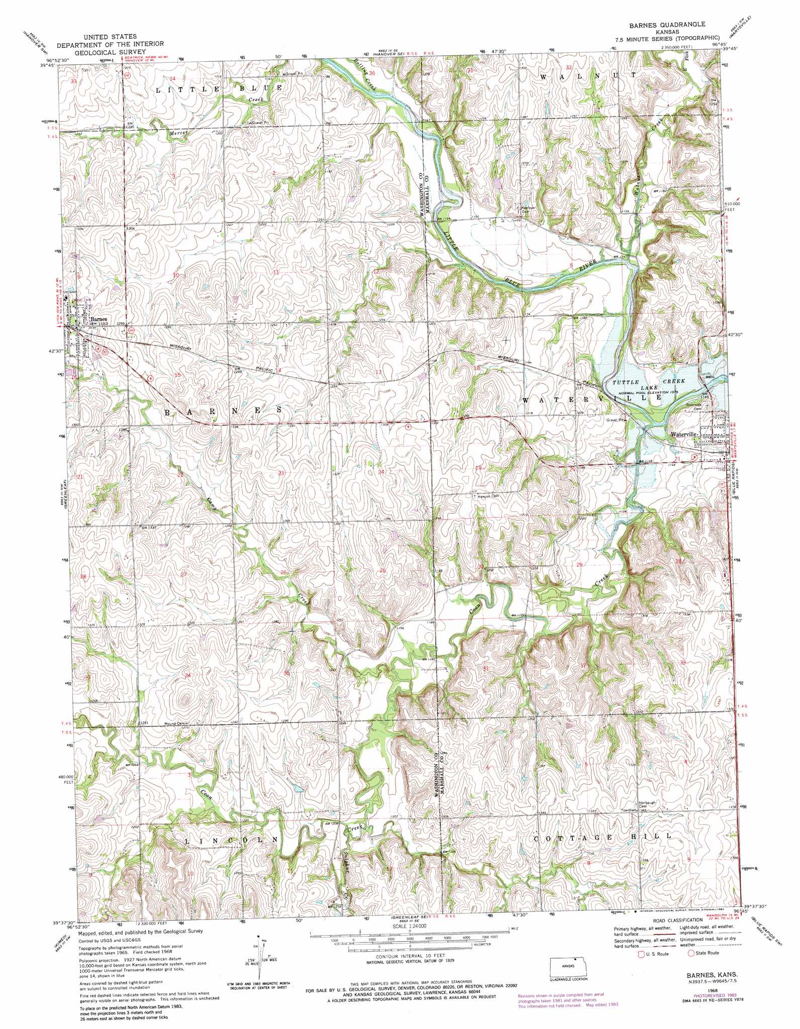
USGS Topo Quad 39096f7 - 1:24,000 scale
| Topo Map Name: | Barnes |
| USGS Topo Quad ID: | 39096f7 |
| Print Size: | ca. 21 1/4" wide x 27" high |
| Southeast Coordinates: | 39.625° N latitude / 96.75° W longitude |
| Map Center Coordinates: | 39.6875° N latitude / 96.8125° W longitude |
| U.S. State: | KS |
| Filename: | o39096f7.jpg |
| Download Map JPG Image: | Barnes topo map 1:24,000 scale |
| Map Type: | Topographic |
| Topo Series: | 7.5´ |
| Map Scale: | 1:24,000 |
| Source of Map Images: | United States Geological Survey (USGS) |
| Alternate Map Versions: |
Barnes KS 1968, updated 1970 Download PDF Buy paper map Barnes KS 1968, updated 1983 Download PDF Buy paper map Barnes KS 2009 Download PDF Buy paper map Barnes KS 2012 Download PDF Buy paper map Barnes KS 2016 Download PDF Buy paper map |
1:24,000 Topo Quads surrounding Barnes
Washington Ne |
Hanover West |
Hanover East |
Herkimer |
Oketo |
Washington |
Hanover Sw |
Hanover Se |
Marysville |
Home |
Linn |
Greenleaf |
Barnes |
Blue Rapids |
Blue Rapids Ne |
Linn Se |
Kimeo |
Greenleaf Se |
Blue Rapids Sw |
Blue Rapids Se |
Clay Center Ne |
Lasita |
Randolph |
Olsburg Nw |
Olsburg |
> Back to 39096e1 at 1:100,000 scale
> Back to 39096a1 at 1:250,000 scale
> Back to U.S. Topo Maps home
Barnes topo map: Gazetteer
Barnes: Populated Places
Barnes elevation 406m 1332′Barnes: Streams
Bolling Creek elevation 347m 1138′Camp Creek elevation 356m 1167′
Coon Creek elevation 341m 1118′
East Fork Walnut Creek elevation 360m 1181′
Sulphur Creek elevation 363m 1190′
Walnut Creek elevation 345m 1131′
Barnes digital topo map on disk
Buy this Barnes topo map showing relief, roads, GPS coordinates and other geographical features, as a high-resolution digital map file on DVD: