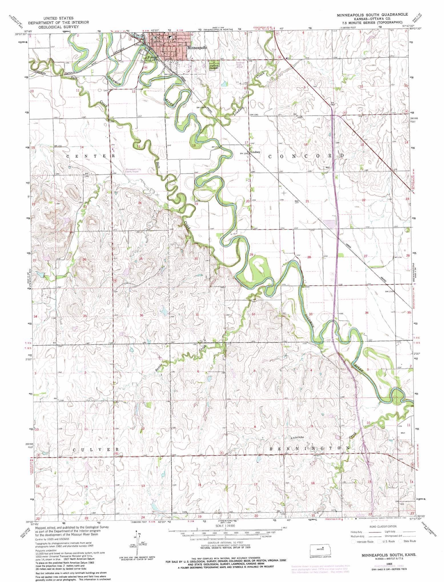
Minneapolis South Topo Map Kansas
To zoom in, hover over the map of Minneapolis South
USGS Topo Quad 39097a6 - 1:24,000 scale
| Topo Map Name: | Minneapolis South |
| USGS Topo Quad ID: | 39097a6 |
| Print Size: | ca. 21 1/4" wide x 27" high |
| Southeast Coordinates: | 39° N latitude / 97.625° W longitude |
| Map Center Coordinates: | 39.0625° N latitude / 97.6875° W longitude |
| U.S. State: | KS |
| Filename: | o39097a6.jpg |
| Download Map JPG Image: | Minneapolis South topo map 1:24,000 scale |
| Map Type: | Topographic |
| Topo Series: | 7.5´ |
| Map Scale: | 1:24,000 |
| Source of Map Images: | United States Geological Survey (USGS) |
| Alternate Map Versions: |
Minneapolis South KS 1965, updated 1966 Download PDF Buy paper map Minneapolis South KS 1965, updated 1980 Download PDF Buy paper map Minneapolis South KS 2009 Download PDF Buy paper map Minneapolis South KS 2012 Download PDF Buy paper map Minneapolis South KS 2015 Download PDF Buy paper map |
1:24,000 Topo Quads surrounding Minneapolis South
Glasco Sw |
Glasco |
Aurora Sw |
Lamar |
Miltonvale |
Ada |
Tescott Ne |
Minneapolis North |
Wells |
Manchester Nw |
Tescott |
Tescott Se |
Minneapolis South |
Bennington |
Vine Creek |
Juniata |
Culver |
Trenton |
New Cambria |
Niles |
Brookville Sw |
Brookville |
Salina Sw |
Salina |
Kipp |
> Back to 39097a1 at 1:100,000 scale
> Back to 39096a1 at 1:250,000 scale
> Back to U.S. Topo Maps home
Minneapolis South topo map: Gazetteer
Minneapolis South: Airports
Minneapolis City County Airport elevation 379m 1243′Solomon Valley Airpark elevation 392m 1286′
Minneapolis South: Parks
Rock City elevation 389m 1276′Minneapolis South: Populated Places
Lindsey elevation 378m 1240′Minneapolis elevation 390m 1279′
Minneapolis South: Streams
Battle Creek elevation 370m 1213′Lindsey Creek elevation 370m 1213′
Pipe Creek elevation 377m 1236′
Salt Creek elevation 368m 1207′
Minneapolis South digital topo map on disk
Buy this Minneapolis South topo map showing relief, roads, GPS coordinates and other geographical features, as a high-resolution digital map file on DVD: