Manchester Nw Topo Map Kansas
To zoom in, hover over the map of Manchester Nw
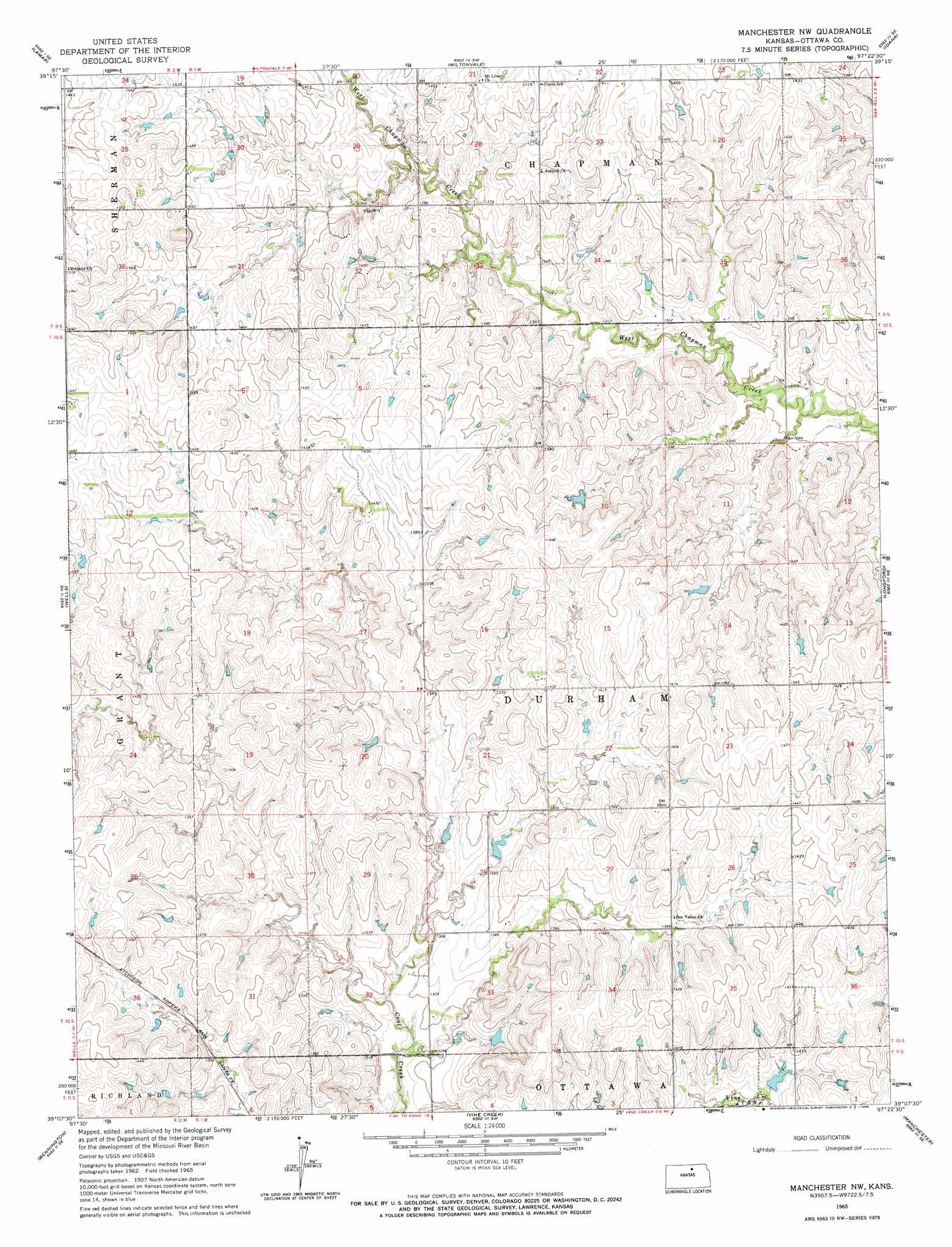
USGS Topo Quad 39097b4 - 1:24,000 scale
| Topo Map Name: | Manchester Nw |
| USGS Topo Quad ID: | 39097b4 |
| Print Size: | ca. 21 1/4" wide x 27" high |
| Southeast Coordinates: | 39.125° N latitude / 97.375° W longitude |
| Map Center Coordinates: | 39.1875° N latitude / 97.4375° W longitude |
| U.S. State: | KS |
| Filename: | o39097b4.jpg |
| Download Map JPG Image: | Manchester Nw topo map 1:24,000 scale |
| Map Type: | Topographic |
| Topo Series: | 7.5´ |
| Map Scale: | 1:24,000 |
| Source of Map Images: | United States Geological Survey (USGS) |
| Alternate Map Versions: |
Manchester NW KS 1965, updated 1966 Download PDF Buy paper map Manchester NW KS 2009 Download PDF Buy paper map Manchester NW KS 2012 Download PDF Buy paper map Manchester NW KS 2015 Download PDF Buy paper map |
1:24,000 Topo Quads surrounding Manchester Nw
Aurora Nw |
Aurora |
Miltonvale Nw |
Miltonvale Ne |
Clay Center Nw |
Aurora Sw |
Lamar |
Miltonvale |
Idana |
Clay Center Sw |
Minneapolis North |
Wells |
Manchester Nw |
Longford |
Industry |
Minneapolis South |
Bennington |
Vine Creek |
Manchester |
Buckeye |
Trenton |
New Cambria |
Niles |
Solomon |
Abilene |
> Back to 39097a1 at 1:100,000 scale
> Back to 39096a1 at 1:250,000 scale
> Back to U.S. Topo Maps home
Manchester Nw topo map: Gazetteer
Manchester Nw: Airports
Condray Airport elevation 428m 1404′Manchester Nw: Parks
Jefferson Point State Park elevation 417m 1368′Manchester Nw digital topo map on disk
Buy this Manchester Nw topo map showing relief, roads, GPS coordinates and other geographical features, as a high-resolution digital map file on DVD: