Ada Topo Map Kansas
To zoom in, hover over the map of Ada
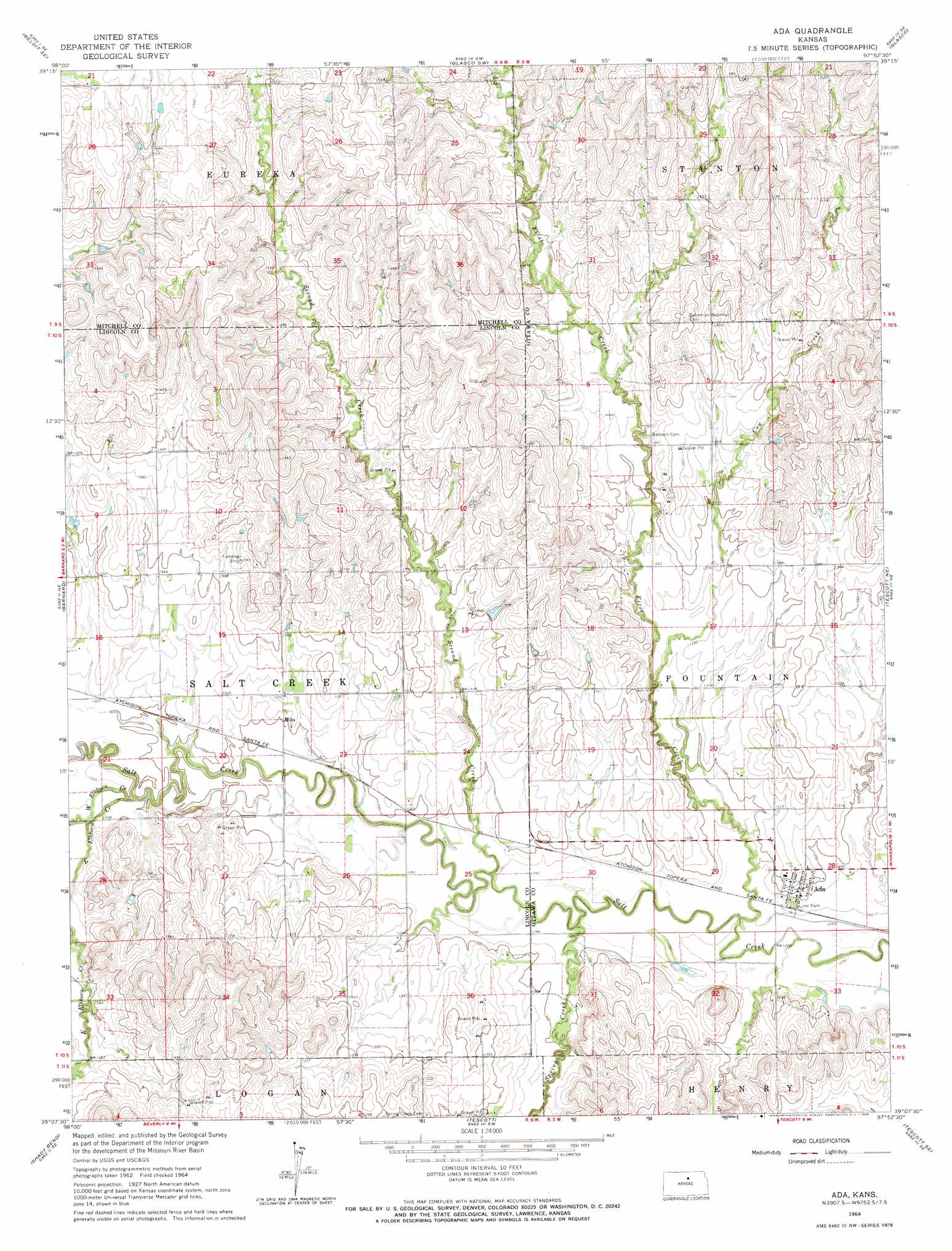
USGS Topo Quad 39097b8 - 1:24,000 scale
| Topo Map Name: | Ada |
| USGS Topo Quad ID: | 39097b8 |
| Print Size: | ca. 21 1/4" wide x 27" high |
| Southeast Coordinates: | 39.125° N latitude / 97.875° W longitude |
| Map Center Coordinates: | 39.1875° N latitude / 97.9375° W longitude |
| U.S. State: | KS |
| Filename: | o39097b8.jpg |
| Download Map JPG Image: | Ada topo map 1:24,000 scale |
| Map Type: | Topographic |
| Topo Series: | 7.5´ |
| Map Scale: | 1:24,000 |
| Source of Map Images: | United States Geological Survey (USGS) |
| Alternate Map Versions: |
Ada KS 1964, updated 1966 Download PDF Buy paper map Ada KS 2009 Download PDF Buy paper map Ada KS 2012 Download PDF Buy paper map Ada KS 2016 Download PDF Buy paper map |
1:24,000 Topo Quads surrounding Ada
Solomon Rapids |
Beloit |
Simpson |
Glasco Ne |
Aurora Nw |
Beloit Sw |
Beloit Se |
Glasco Sw |
Glasco |
Aurora Sw |
Lincoln Nw |
Barnard |
Ada |
Tescott Ne |
Minneapolis North |
Lincoln |
Shady Bend |
Tescott |
Tescott Se |
Minneapolis South |
Westfall Nw |
Westfall |
Juniata |
Culver |
Trenton |
> Back to 39097a1 at 1:100,000 scale
> Back to 39096a1 at 1:250,000 scale
> Back to U.S. Topo Maps home
Ada topo map: Gazetteer
Ada: Parks
Luke Park elevation 393m 1289′Ada: Populated Places
Ada elevation 396m 1299′Milo elevation 396m 1299′
Ada: Streams
Cow Creek elevation 397m 1302′East Elkhorn Creek elevation 393m 1289′
First Creek elevation 388m 1272′
Second Creek elevation 394m 1292′
Spring Creek elevation 387m 1269′
West Elkhorn Creek elevation 394m 1292′
Ada digital topo map on disk
Buy this Ada topo map showing relief, roads, GPS coordinates and other geographical features, as a high-resolution digital map file on DVD: